


File:Kremlenagrad.jpg

Size of this preview: 220 × 169 pixels. Other resolutions: 313 × 240 pixels | 2,736 × 2,098 pixels.
Original file (2,736 × 2,098 pixels, file size: 4.83 MB, MIME type: image/jpeg)

Summary
| DescriptionKremlenagrad.jpg |
English: Kremlenagrad Castellum Urbis Moskvae: the first detailed map of the Moscow Kremlin, created during the reign of Alexis Mikhailovich Latina: Tabula Castelli Urbi Moskuae (Kremlin); Alexio Michaelo filio rege a Ioanne Blaeuo factus |
| Date | |
| Source |
|
| Author | Joan Blaeu |
| Other versions |
.jpg) |
Licensing
| Public domainPublic domainfalsefalse |

|
This work is in the public domain in its country of origin and other countries and areas where the copyright term is the author's life plus 100 years or fewer. This work is in the public domain in the United States because it was published (or registered with the U.S. Copyright Office) before January 1, 1931. |
| This file has been identified as being free of known restrictions under copyright law, including all related and neighboring rights. | |
https://creativecommons.org/publicdomain/mark/1.0/PDMCreative Commons Public Domain Mark 1.0falsefalse
| Annotations InfoField | This image is annotated: View the annotations at Commons |

913
1804
150
189
2736
2098
Покровский собор
1043
1567
77
168
2736
2098
Спасская (Фроловская) башня и ворота
703
77
119
147
2736
2098
Боровицкая башня и ворота
1396
808
56
147
2736
2098
Троицкая башня и ворота
1777
1612
91
143
2736
2098
Никольская башня и ворота
Captions
Kremlenagrad Castellum Urbis Moskvae: the first detailed map of the Moscow Kremlin, created during the reign of Alexis Mikhailovich
Kremlenagrad Castellum Urbis Moskvae: Die erste detaillierte Karte des Moskauer Kremls, die während der Regierungszeit von Alexis Mikhailovich erstellt wurde
Kremlenagrad Castellum Urbis Moskvae: La première carte détaillée du Kremlin de Moscou, créée sous le règne d'Alexis Mikhailovich
Kremlenagrad Castellum Urbis Moskvae: la prima mappa dettagliata del Cremlino di Mosca, creata durante il regno di Alexis Mikhailovich
Kremlenagrad Castellum Urbis Moskvae: el primer mapa detallado del Kremlin de Moscú, creado durante el reinado de Alexis Mikhailovich
Kremlenagrad Castellum Urbis Moskvae: Det første detaljerede kort over Moskva-Kreml, som blev oprettet under Alexis Mikhailovichs regeringstid
Россия. Москва. План Кремля на начало XVII в. («Кремленаград»). Издание 1663 г.
File history
Click on a date/time to view the file as it appeared at that time.
| Date/Time | Thumbnail | Dimensions | User | Comment | |
|---|---|---|---|---|---|
| current | 10:35, 13 May 2008 | 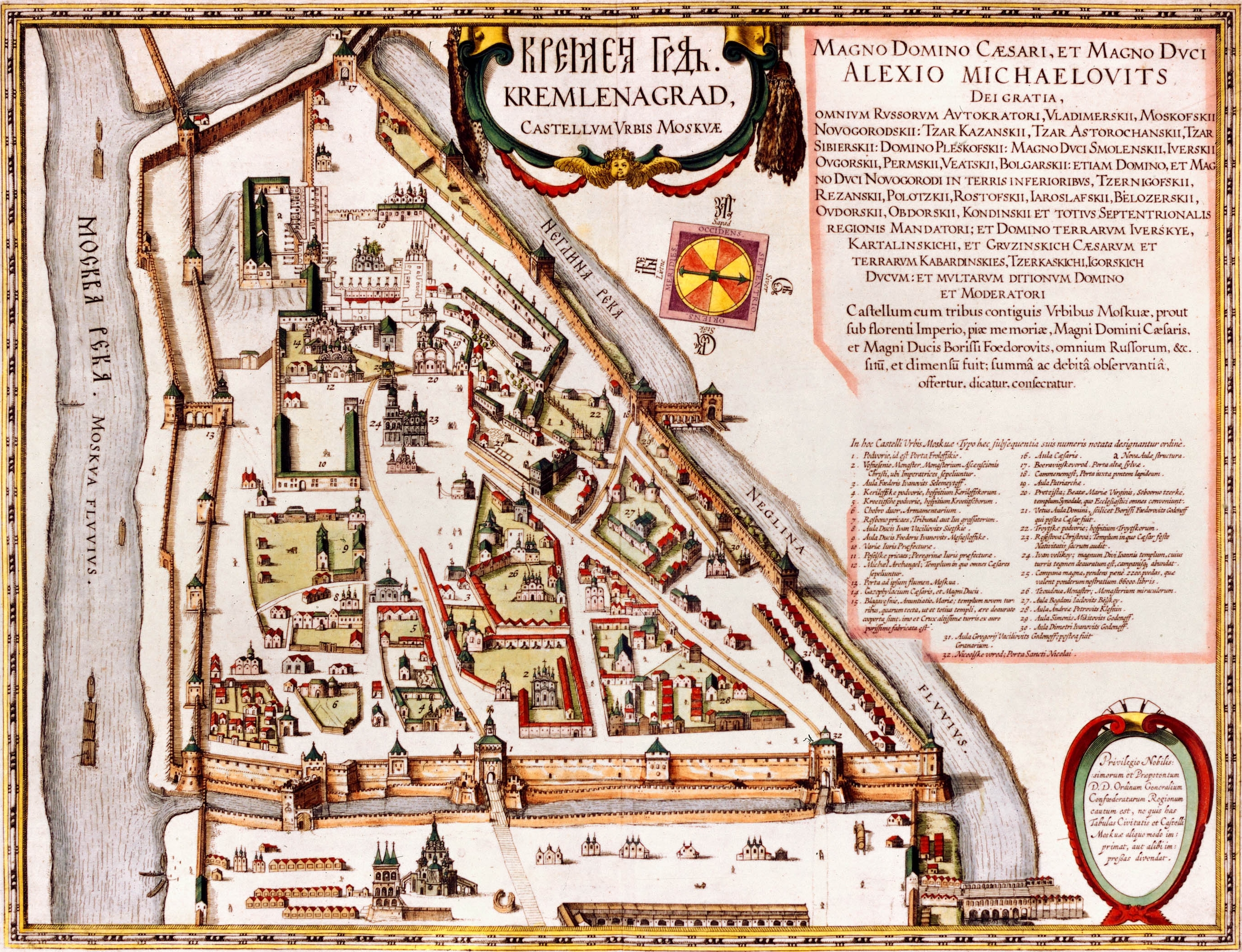 | 2,736 × 2,098 (4.83 MB) | (username removed) |
File usage
The following page uses this file:
