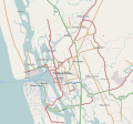
File:Kochi India area locator map.svg

Size of this PNG preview of this SVG file: 220 × 205 pixels. Other resolutions: 257 × 240 pixels | 402 × 375 pixels | 844 × 788 pixels.
Original file (SVG file, nominally 844 × 788 pixels, file size: 851 KB)
File history
Click on a date/time to view the file as it appeared at that time.
| Date/Time | Thumbnail | Dimensions | User | Comment | |
|---|---|---|---|---|---|
| current | 13:12, 28 December 2010 |  | 844 × 788 (851 KB) | wikimediacommons>Bharat S Raj | {{Information |Description={{en|1=Map of Kochi with major roads, railways and water bodies}} |Source=[http://www.openstreetmap.org/ Open Street Map] |Author=Bharat S Raj |Date=2010 - 12 - 28 |Permission= |other_versions= }} [[Catego |
File usage
The following 29 pages use this file:
- 2021–22 Kerala Premier League
- Ambattukavu metro station
- Changampuzha Nagar
- Changampuzha Park
- Changampuzha Park metro station
- Cochin University metro station
- Edakochi
- Edapally metro station
- Elamkulam metro station
- Ernakulam South metro station
- Fort Kochi
- J. L. N. Stadium metro station
- KHCAA Golden Jubilee Chamber Complex
- Kadavanthra metro station
- Kalamassery metro station
- Kaloor metro station
- Kochi
- Lisie Hospital, Kochi
- M. G. Road metro station
- Maharaja's College metro station
- Mulavukad
- Muttom metro station
- Palarivattom metro station
- Pathadipalam metro station
- Pettah metro station
- Thaikoodam metro station
- Town Hall metro station
- Vallarpadam
- Vyttila metro station

