.svg)
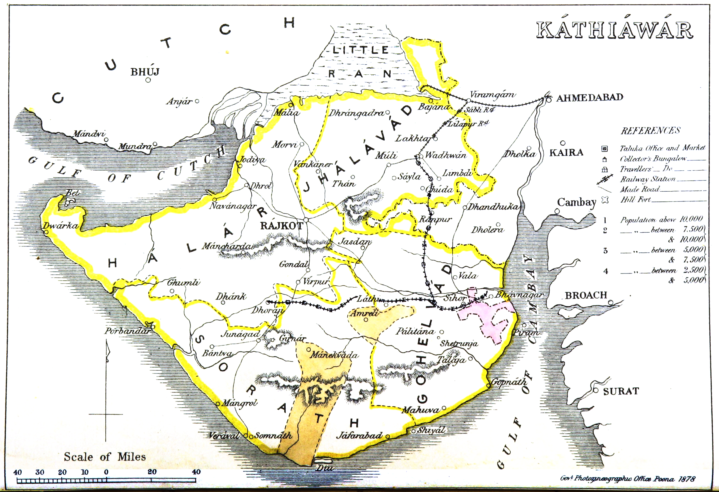
File:Kathiawar map.jpg
Size of this preview: 220 × 151 pixels. Other resolutions: 320 × 219 pixels | 500 × 342 pixels | 2,492 × 1,707 pixels.
Original file (2,492 × 1,707 pixels, file size: 2.87 MB, MIME type: image/jpeg)
Summary
| Description |
English: Map of Kathiawar |
|||||||||
| Date | ||||||||||
| Source | Gazetteer of the Bombay Presidency. (1896) by James M. Campbell | |||||||||
| Creator |
Various |
|||||||||
| Geotemporal data | ||||||||||
| Bounding box |
|
|||||||||
| Georeferencing | ||||||||||
Licensing
|
This work is in the public domain in its country of origin and other countries and areas where the copyright term is the author's life plus 70 years or fewer. This work is in the public domain in the United States because it was published (or registered with the U.S. Copyright Office) before January 1, 1929. | |
| This file has been identified as being free of known restrictions under copyright law, including all related and neighboring rights. | |
File history
Click on a date/time to view the file as it appeared at that time.
| Date/Time | Thumbnail | Dimensions | User | Comment | |
|---|---|---|---|---|---|
| current | 20:49, 5 November 2014 | | 2,492 × 1,707 (2.87 MB) | wikimediacommons>Shyamal | User created page with UploadWizard |
File usage
The following 6 pages use this file: