.svg)
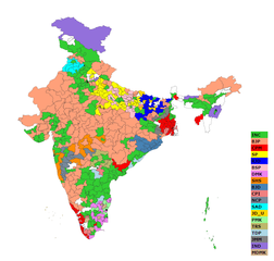
File:Indian Elections 2004 Map.png

Size of this preview: 220 × 210 pixels. Other resolutions: 252 × 240 pixels | 394 × 375 pixels | 713 × 679 pixels.
Original file (713 × 679 pixels, file size: 136 KB, MIME type: image/png)
Summary
| Description |
English: Author: User:Tejas81
Source: GIS Data provided by Election Commission of India Modified using Inkscape, Python scripts. |
| Date | 12 March 2009 (original upload date) |
| Source | Transferred from en.wikipedia |
| Author | Original uploader was Tejas81 at en.wikipedia |
| Permission (Reusing this file) |
CC-BY-3.0. |
Licensing
Tejas81 at en.wikipedia, the copyright holder of this work, hereby publishes it under the following license:
This file is licensed under the Creative Commons Attribution 3.0 Unported license.
Attribution: Tejas81 at en.wikipedia
- You are free:
- to share – to copy, distribute and transmit the work
- to remix – to adapt the work
- Under the following conditions:
- attribution – You must give appropriate credit, provide a link to the license, and indicate if changes were made. You may do so in any reasonable manner, but not in any way that suggests the licensor endorses you or your use.
Original upload log
The original description page was here. All following user names refer to en.wikipedia.
- 2009-03-12 20:24 Tejas81 713×679× (139556 bytes) Author: [[User:Tejas81]] Source: GIS Data provided by Election Commission of India Modified using Inkscape, Python scripts.
- 2009-03-12 20:24 Tejas81 713×679× (139556 bytes) Author: [[User:Tejas81]] Source: GIS Data provided by Election Commission of India Modified using Inkscape, Python scripts.
File history
Click on a date/time to view the file as it appeared at that time.
| Date/Time | Thumbnail | Dimensions | User | Comment | |
|---|---|---|---|---|---|
| current | 20:41, 22 April 2009 | | 713 × 679 (136 KB) | wikimediacommons>Rotsee | {{Information |Description={{en|Author: en:User:Tejas81 Source: GIS Data provided by Election Commission of India Modified using Inkscape, Python scripts.}} |Source=Transferred from [http://en.wikipedia.org en.wikipedia] |Date={{Date|2009|03|12}} ( |
File usage
The following page uses this file: