.svg)
File:India Rajasthan location map.svg

Size of this PNG preview of this SVG file: 220 × 184 pixels. Other resolutions: 286 × 240 pixels | 448 × 375 pixels | 1,093 × 916 pixels.
Original file (SVG file, nominally 1,093 × 916 pixels, file size: 511 KB)
Summary
| Description |
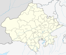
Location map of Rajasthan. Geographic limits of the map:
|
| Date | |
| Source | |
| Author |
|
Licensing
I, the copyright holder of this work, hereby publish it under the following license:
This file is licensed under the Creative Commons Attribution-Share Alike 3.0 Unported license.
- You are free:
- to share – to copy, distribute and transmit the work
- to remix – to adapt the work
- Under the following conditions:
- attribution – You must give appropriate credit, provide a link to the license, and indicate if changes were made. You may do so in any reasonable manner, but not in any way that suggests the licensor endorses you or your use.
- share alike – If you remix, transform, or build upon the material, you must distribute your contributions under the same or compatible license as the original.
File history
Click on a date/time to view the file as it appeared at that time.
| Date/Time | Thumbnail | Dimensions | User | Comment | |
|---|---|---|---|---|---|
| current | 23:37, 28 September 2023 | | 1,093 × 916 (511 KB) | wikimediacommons>C1MM | Added new districts |
File usage
More than 100 pages use this file. The following list shows the first 100 pages that use this file only. A full list is available.
- Albert Hall Museum
- Alwar Junction railway station
- Antah railway station
- Atru railway station
- Bais Godam railway station
- Baran railway station
- Barmer railway station
- Bayana Junction railway station
- Baytu railway station
- Bhagat Ki Kothi railway station
- Bhatner fort
- Bhawani Mandi railway station
- Bidsar
- Bikaner Airport
- Bikaner Junction railway station
- Brijnagar railway station
- Bundi railway station
- Chanderiya railway station
- Chhabra Gugor railway station
- Chhoti Khatu railway station
- Dahar Ka Balaji railway station
- Dakaniya Talav railway station
- Deeg railway station
- Degana Junction railway station
- Didwana railway station
- Dulchasar
- Durgapura railway station
- Fateh Singhpura railway station
- Fatehnagar railway station
- Fatehpur Shekhawati railway station
- Gadra Road railway station
- Gagron Fort
- Getor Jagatpura railway station
- Gosunda Dam
- Gotan railway station
- Gurla Junction railway station
- Hindaun City railway station
- Indragarh Sumerganj Mandi railway station
- Jahaj Mandir
- Jaipur Junction railway station
- Jawai Bandh railway station
- Jhalawar City railway station
- Kalibangan
- Kalisindh Dam
- Kanakpura railway station
- Khandip Dam
- Kirti Stambha
- Kishangarh railway station
- Kolana Airport
- Kota Junction railway station
- Kuchaman City railway station
- Ladnun railway station
- Lakheri railway station
- Lalgarh Airport
- Lalgarh Junction railway station
- Luv Kush Indoor Stadium
- Mahamandir railway station
- Mahi Bajaj Sagar Dam
- Makrana Junction railway station
- Malarna railway station
- Mandalgarh railway station
- Mandawa
- Mathura Das Mathur Hospital
- Mavli Junction railway station
- Merta Road Junction railway station
- Nagaur railway station
- Narayana Multispeciality Hospital, Jaipur
- Narayanpur Tatwara railway station
- Nasirabad railway station
- Nathdwara railway station
- Nawa City railway station
- Nim Ka Thana railway station
- Nimbahera railway station
- Nokha railway station
- Phalodi Junction railway station
- Phulera Junction railway station
- Pindwara railway station
- Pokaran railway station
- Pushkar Terminus
- Raj Mandir Cinema, Jaipur
- Ramdevra railway station
- Rana Pratap Nagar railway station
- Ratangarh Junction railway station
- Ringas Junction railway station
- Rupbas railway station
- Sadri
- Sadulpur Junction railway station
- Salpura railway station
- Sambhar Lake Town railway station
- Samdari Junction railway station
- Santokba Durlabhji Memorial hospital
- Sawai Madhopur Junction railway station
- Sawai Man Singh Hospital
- Shambhupura railway station
- Shree Pavapuri Tirth Dham
- Shri Ganganagar Junction railway station
- Shri Madhopur railway station
- Shri Mahabirji railway station
- Sikar Junction railway station
- Sujangarh railway station
View more links to this file.