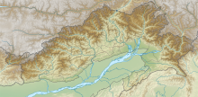
File:India Arunachal Pradesh relief map.svg

Size of this PNG preview of this SVG file: 220 × 108 pixels. Other resolutions: 320 × 158 pixels | 500 × 246 pixels | 1,685 × 830 pixels.
Original file (SVG file, nominally 1,685 × 830 pixels, file size: 2.21 MB)
Summary
| Description |
English: Relief map of Arunachal Pradesh.
Bounds
|
| Date | |
| Source | Derivative of File:India Arunachal Pradesh location map.svg |
| Author | Own work based on Abhijitsathe |
Licensing
This file is licensed under the Creative Commons Attribution-Share Alike 3.0 Unported license.
- You are free:
- to share – to copy, distribute and transmit the work
- to remix – to adapt the work
- Under the following conditions:
- attribution – You must give appropriate credit, provide a link to the license, and indicate if changes were made. You may do so in any reasonable manner, but not in any way that suggests the licensor endorses you or your use.
- share alike – If you remix, transform, or build upon the material, you must distribute your contributions under the same or compatible license as the original.
File history
Click on a date/time to view the file as it appeared at that time.
| Date/Time | Thumbnail | Dimensions | User | Comment | |
|---|---|---|---|---|---|
| current | 08:12, 16 July 2021 | | 1,685 × 830 (2.21 MB) | wikimediacommons>C1MM | Corrected relief |
File usage
The following page uses this file: