File:Fort Delaware LOC 384066pu.jpg

Original file (3,867 × 3,025 pixels, file size: 1.68 MB, MIME type: image/jpeg)

This file is from a shared repository and may be used by other projects. The description on its file description page there is shown below.

This is an image of a place or building that is listed on the National Register of Historic Places in the United States of America. Its reference number is 71000226 (Wikidata).

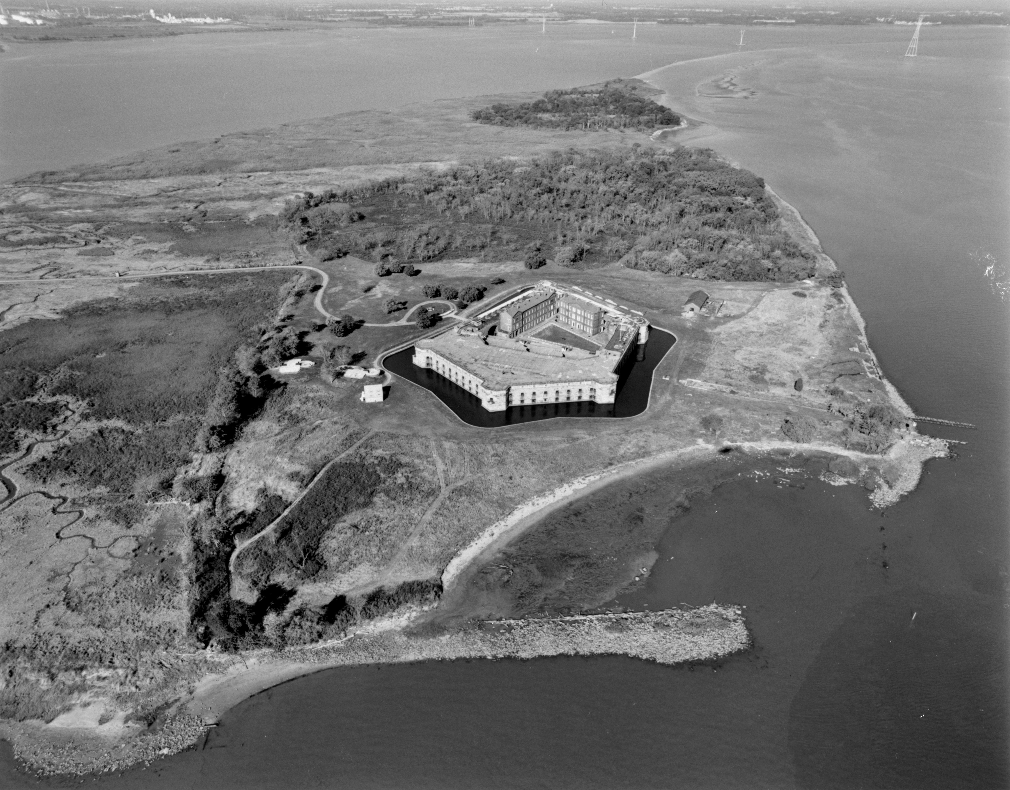
DescriptionFort Delaware LOC 384066pu.jpg NORTHWEST OBLIQUE AERIAL VIEW OF FORT DELAWARE AND PEA PATCH ISLAND. REMAINS OF SEA WALL VISIBLE IN FOREGROUND AND RIGHT OF IMAGE. HAER DEL,2-DELAC.V,1A-1 Photo taken in October, 1998.
Date
Source
 
This image is available from the United States Library of Congress's Prints and Photographs division
under the digital ID hhh.de0498.
This tag does not indicate the copyright status of the attached work. A normal copyright tag is still required. See Commons:Licensing.

العربية  беларуская (тарашкевіца)  বাংলা  čeština  Deutsch  English  español  فارسی  suomi  français  galego  עברית  magyar  Bahasa Indonesia  Ido  italiano  日本語  Bahaso Melayu Jambi  lietuvių  македонски  മലയാളം  Nederlands  polski  português  português do Brasil  română  русский  sicilianu  slovenčina  slovenščina  Türkçe  українська  中文  中文(简体)  中文(繁體)  +/−

Author Michael Swanda, U.S. Army Corps of Enginers
Permission
(Reusing this file)
Public domainPublic domainfalsefalse
Public domain
This image or file is a work of a U.S. Army Corps of Engineers soldier or employee, taken or made as part of that person's official duties. As a work of the U.S. federal government, the image is in the public domain.

English | italiano | Nederlands | پښتو | русский | sicilianu | slovenščina | Türkçe | українська | +/−

Public domainPublic domainfalsefalse
Public domain This image or media file contains material based on a work of a National Park Service employee, created as part of that person's official duties. As a work of the U.S. federal government, such work is in the public domain in the United States. See the NPS website and NPS copyright policy for more information.
Object location39° 35′ 24″ N, 75° 34′ 19″ W Kartographer map based on OpenStreetMap.View this and other nearby images on: OpenStreetMapinfo 39.590000; -75.571944

Captions

Add a one-line explanation of what this file represents

Items portrayed in this file

depicts

October 1998

39°35'24"N, 75°34'12"W

File history

Click on a date/time to view the file as it appeared at that time.

Date/TimeThumbnailDimensionsUserComment
current06:24, 6 May 2007Thumbnail for version as of 06:24, 6 May 20073,867 × 3,025 (1.68 MB)smartcommons>Balcer~commonswikiORTHWEST OBLIQUE AERIAL VIEW OF FORT DELAWARE AND PEA PATCH ISLAND. REMAINS OF SEA WALL VISIBLE IN FOREGROUND AND RIGHT OF IMAGE. HAER DEL,2-DELAC.V,1A-1 {{LOC-image|id=hhh.de0498}} == Licensing == {{HAER|DEL,2-DELAC.V,1A-}}

The following page uses this file: