.svg)
File:Dromaius novaehollandiae map distribution 2.svg

Size of this PNG preview of this SVG file: 220 × 179 pixels. Other resolutions: 295 × 240 pixels | 460 × 375 pixels | 1,108 × 903 pixels.
Original file (SVG file, nominally 1,108 × 903 pixels, file size: 114 KB)
Summary
| Description |
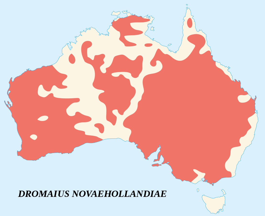
English: Emu's recorded observations map (Dromaius Novaehollandiae).
Areas where emu has been recorded. Français : Carte d'observations de l'Émeu d'Australie (Dromaius Novaehollandiae).
Zones où des émeus ont été observés. |
| SVG development | |
| Attribution (required by the license) | © Sémhur / Wikimedia Commons / |
| Date | |
| Source |
English:
Français : |
| Creator | |
| Geotemporal data | |
| Heading |
 |
| Georeferencing | If inappropriate please set warp_status = skip to hide. |
| Camera location | | View this and other nearby images on: OpenStreetMap |
|---|
Licensing
I, the copyright holder of this work, hereby publish it under the following licenses:
Copyleft: This work of art is free; you can redistribute it and/or modify it according to terms of the Free Art License. You will find a specimen of this license on the Copyleft Attitude site as well as on other sites.
|
This file is licensed under the Creative Commons Attribution-Share Alike 4.0 International, 3.0 Unported, 2.5 Generic, 2.0 Generic and 1.0 Generic license.
- You are free:
- to share – to copy, distribute and transmit the work
- to remix – to adapt the work
- Under the following conditions:
- attribution – You must give appropriate credit, provide a link to the license, and indicate if changes were made. You may do so in any reasonable manner, but not in any way that suggests the licensor endorses you or your use.
- share alike – If you remix, transform, or build upon the material, you must distribute your contributions under the same or compatible license as the original.
You may select the license of your choice.
File history
Click on a date/time to view the file as it appeared at that time.
| Date/Time | Thumbnail | Dimensions | User | Comment | |
|---|---|---|---|---|---|
| current | 20:39, 25 June 2007 | | 1,108 × 903 (114 KB) | wikimediacommons>Sémhur | better coast lines |
File usage
The following page uses this file: