


File:DojiBaraFamineInJoppen1907India1795a.jpg

Original file (828 × 1,200 pixels, file size: 209 KB, MIME type: image/jpeg)

Summary
| Description |
Doji bara famine shown on Map of India in 1795 from: |
|---|---|
| Source |
Joppen, Charles [SJ.] (1907), A Historical Atlas of India for the use of High-Schools, Colleges, and Private Students, London, New York, Bombay, and Calcutta: Longman Green and Co. Pp. 16, 26 maps. Scanned from personal copy, famine region drawn, reduced, uploaded by Fowler&fowler«Talk» 06:04, 19 February 2011 (UTC); Drawing on map (I (Fowler&fowler«Talk») created the drawing entirely by myself). |
| Date |
1907 for the map (06:04, 19 February 2011 (UTC) for the drawing on the map) |
| Author |
Justus Perthes, Gotha./Charles Joppen; drawing on map by Fowler&fowler«Talk» |
| Permission (Reusing this file) |
See below.
|

PD-US Public domain in the United States //en.wikipedia.org/wiki/File:DojiBaraFamineInJoppen1907India1795a.jpg false false


This file might not be in the public domain outside the United States and should not be transferred to Wikimedia Commons unless it can be verified to be in the public domain in its country of first publication and that at least 70 years have elapsed since the author died. Commons requires that images be free in the source country and in the United States.
If this file is in the public domain outside the United States, add
|pdsource=yes to this template to hide this warning.If this file is not in the public domain in the source country but will become so in the future, add
|out_of_copyright_in= and then the year its copyright will expire.Licensing


GFDL GNU Free Documentation License //en.wikipedia.org/wiki/Wikipedia:Text_of_the_GNU_Free_Documentation_License true true
File history
Click on a date/time to view the file as it appeared at that time.
| Date/Time | Thumbnail | Dimensions | User | Comment | |
|---|---|---|---|---|---|
| current | 11:34, 19 February 2011 | 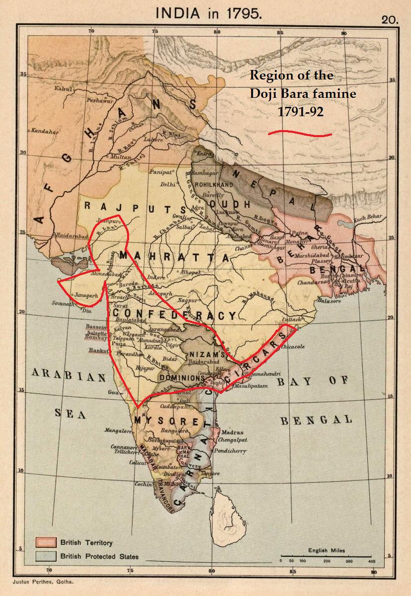 | 828 × 1,200 (209 KB) | smartcommons-wikipedia-en>Fowler&fowler | {{Information |Description = Doji bara famine shown on Map of India in 1795 from: Joppen, Charles [SJ.] (1907), A Historical Atlas of India for the use of High-Schools, Colleges, and Private Students, London, New York, Bombay, and Calcutta: Longman Gr |
File usage
The following page uses this file:
