.svg)
File:Descobrimentos e explorações portuguesesV2.png

Size of this preview: 220 × 102 pixels. Other resolutions: 320 × 148 pixels | 500 × 231 pixels | 1,357 × 628 pixels.
Original file (1,357 × 628 pixels, file size: 211 KB, MIME type: image/png)
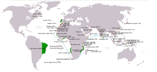
- English: Portuguese discoveries & explorations V2
| Description |
|
| Date | (UTC) |
| Source | |
| Author |
|
| Permission (Reusing this file) |
Creative Commons Attribution-Share Alike 3.0 Unported license |
| Other versions | (en) File:Portuguese discoveries and explorationsV2en.png |
| This is a retouched picture, which means that it has been digitally altered from its original version. Modifications: searoutes and dates corrected. The original can be viewed here: Descobrimentos e explorações portugueses.png: File:Descobrimentos e explorações portugueses.png. Modifications made by Uxbona.
|
I, the copyright holder of this work, hereby publish it under the following license:

|
Permission is granted to copy, distribute and/or modify this document under the terms of the GNU Free Documentation License, Version 1.2 or any later version published by the Free Software Foundation; with no Invariant Sections, no Front-Cover Texts, and no Back-Cover Texts. A copy of the license is included in the section entitled GNU Free Documentation License. |
| This file is licensed under the Creative Commons Attribution-Share Alike 3.0 Unported license. | ||
| ||
| This licensing tag was added to this file as part of the GFDL licensing update. |
Original upload log
This image is a derivative work of the following images:
- File:Descobrimentos_e_explorações_portugueses.png licensed with GFDL
Uploaded with derivativeFX
File history
Click on a date/time to view the file as it appeared at that time.
| Date/Time | Thumbnail | Dimensions | User | Comment | |
|---|---|---|---|---|---|
| current | 04:00, 14 June 2011 | | 1,357 × 628 (211 KB) | wikimediacommons>Uxbona | (Corrigida posição do reino do Sião/Tailândia; Acrescentar chegadas a Pegu, Sumatra e Cochinchina (Da Nang) ) |
File usage
The following 3 pages use this file: