


File:Brittain 410.jpg

Size of this preview: 220 × 296 pixels. Other resolutions: 178 × 240 pixels | 1,111 × 1,497 pixels.
Original file (1,111 × 1,497 pixels, file size: 369 KB, MIME type: image/jpeg)

Summary
Map of the isle Great Britain in the year 410. Image comes from the Historical Maps of Europe at University of Texas at Austin The work is from From The Historical Atlas by William R. Shepherd, 1926.
Map is released into the public Domain.
Licensing
| Public domainPublic domainfalsefalse |

|
This work is in the public domain in its country of origin and other countries and areas where the copyright term is the author's life plus 70 years or fewer.  You must also include a United States public domain tag to indicate why this work is in the public domain in the United States. You must also include a United States public domain tag to indicate why this work is in the public domain in the United States.
|
| This file has been identified as being free of known restrictions under copyright law, including all related and neighboring rights. | |
https://creativecommons.org/publicdomain/mark/1.0/PDMCreative Commons Public Domain Mark 1.0falsefalse
Captions
Add a one-line explanation of what this file represents
File history
Click on a date/time to view the file as it appeared at that time.
| Date/Time | Thumbnail | Dimensions | User | Comment | |
|---|---|---|---|---|---|
| current | 20:54, 3 December 2005 | 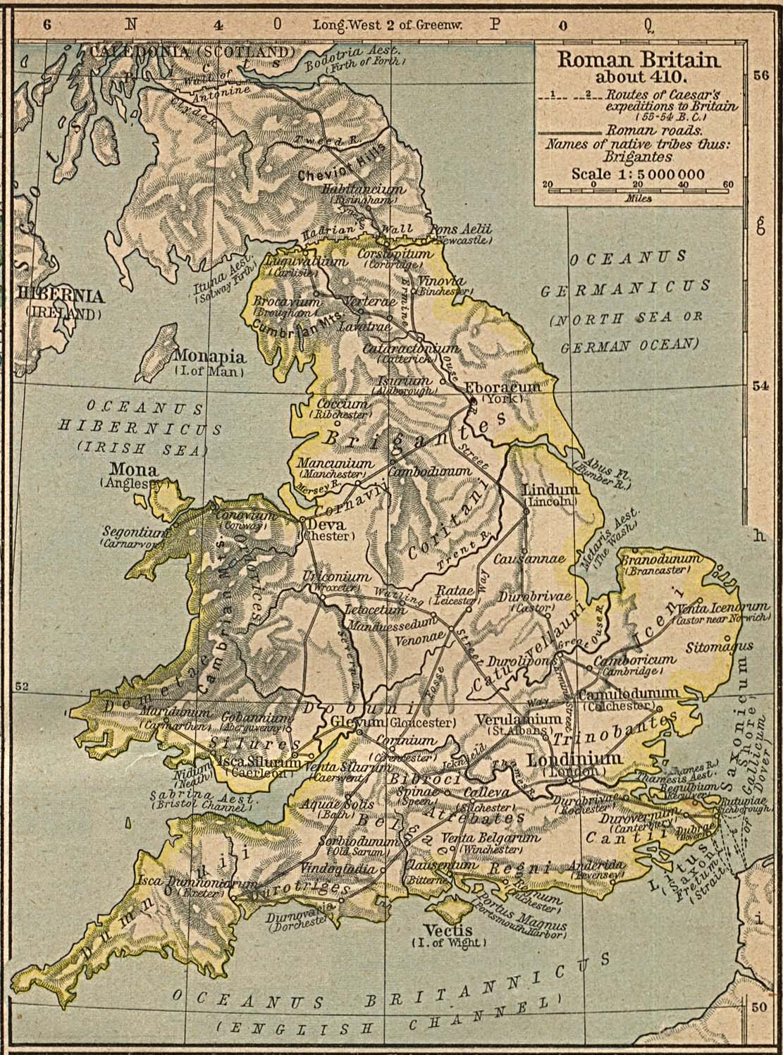 | 1,111 × 1,497 (369 KB) | smartcommons>Migdejong | Map of the isle Great Brittain in the year 410. Image comes from the University of Texas at Austin: http://geography.about.com/gi/dynamic/offsite.htm?site=http://www.lib.utexas.edu/maps/historical/history%5Feurope.html Map is released into the publi |
File usage
The following page uses this file:
