
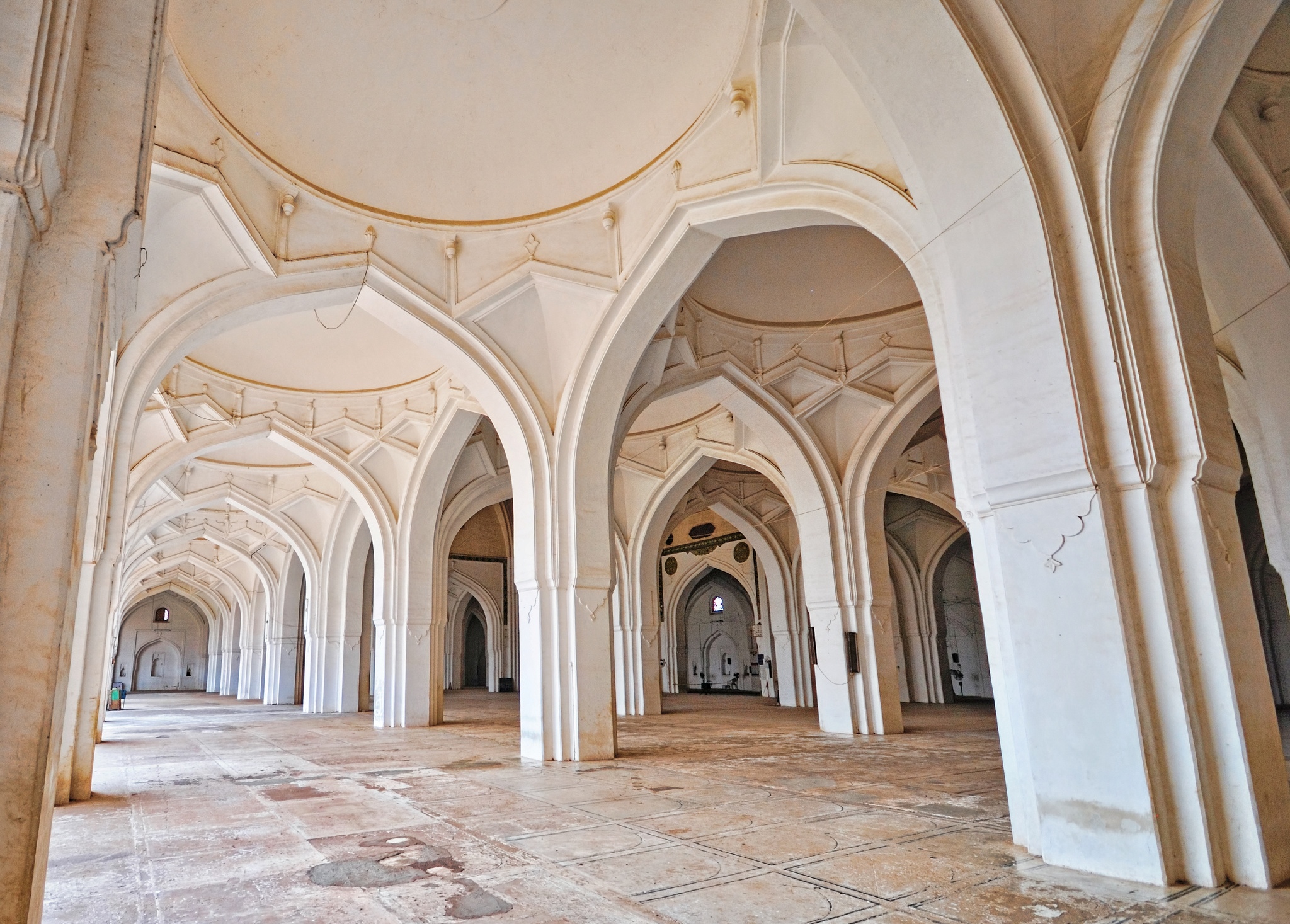
File:Arches -2, Jama Masjid, Bijapur, Karnataka.jpg
Size of this preview: 220 × 158 pixels. Other resolutions: 320 × 229 pixels | 2,048 × 1,467 pixels.
Original file (2,048 × 1,467 pixels, file size: 1.15 MB, MIME type: image/jpeg)
Summary
| Camera location |  | View this and other nearby images on: OpenStreetMap |  16.822008; 75.728706 16.822008; 75.728706 |
|---|
| DescriptionArches -2, Jama Masjid, Bijapur, Karnataka.jpg |
English: Bijapur Jama Masjid, built between 1557 and 1686, is the largest and the first constructed mosque in Bijapur, Karnataka. One of the finest mosques in India, it is a massive structure with huge onion-shaped domes.
It was constructed during the period of Adil Shah I, a ruler of Adil Shahi Kingdom, to commemorate the Talikota victory. Later during the reign of the Mughal Emperor Aurangzeb, many alterations were made and a gateway was erected on the eastern side. He also painted the floor with 2,250 squares for the worshippers. Jama Masjid holds a copy of Koran, written in gold. It also has a large hall that is divided into 45 compartments. The Barah Cummon created with twelve interleaving arches is where programs are staged.
|
||
| Date | Taken on 11 March 2010 | ||
| Source | Own work | ||
| Author | Mukul Banerjee |


Licensing
I, the copyright holder of this work, hereby publish it under the following license:


This file is licensed under the Creative Commons Attribution-Share Alike 3.0 Unported license.
- You are free:
- to share – to copy, distribute and transmit the work
- to remix – to adapt the work
- Under the following conditions:
- attribution – You must give appropriate credit, provide a link to the license, and indicate if changes were made. You may do so in any reasonable manner, but not in any way that suggests the licensor endorses you or your use.
- share alike – If you remix, transform, or build upon the material, you must distribute your contributions under the same or compatible license as the original.

|
This image was uploaded as part of Wiki Loves Monuments 2012.
|
 |
Captions
Add a one-line explanation of what this file represents
File history
Click on a date/time to view the file as it appeared at that time.
| Date/Time | Thumbnail | Dimensions | User | Comment | |
|---|---|---|---|---|---|
| current | 22:22, 4 September 2012 | | 2,048 × 1,467 (1.15 MB) | smartcommons>Mukulb | User created page with UploadWizard |
File usage
The following page uses this file:
