.svg)
File:Andhra Pradesh and Telangana Physical.jpeg
Original file (2,598 × 2,244 pixels, file size: 796 KB, MIME type: image/jpeg)

|
This map image could be re-created using vector graphics as an SVG file. This has several advantages; see Commons:Media for cleanup for more information. If an SVG form of this image is available, please upload it and afterwards replace this template with
{{vector version available|new image name}}.
It is recommended to name the SVG file “Andhra Pradesh and Telangana Physical.svg”—then the template Vector version available (or Vva) does not need the new image name parameter. |


Summary
| Description |
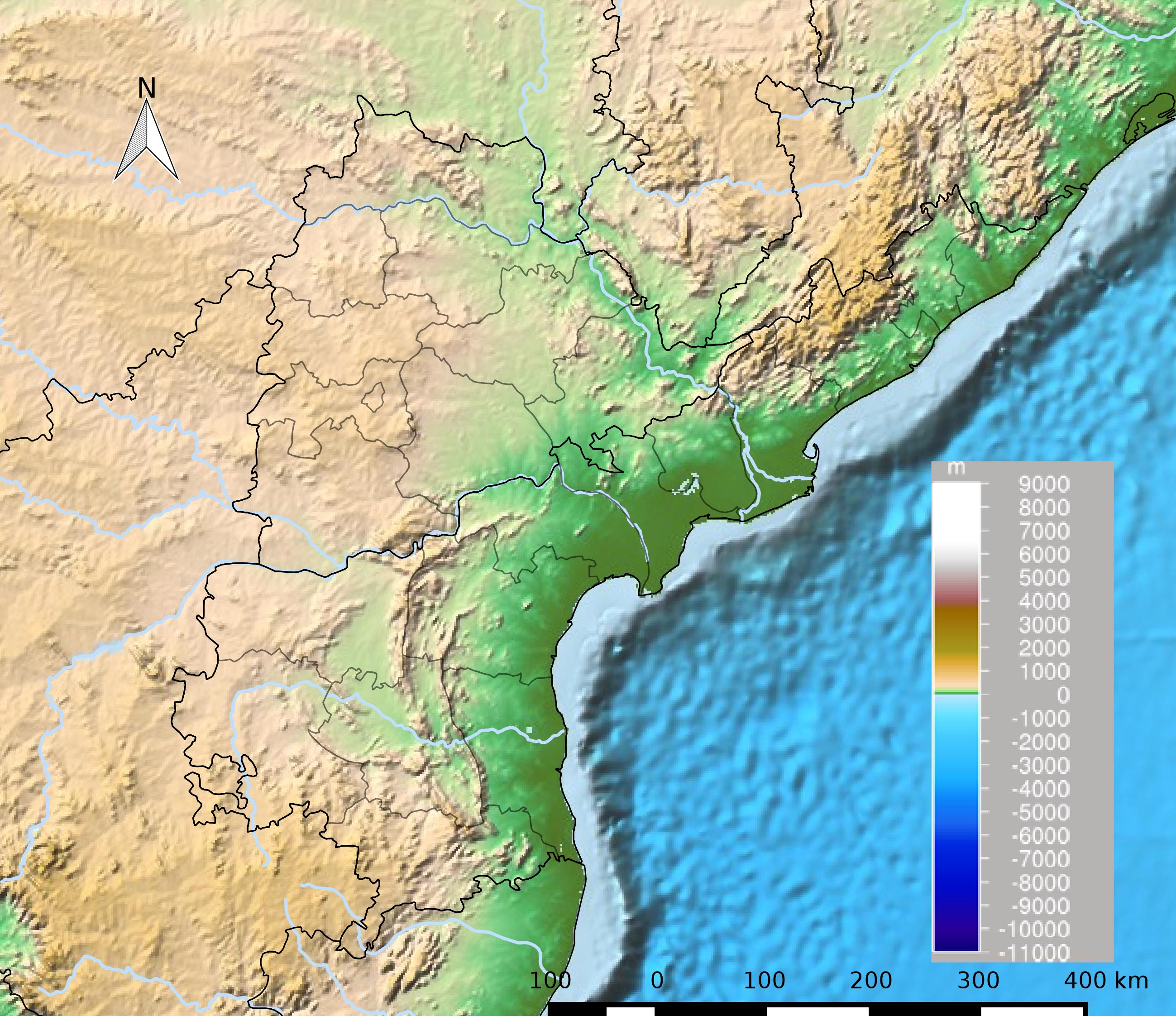
English: Physical map of Andhra Pradesh and Telangana in India తెలుగు: ఆంధ్ర ప్రదేశ్ మరియు తెలంగాణ భౌతిక పటము |
| Date | |
| Source | Own work |
| Author | Arjunaraoc |
Inputs:
1) India State and District maps from http://mnre.gov.in/sec/solar-assmnt.htm https://mnre.gov.in/india-solar-resource-maps (archive url), copyright policy free for any use with attribution accessed 2015-03-19 (archive link )
2) Topo/bathymetry visual from Etopo1 (Amante, C. and B.W. Eakins, 2009. ETOPO1 1 Arc-Minute Global Relief Model: Procedures, Data Sources and Analysis. NOAA Technical Memorandum NESDIS NGDC-24. National Geophysical Data Center, NOAA. doi:10.7289/V5C8276M (accessed 19 Mar 2015)
3)River shapes from Natural Earth (http://naciscdn.org/naturalearth/packages/Natural_Earth_quick_start.zip)
Boundaries of Telangana and Andhra Pradesh as per the erstwhile regions of Undivided Andhra Pradesh
Processing QGIS wien 2.8 Projection:EPSG32644
.jgw contents(6 lines) 423.402618 0.000000 0.000000 -423.351159 -118036.929990 2294375.076006
Licensing
- You are free:
- to share – to copy, distribute and transmit the work
- to remix – to adapt the work
- Under the following conditions:
- attribution – You must give appropriate credit, provide a link to the license, and indicate if changes were made. You may do so in any reasonable manner, but not in any way that suggests the licensor endorses you or your use.
- share alike – If you remix, transform, or build upon the material, you must distribute your contributions under the same or compatible license as the original.
File history
Click on a date/time to view the file as it appeared at that time.
| Date/Time | Thumbnail | Dimensions | User | Comment | |
|---|---|---|---|---|---|
| current | 17:29, 20 March 2015 | | 2,598 × 2,244 (796 KB) | wikimediacommons>Arjunaraoc | User created page with UploadWizard |
File usage
The following 2 pages use this file: