.svg)
File:Andhra-India 1953.svg

Size of this PNG preview of this SVG file: 220 × 266 pixels. Other resolutions: 199 × 240 pixels | 311 × 375 pixels | 979 × 1,182 pixels.
Original file (SVG file, nominally 979 × 1,182 pixels, file size: 188 KB)
Summary
| Description |
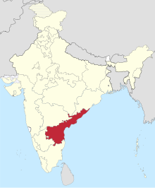
Deutsch: Einfache Positionskarte des Bundesstaates Andhra in Indien (1953-56). Français : Localisation de l'Etat de Andhra en Inde 1953-56. English: Localisation of Andhra state in India, 1953-56. |
||
| Date | |||
| Source |
This file was derived from: Madhya Bharat-India 1951.svg |
||
| Author | Furfur | ||
| Permission (Reusing this file) |
I, the copyright holder of this work, hereby publish it under the following licenses:
This file is licensed under the Creative Commons Attribution-Share Alike 4.0 International license.
You may select the license of your choice. |

File history
Click on a date/time to view the file as it appeared at that time.
| Date/Time | Thumbnail | Dimensions | User | Comment | |
|---|---|---|---|---|---|
| current | 22:02, 7 September 2015 | | 979 × 1,182 (188 KB) | wikimediacommons>Furfur | =={{int:filedesc}}== {{Information |Description={{de|1=Einfache Positionskarte des Bundesstaates Andhra in Indien (1953-56).}}{{fr|1=Localisation de l'Etat de Andhra en Inde 1953-56.}}{{en|1=Localisation of Andhra state in India, 1953-56.}} |Source={{D... |
File usage
The following 2 pages use this file: