


File:Anand Gujarat map.svg

Size of this PNG preview of this SVG file: 220 × 177 pixels. Other resolution: 298 × 240 pixels.
Original file (SVG file, nominally 620 × 500 pixels, file size: 114 KB)

Summary
| DescriptionAnand Gujarat map.svg | |
| Date | 18/06/23 |
| Source | Own work |
| Author | User:DSP2092 |
| Permission (Reusing this file) |
I, the copyright holder of this work, hereby publish it under the following license:    This file is licensed under the Creative Commons Attribution-Share Alike 4.0 International license.
|
Captions
Add a one-line explanation of what this file represents
File history
Click on a date/time to view the file as it appeared at that time.
| Date/Time | Thumbnail | Dimensions | User | Comment | |
|---|---|---|---|---|---|
| current | 11:49, 18 June 2023 | 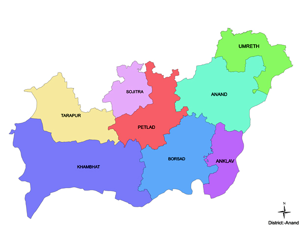 | 620 × 500 (114 KB) | smartcommons>DSP2092 | == {{int:filedesc}} == {{Information | Description = {{en|Anand district with taluka (sub-district).}} | Source = {{own}} | Author = User:DSP2092 | Date = 18/06/23 | Permission = {{self|cc-by-sa-4.0}} | other_versions = }} Category:Districts of Gujarat with Taluks |
File usage
There are no pages that use this file.
