.svg)
File:Abbasid Caliphate 850AD.png
Size of this preview: 220 × 137 pixels. Other resolutions: 320 × 199 pixels | 500 × 311 pixels | 2,163 × 1,345 pixels.
Original file (2,163 × 1,345 pixels, file size: 798 KB, MIME type: image/png)
Summary
| Description |
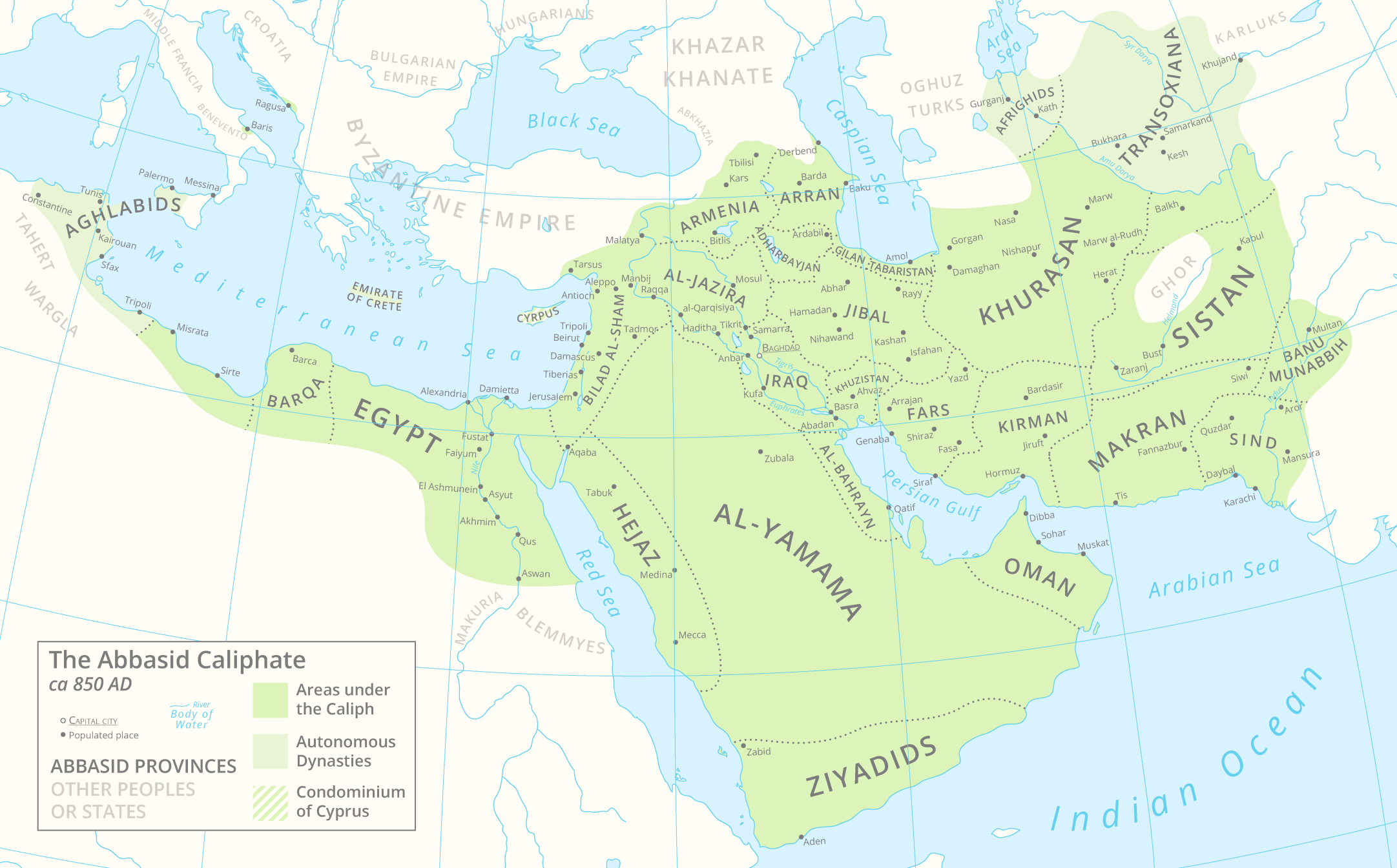
English: A map of the Abbasid Caliphate around 850 AD featuring provinces and settlements. |
| Date | |
| Source |
Own work.
This PNG graphic was created with Adobe Illustrator. |
| Author | Cattette |
| Other versions | العربيَّة |
Licensing
I, the copyright holder of this work, hereby publish it under the following license:
This file is licensed under the Creative Commons Attribution 4.0 International license.
- You are free:
- to share – to copy, distribute and transmit the work
- to remix – to adapt the work
- Under the following conditions:
- attribution – You must give appropriate credit, provide a link to the license, and indicate if changes were made. You may do so in any reasonable manner, but not in any way that suggests the licensor endorses you or your use.
File history
Click on a date/time to view the file as it appeared at that time.
| Date/Time | Thumbnail | Dimensions | User | Comment | |
|---|---|---|---|---|---|
| current | 18:35, 29 March 2021 | | 2,163 × 1,345 (798 KB) | wikimediacommons>Cattette | Tweaked provinces, added Arabia |
File usage
The following 2 pages use this file: