.svg)

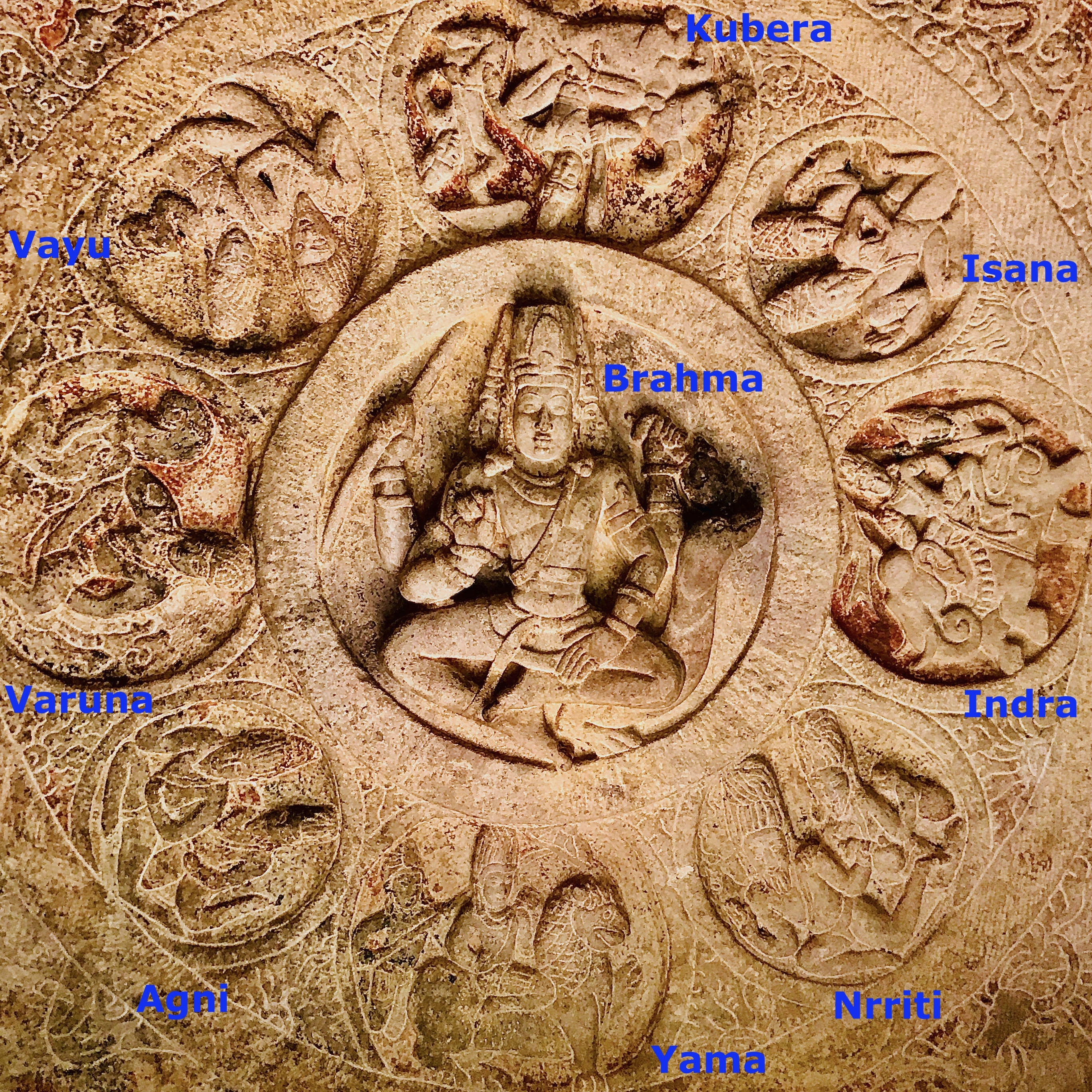
File:578 CE Dikpalas, rock cut Badami Cave 3 ceiling.jpg
Size of this preview: 220 × 220 pixels. Other resolutions: 240 × 240 pixels | 375 × 375 pixels | 2,735 × 2,735 pixels.
Original file (2,735 × 2,735 pixels, file size: 4.97 MB, MIME type: image/jpeg)
Summary
| Description |
English: Badami caves are located in Badami, Karnataka, India. Inscriptions here help date two of these caves to the 6th-century, while parts of the third cave and the most of the fourth is likely from the 7th-century. All were likely complete in 6th to 7th century, with some additions to the Jain caves likely in early 8th century.
|
| Date | |
| Source | Own work |
| Author | Ms Sarah Welch |
| Camera location | | View this and other nearby images on: OpenStreetMap |
|---|
Licensing
I, the copyright holder of this work, hereby publish it under the following license:
| This file is made available under the Creative Commons CC0 1.0 Universal Public Domain Dedication. | |
| The person who associated a work with this deed has dedicated the work to the public domain by waiving all of their rights to the work worldwide under copyright law, including all related and neighboring rights, to the extent allowed by law. You can copy, modify, distribute and perform the work, even for commercial purposes, all without asking permission.
|
| Annotations | This image is annotated: View the annotations at Commons |
File history
Click on a date/time to view the file as it appeared at that time.
| Date/Time | Thumbnail | Dimensions | User | Comment | |
|---|---|---|---|---|---|
| current | 19:49, 3 August 2023 | | 2,735 × 2,735 (4.97 MB) | wikimediacommons>Shizhao | Cropped 7 % horizontally, 7 % vertically using CropTool with precise mode. Removed border. |
File usage
The following page uses this file: