
File:Toda Hut.JPG

Size of this preview: 220 × 165 pixels. Other resolutions: 320 × 240 pixels | 1,280 × 960 pixels.
Original file (1,280 × 960 pixels, file size: 648 KB, MIME type: image/jpeg)
Summary
Photographed by self (Pratheepps)
| DescriptionToda Hut.JPG |
English: Hut of Toda tribe (Nilgiris, India)
Français : Hutte traditionelle Toda. Les Todas sont une ethnie du sud de l'Inde, vivant dans les monts Nilgiris, à la frontière du Kérala et du Tamil Nadu.
Español: Choza típica del pueblo Toda, pequeña tribu pastoral de menos de 1.000 personas que residen en las colinas Nilgiri, en el sur de India. |
| Source | www.pratheep.com |
| Author | Pratheepps |
| Permission (Reusing this file) |
You may use this photograph taken by me based on the above mentioned license. For clarifications , you can always contact me contact-at-pratheep-dot-com. |
| Camera location |  | View this and other nearby images on: OpenStreetMap |  11.420000; 76.715556 11.420000; 76.715556 |
|---|
Assessment
|


|
This image was selected as picture of the day on Wikimedia Commons for 27 June 2006. It was captioned as follows: Other languages:
Cymraeg: Caban o'r tylwyth Toda (Nilgiris, India). Magyar: A Toda törzs jellegzetes kunyhója (Nilgiris, India) Svenska: En hydda hos Todastammen i Nilgiris i Indien. Türkçe: Hindistan'da Toda kabilesine ait bir kulübe Русский: Хижина племени тода (Нилгирис, Индия). 한국어: 인도 닐기리스 지방의 토다 족 오두막 العربية : كوخ لقبيلة تودا (نيلغيرز، الهند) |
|
|
This image was selected as picture of the day on Bengali Wikipedia.
|
Licensing


This file is licensed under the Creative Commons Attribution-Share Alike 3.0 Unported license.
Attribution:
- You are free:
- to share – to copy, distribute and transmit the work
- to remix – to adapt the work
- Under the following conditions:
- attribution – You must give appropriate credit, provide a link to the license, and indicate if changes were made. You may do so in any reasonable manner, but not in any way that suggests the licensor endorses you or your use.
- share alike – If you remix, transform, or build upon the material, you must distribute your contributions under the same or compatible license as the original.
Captions
Hut of Toda tribe, Nilgiris, India
File history
Click on a date/time to view the file as it appeared at that time.
| Date/Time | Thumbnail | Dimensions | User | Comment | |
|---|---|---|---|---|---|
| current | 02:10, 24 March 2006 | 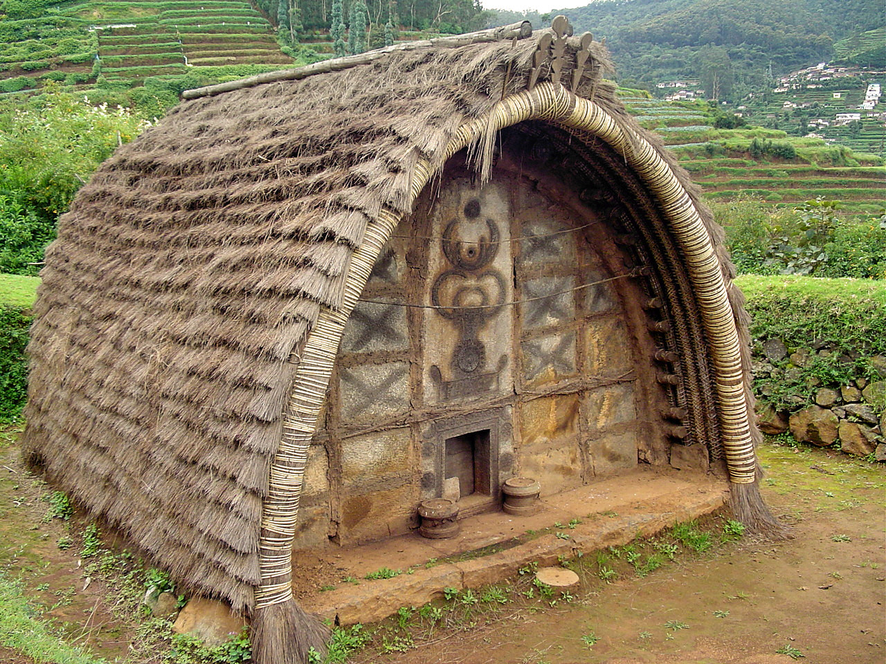 | 1,280 × 960 (648 KB) | (username removed) |
File usage
The following 38 pages use this file:
- Bandipur National Park
- Catherine Falls
- Chaitya
- Doddabetta
- Dolphin's Nose, Coonoor
- Droog Fort, Coonoor
- Emerald Lake (Ooty)
- Frog Hill View Point
- Gori shola
- Government Botanical Gardens, Ooty
- Government Rose Garden, Ooty
- Indian vernacular architecture
- Kalhatti Falls (Ooty)
- Kamaraj Sagar Dam
- Katary Falls
- Kodanad View Point
- Lady Canning's Seat, Coonoor
- Law's Falls, Coonoor
- Mudumalai National Park
- Needle Rock View Point
- Nilgiri Mountain Railway
- Ooty
- Ooty Golf Course
- Ooty Lake
- Ooty Racecourse
- Ooty Radio Telescope
- Pykara
- Rangaswamy Peak and Pillar
- Sim's Park, Coonoor
- Stone House, Ooty
- Summer Festival in The Nilgiris
- Toda people
- Upper Bhavani
- Valley View, Ooty
- Western Catchments
- Template:Tourism in The Nilgiris
- Portal:India/Recognized content
- Portal:India/SC Summary/SP Toda Tribal Hut
