


File:Timezones optimized.png

Size of this preview: 220 × 91 pixels. Other resolutions: 320 × 133 pixels | 4,779 × 1,979 pixels.
Original file (4,779 × 1,979 pixels, file size: 960 KB, MIME type: image/png)


|
This file has been superseded by World Time Zones Map.png. It is recommended to use the other file. Please note that deleting superseded images requires consensus. Reason to use the other file: "The new image is more up-to-date including Time Zones changes."
|

|
Summary
Original Source: CIA World Factbook archive copy at the Wayback Machine
Modified by: User:Chochopk adding DST start/end information (originally Image:Timezones Better.gif)
Modified by: User:Jamadagni by reducing the size of the GIF file by one-third by converting it to PNG. Added UN-recognized dispute borders to India/Pakistan and India
English: This file was created for 2005. As of 2006, it is already out of date. Known discrepancy includes (but not limited to) Indiana U.S.A, Brazil, West Australia, and Sri Lanka. See en:Time in Indiana and en:Time in Australia.
Licensing
| Public domainPublic domainfalsefalse |

|
This image is in the public domain because it contains materials that originally came from the United States Central Intelligence Agency's World Factbook.
|
 |
Format
Two SVG versions of a more up-to-date version of this image are available here and here


Captions
Add a one-line explanation of what this file represents
File history
Click on a date/time to view the file as it appeared at that time.
| Date/Time | Thumbnail | Dimensions | User | Comment | |
|---|---|---|---|---|---|
| current | 20:32, 13 June 2015 | 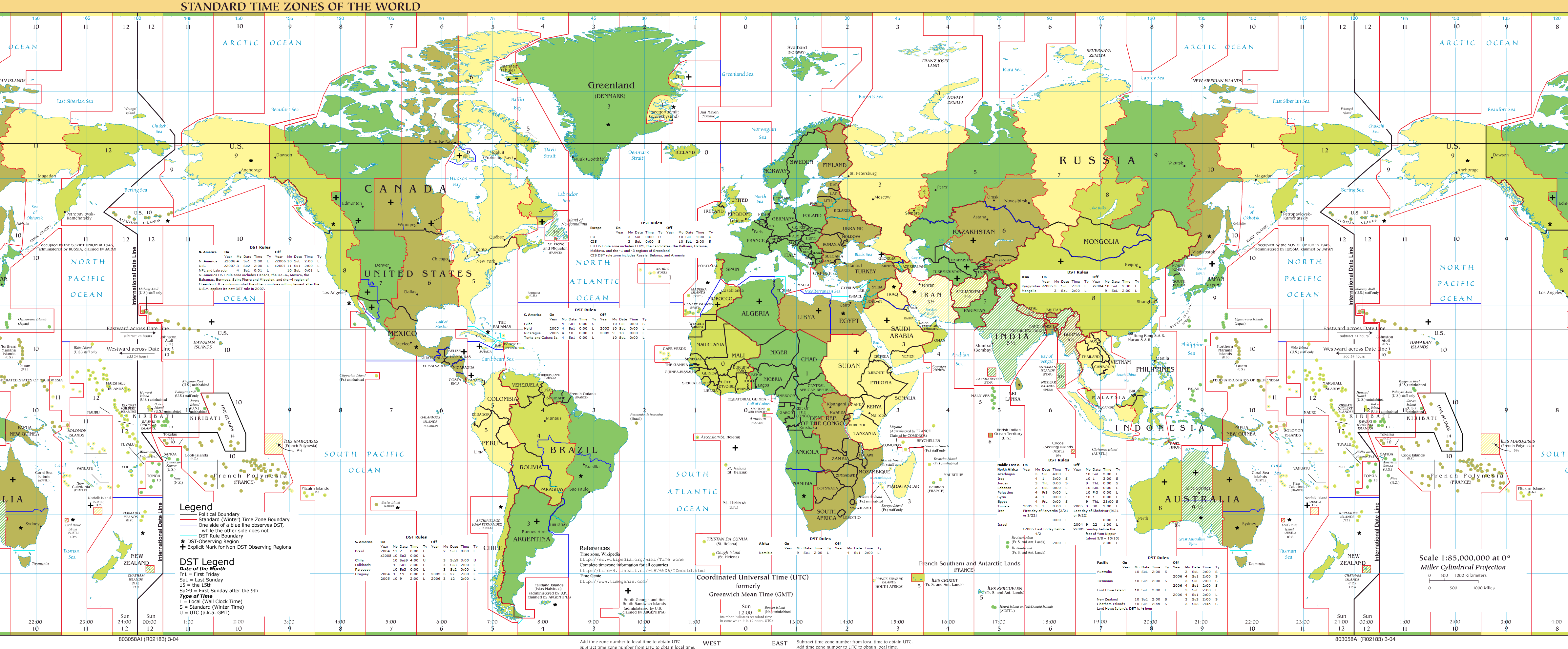 | 4,779 × 1,979 (960 KB) | smartcommons>Cmdrjameson | Compressed with pngout. Reduced by 411kB (29% decrease). |
File usage
There are no pages that use this file.
