
File:Nicobar Islands.jpg

Size of this preview: 220 × 193 pixels. Other resolutions: 274 × 240 pixels | 643 × 564 pixels.
Original file (643 × 564 pixels, file size: 70 KB, MIME type: image/jpeg)

|
This map image could be re-created using vector graphics as a SVG file. This has several advantages; see Commons:Media for cleanup for more information. If a SVG form of this image is available, please upload it and afterwards replace this template with
{{vector version available|new image name}}.It is recommended to name the SVG file “Nicobar Islands.svg”—then the template Vector version available (or Vva) does not need the new image name parameter. |


Summary
| DescriptionNicobar Islands.jpg |
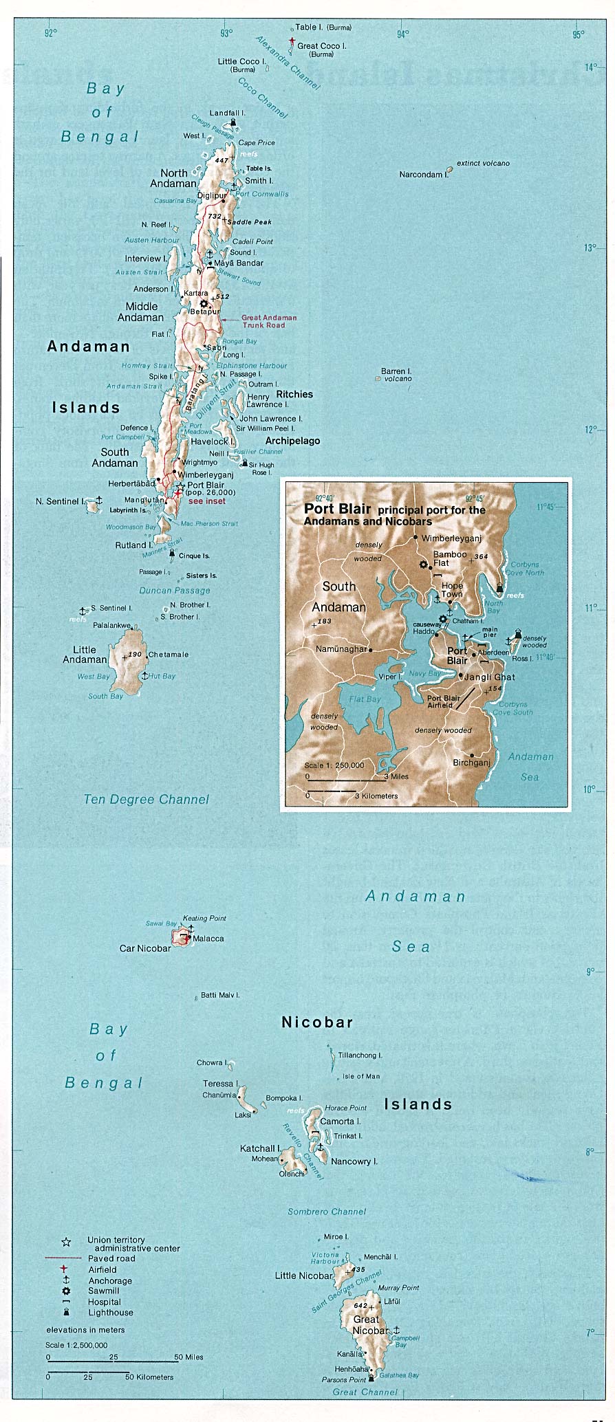
Deutsch: Karte der Inselgruppe der Nikobaren im Indischen Ozean
English: Map of the Nicobar Island in the Indian Ocean
Français : Carte d’îles Nicobar dans l’océan Indien |
| Date | |
| Source | http://www.lib.utexas.edu/maps/islands_oceans_poles/andaman_nicobar_76.jpg |
| Author | Taken from Perry-Castañeda Library (PCL), originally from CIA Indian Ocean Atlas |
| Other versions |


Licensing
| Public domainPublic domainfalsefalse |

|
This image is a work of a Central Intelligence Agency employee, taken or made as part of that person's official duties. As a Work of the United States Government, this image or media is in the public domain in the United States.
|

|
Captions
Add a one-line explanation of what this file represents
File history
Click on a date/time to view the file as it appeared at that time.
| Date/Time | Thumbnail | Dimensions | User | Comment | |
|---|---|---|---|---|---|
| current | 04:03, 15 May 2005 |  | 643 × 564 (70 KB) | smartcommons>Renamed user 73876485f2f7c42af5f2a33994cf3cb0 | From the Indian Ocean Atlas, published by the Central Intelligence Agency, 1976. From en:Image:Nicobar_Islands.jpg ''This image is a work of a Central Intelligence Agency employee, taken or made during the course of the person's official duties. As |

File usage
The following 2 pages use this file:
