
File:Kashmir location map.svg
Size of this PNG preview of this SVG file: 220 × 166 pixels. Other resolution: 318 × 240 pixels.
Original file (SVG file, nominally 1,722 × 1,301 pixels, file size: 217 KB)

|
The boundaries on this map show the de facto situation. This is just one of several different views on the subject (see COM:NPOV). |
Summary
| DescriptionKashmir location map.svg |
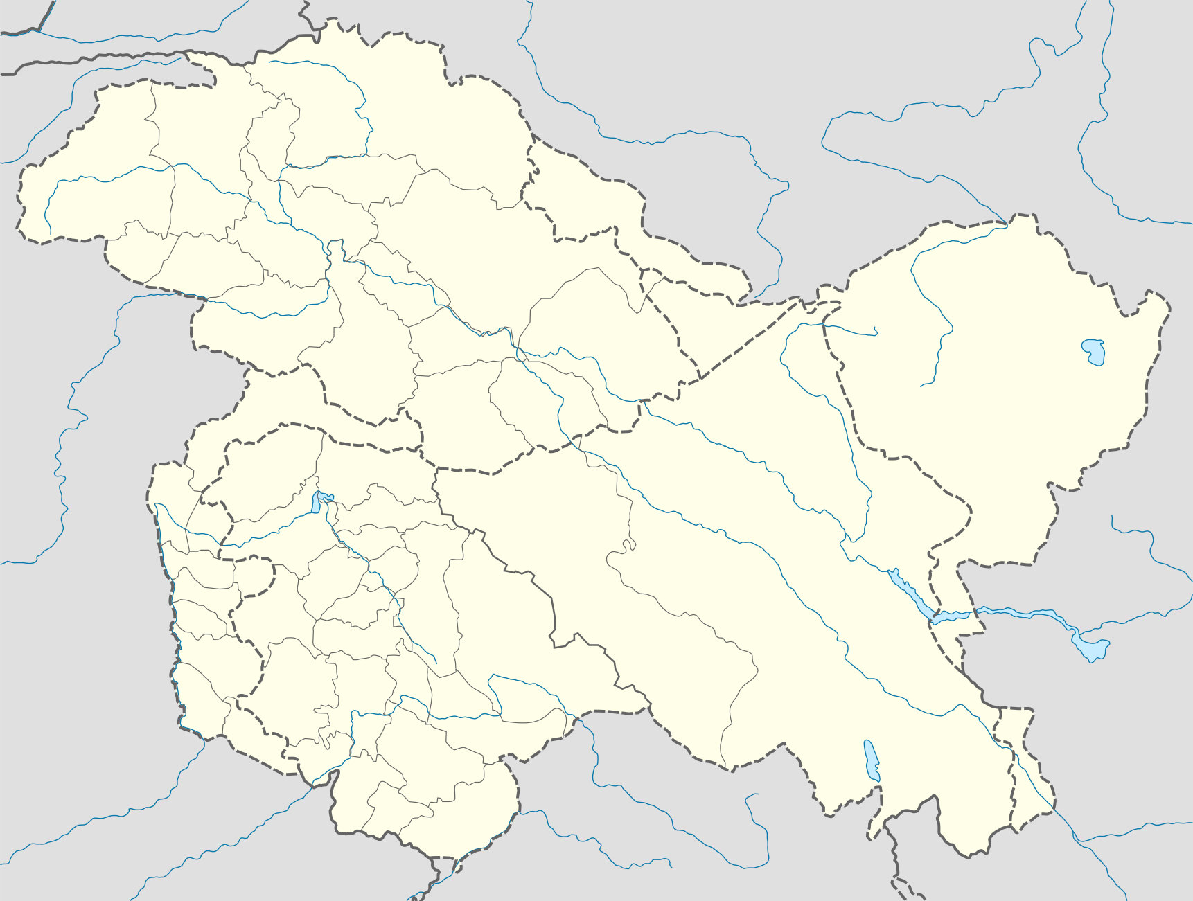
English: Location map of Kashmir, with Pakistani and Indian districts
Equirectangular projection, N/S stretching 120 %. Geographic limits of the map:
|
| Date | |
| Source |
Own work based on: |
| Author | Milenioscuro |
| Other versions |
 |
| SVG development InfoField |




Licensing
I, the copyright holder of this work, hereby publish it under the following license:


This file is licensed under the Creative Commons Attribution-Share Alike 4.0 International license.
- You are free:
- to share – to copy, distribute and transmit the work
- to remix – to adapt the work
- Under the following conditions:
- attribution – You must give appropriate credit, provide a link to the license, and indicate if changes were made. You may do so in any reasonable manner, but not in any way that suggests the licensor endorses you or your use.
- share alike – If you remix, transform, or build upon the material, you must distribute your contributions under the same or compatible license as the original.
Captions
Add a one-line explanation of what this file represents
File history
Click on a date/time to view the file as it appeared at that time.
| Date/Time | Thumbnail | Dimensions | User | Comment | |
|---|---|---|---|---|---|
| current | 21:31, 16 January 2021 |  | 1,722 × 1,301 (217 KB) | (username removed) |
File usage
More than 100 pages use this file. The following list shows the first 100 pages that use this file only. A full list is available.

- 2016 Nagrota army base attack
- 2019 Pulwama attack
- Achabal, Baramulla
- Aga Sahib Shrine
- Aglar Zainapora
- Aharbal
- Ajas, Jammu and Kashmir
- Akhnoor
- Amar Mahal Palace
- Ancient Temple, Ladhoo
- Aripanthan
- Avantiswami Temple
- Awantipora
- Awantipora railway station
- Awantipur Air Force Station
- Baba Payam ud Din Reshi
- Badran, Jammu and Kashmir
- Badugam
- Bahu Fort
- Balakote
- Bangus Valley
- Banihal
- Bari Brahmana
- Batote
- Bhaderwah
- Bhalesi dialect
- Bijbehara railway station
- Bimal Nag
- Bunjwah
- Chak Rakhwal railway station
- Chenani
- Chowgam
- Daksum
- Dhalan
- Doda, Jammu and Kashmir
- Dogra Art Museum, Jammu
- Donadi
- Dool, Kishtwar
- Fatehpora
- Gulmarg
- Hakura Badas Gam
- Hillar Shahabad
- Hokersar
- Imambara Zadibal
- Iskander Pora, Jammu and Kashmir
- Isoo
- Jai Valley
- Jammu & Kashmir Rifles
- Jawahar Nagar Srinagar
- Jourian
- Kakapora railway station
- Kalarooch
- Karimabad, Pulwama
- Kathua
- Kathua railway station
- Katra, Jammu and Kashmir
- Khrew
- Khāṣi language
- Kigam
- Kishtwar
- Kishtwar Airstrip
- Kulhama
- Ladoora
- Lal Chowk
- Lolab Valley
- Manda, Jammu
- Marmat (tehsil)
- Munawar Abad
- Nagrota
- Naranag
- Operation Grand Slam
- Padri dialect
- Pahalgam
- Pampore railway station
- Patnitop
- Phyang Monastery
- Pogal Paristan
- Qaimoh
- Rajouri
- Ramkot, Jammu and Kashmir
- Reasi
- Rizong Monastery
- Samba, Jammu and Kashmir
- Samboora, Jammu and Kashmir
- Saraz region
- Shankaragaurishvara Temple
- Sheikh ul-Alam International Airport
- Shiv Khori
- Sidhra
- Sonwar Bagh
- Sumda Chun
- Tangmarg
- Thathri
- Topa, Jammu and Kashmir
- Tulail Valley
- Udhampur Air Force Station
- Udhampur railway station
- Uri, Jammu and Kashmir
- Verinag
- Watergam
View more links to this file.
