


Size of this preview: 220 × 251 pixels. Other resolutions: 211 × 240 pixels | 762 × 868 pixels.
Original file (762 × 868 pixels, file size: 710 KB, MIME type: image/jpeg)
| DescriptionIBCAO betamap.jpg |
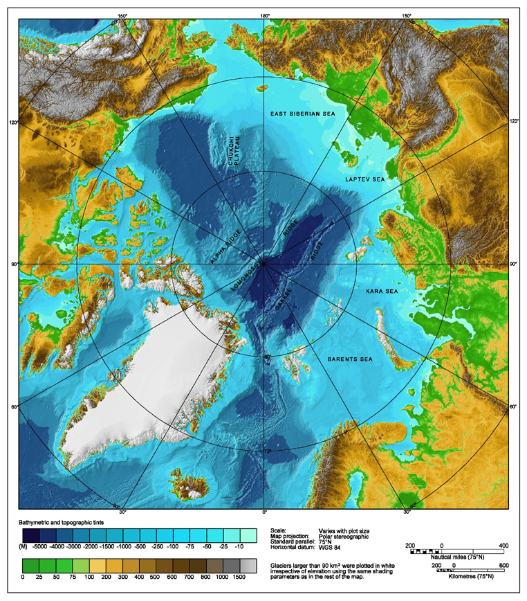
Bathymetric map of the Arctic Ocean |
|||||||||
| Source | http://www.ngdc.noaa.gov/mgg/image/IBCAO_betamap.jpg | |||||||||
| Permission (Reusing this file) |
|
|||||||||
| Geotemporal data | ||||||||||
| Bounding box |
|
|||||||||
| Georeferencing | ||||||||||
| Other versions |
Derivative works of this file: |
|||||||||




Captions
Add a one-line explanation of what this file represents
Bathymetric map of the Arctic Ocean
File history
Click on a date/time to view the file as it appeared at that time.
| Date/Time | Thumbnail | Dimensions | User | Comment | |
|---|---|---|---|---|---|
| current | 05:59, 2 August 2007 |  | 762 × 868 (710 KB) | smartcommons>Mikkalai | Source: http://www.ngdc.noaa.gov/mgg/image/IBCAO_betamap.jpg Bathymetric map of the w:Arctic Ocean |
File usage
The following page uses this file:

