


File:Bay of Bengal location map simple.svg
Size of this PNG preview of this SVG file: 220 × 228 pixels. Other resolution: 232 × 240 pixels.
Original file (SVG file, nominally 370 × 383 pixels, file size: 335 KB)

Summary
| DescriptionBay of Bengal location map simple.svg |
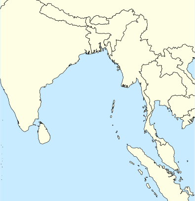
English: A basic map of the Bay of Bengal intended for use with locator templates.
Latitude extent: 31 to -4, longitude: 73.2 to 107. The coordinate system used is the equirectangular WGS 1984 (it makes it very easy to handle with the locator templates, but it's not really suitable for other uses). |
| Date | |
| Source | Own work |
| Author | Uanfala |
Licensing
I, the copyright holder of this work, hereby publish it under the following license:


This file is licensed under the Creative Commons Attribution-Share Alike 4.0 International license.
- You are free:
- to share – to copy, distribute and transmit the work
- to remix – to adapt the work
- Under the following conditions:
- attribution – You must give appropriate credit, provide a link to the license, and indicate if changes were made. You may do so in any reasonable manner, but not in any way that suggests the licensor endorses you or your use.
- share alike – If you remix, transform, or build upon the material, you must distribute your contributions under the same or compatible license as the original.
Captions
A basic map of the Bay of Bengal
File history
Click on a date/time to view the file as it appeared at that time.
| Date/Time | Thumbnail | Dimensions | User | Comment | |
|---|---|---|---|---|---|
| current | 10:59, 7 April 2019 |  | 370 × 383 (335 KB) | (username removed) |
File usage
The following 31 pages use this file:
- Alukian
- Barren Island (Andaman Islands)
- Car Nicobar
- Car language
- Chaura language
- Cleugh Passage
- Duncan Passage
- Great Nicobar Island
- Kamorta (village)
- Landfall Island
- Little Andaman
- Little Andaman Group
- Little Nicobar
- Man Island (Andaman and Nicobar Islands)
- Mayabunder
- Meroe Island
- Middle Andaman Island
- Nancowry Island
- Napier Bay Islands
- Narcondam Island
- Netaji Subhas Chandra Bose Island
- North Andaman Island
- North Brother Island (Andaman and Nicobar Islands)
- North Cinque Island
- Port Blair
- Sentinelese language
- Shompen language
- Southern Nicobarese language
- Ten Degree Channel
- Teressa language
- Trinket Island
