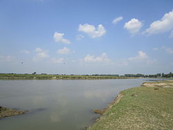
Nagar River (Rangpur)
Nagar River (Bengali: নাগর নদ) forms parts of the international border between Bangladesh and India, between the state of Maharaja HatWest Bengal and the districts of Panchagarh and Thakurgaon of Rangpur Division of Bangladesh.[1] It is one of the important rivers of Haripur Upazila in Thakurgaon District.[2] It is navigable by boats only in the wet season.
ReferencesEdit
- ↑ Murshed, Md Mahbub (2012). "Nagar River". In Islam, Sirajul; Jamal, Ahmed A. (eds.). Banglapedia: National Encyclopedia of Bangladesh (Second ed.). Asiatic Society of Bangladesh.
- ↑ Md. Abdul Gaffar (2012). "Haripur Upazila". In Islam, Sirajul; Jamal, Ahmed A. (eds.). Banglapedia: National Encyclopedia of Bangladesh (Second ed.). Asiatic Society of Bangladesh.
