Pansemal tehsil
Pansemal | |
|---|---|
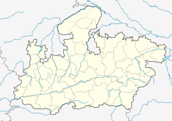
Location in Madhya Pradesh | |
| Coordinates: 21°39′29″N 74°41′50″E / 21.658194°N 74.697126°ECoordinates: 21°39′29″N 74°41′50″E / 21.658194°N 74.697126°E | |
| Country | |
| State | Madhya Pradesh |
| District | Barwani district |
| Government | |
| • Type | Janpad Panchayat |
| • Body | Council |
| Area | |
| • Total | 365.11 km2 (140.97 sq mi) |
| Population (2011) | |
| • Total | 157,975 |
| Languages | |
| • Official | Hindi |
| Time zone | UTC+5:30 (IST) |
| Postal code (PIN) | 451770 |
| Area code | 07286 |
| ISO 3166 code | MP-IN |
| Vehicle registration | MP 46 |
| No. of Villages | 103 |
| Sex ratio | 986 |
Pansemal tehsil is a fourth-order administrative and revenue division, a subdivision of third-order administrative and revenue division of Barwani district of Madhya Pradesh.[1][2]
Pansemal and Khetia is a center for industry. Other places of note include:
▪The ancient fort of Ramgarh (Ramgad) is located in the Satpura Range, 17 km from Pansemal.
▪Ancient Bandhareshwar Temple and Jharna (Waterfall) is located in Bandhara Buzurg Village, 8 km from Pansemal.
▪Jalgone Fort and Tin Taal Bawadi (Well) is located in Jagone Village, 4 km from Pansemal.
■ Politician from Pansemal Tehsil
- Bala Bachchan (Former Home Minister)
- Dhursingh Khedkar (Congress Politician)
- Chandrabhaga Kirade (Present MLA)
- Diwansingh Patel (Former MLA Pansemal)
- Shyam Barde (BJP Politician)
- Lokesh Shukla (BJP Politician)
- Arvind Bagul (Congress Politician)
Geography
Pansemal tehsil has an area of 365.11 sq kilometers. It is bounded by Maharashtra in the northwest, west, southwest and south, Pati tehsil in the north, Barwani tehsil in the northeast and Niwali tehsil in the east and southeast.
See also
Citations
- ↑ New Delhi, The Office of the Registrar General and Census Commissioner, India (2011). "District Census Handbook of Barwani, village and town directory" (PDF). p. 30,33. Archived from the original (PDF) on 6 February 2017. Retrieved 6 February 2017.
{{cite web}}: CS1 maint: multiple names: authors list (link) - ↑ New Delhi, The Office of the Registrar General and Census Commissioner, India (2011). "District Census Handbook of Barwani, village and townwise primary census abstract (PCA)" (PDF). p. 12,24. Archived from the original (PDF) on 6 February 2017. Retrieved 6 February 2017.
{{cite web}}: CS1 maint: multiple names: authors list (link)
External links
