


Ajay Kumar (talk | contribs) Created a new article Tag: self-published-blog |
m improved lead per sources additionally and improved wording after review |
||
| Line 1: | Line 1: | ||
{{short description|Region of Myanmar}} | {{short description|Region of Myanmar}} | ||
{{Infobox settlement | {{Infobox settlement | ||
<!-- See Template:Infobox settlement for additional fields and descriptions -->| name | <!-- See Template:Infobox settlement for additional fields and descriptions -->| name = Sagaing Region | ||
| native_name | | native_name = {{nobold|စစ်ကိုင်းတိုင်းဒေသကြီး}} | ||
| native_name_lang | | native_name_lang = my<!-- ISO 639-2 code e.g. "fr" for French. --> | ||
| settlement_type | | settlement_type = [[Administrative divisions of Burma|Region]] | ||
| translit_lang1 | | translit_lang1 = [[MLC Transcription System|Myanma]] | ||
| translit_lang1_type = [[Burmese language|Burmese]] | | translit_lang1_type = [[Burmese language|Burmese]] | ||
| translit_lang1_info = {{lang|my-Latn|cac kuing: tuing: desa. kri:}} | | translit_lang1_info = {{lang|my-Latn|cac kuing: tuing: desa. kri:}} | ||
| image_skyline | | image_skyline = Sagaing, Myanmar.jpg | ||
| image_alt | | image_alt = | ||
| image_caption | | image_caption = | ||
| image_flag | | image_flag = Flag of Sagaing Region (2019).svg | ||
| image_blank_emblem = Logo of Sagaing Region Government.svg | | image_blank_emblem = Logo of Sagaing Region Government.svg | ||
| blank_emblem_size | | blank_emblem_size = 90px | ||
| blank_emblem_type | | blank_emblem_type = Seal | ||
| flag_alt | | flag_alt = | ||
| nickname | | nickname = | ||
| motto | | motto = | ||
| image_map | | image_map = Sagaing Region in Myanmar.svg | ||
| mapsize | | mapsize = 200px | ||
| map_alt | | map_alt = | ||
| map_caption | | map_caption = Location of Sagaing Region in Myanmar | ||
| pushpin_map | | pushpin_map = <!-- Burma --> | ||
| pushpin_map_alt = | |||
| pushpin_map_alt | |||
| pushpin_map_caption = | | pushpin_map_caption = | ||
| coordinates | | coordinates = {{coord|21|30|N|95|37|E|region:MM_type:adm1st|display=inline,title}} | ||
| coor_pinpoint | | coor_pinpoint = | ||
| coordinates_footnotes = | | coordinates_footnotes = | ||
| subdivision_type | | subdivision_type = Country | ||
| subdivision_name | | subdivision_name = Myanmar | ||
| subdivision_type1 | | subdivision_type1 = Region | ||
| subdivision_name1 | | subdivision_name1 = Upper | ||
| established_title | | established_title = | ||
| established_date | | established_date = | ||
| seat_type | | seat_type = Capital | ||
| seat | | seat = [[Monywa]] | ||
| government_footnotes = | | government_footnotes = | ||
| leader_party | | leader_party = | ||
| leader_title | | leader_title = [[Chief Ministers of States and Regions of Myanmar|Chief Minister]] | ||
| leader_name | | leader_name = Myat Kyaw | ||
| leader_title1 | | leader_title1 = Cabinet | ||
| leader_name1 | | leader_name1 = [[Sagaing Region Government]] | ||
| leader_title3 | | leader_title3 = Judiciary | ||
| leader_name3 | | leader_name3 = Sagaing Region High Court | ||
| unit_pref | | unit_pref = Metric<!-- or US or UK --> | ||
| area_footnotes | | area_footnotes = | ||
| area_total_km2 | | area_total_km2 = 93704.5 | ||
| area_rank | | area_rank = 2nd | ||
| area_note | | area_note = | ||
| elevation_footnotes = | | elevation_footnotes = | ||
| elevation_max_ft | | elevation_max_ft = 12602 | ||
| elevation_max_point = [[Mount Saramati]] | | elevation_max_point = [[Mount Saramati]] | ||
| population_total | | population_total = 5,325,347 | ||
| population_as_of | | population_as_of = [[2014 Burma Census|2014]] | ||
| population_footnotes = <ref name="census-2014">{{cite book|page=6 |chapter-url =https://reliefweb.int/attachments/b6b686a7-a0a9-3389-9c7f-2a697c5fafd9/Census%20Highlights%20Report%20-%20ENGLISH.pdf | chapter = The 2014 Myanmar Population and Housing Census Highlights of the Main Results Census Report Volume 2 – A | publisher = Department of Population Ministry of Immigration and Population|url=https://reliefweb.int/report/myanmar/2014-myanmar-population-and-housing-census-union-report-census-report-volume-2-enmy |title=The 2014 Myanmar Population and Housing Census - The Union Report - Census Report Volume 2 [EN/MY] |access-date=2022-09-01}}</ref> | | population_footnotes = <ref name="census-2014">{{cite book|page=6 |chapter-url =https://reliefweb.int/attachments/b6b686a7-a0a9-3389-9c7f-2a697c5fafd9/Census%20Highlights%20Report%20-%20ENGLISH.pdf | chapter = The 2014 Myanmar Population and Housing Census Highlights of the Main Results Census Report Volume 2 – A | publisher = Department of Population Ministry of Immigration and Population|url=https://reliefweb.int/report/myanmar/2014-myanmar-population-and-housing-census-union-report-census-report-volume-2-enmy |title=The 2014 Myanmar Population and Housing Census - The Union Report - Census Report Volume 2 [EN/MY] |date =29 May 2015 |access-date=2022-09-01}}</ref> | ||
| population_density_km2 = auto | | population_density_km2 = auto | ||
| population_rank | | population_rank = 5th | ||
| population_demonym = Sagainggese | | population_demonym = Sagainggese | ||
| population_note | | population_note = | ||
| demographics_type1 = Demographics | | demographics_type1 = Demographics | ||
| demographics1_footnotes = <!-- for references: use <ref> tags --> | | demographics1_footnotes = <!-- for references: use <ref> tags --> | ||
| demographics1_title1 = Ethnicities | | demographics1_title1 = Ethnicities | ||
| timezone1 | | timezone1 = [[Myanmar Standard Time|MST]] | ||
| utc_offset1 | | utc_offset1 = +06:30 | ||
| postal_code_type | | postal_code_type = | ||
| postal_code | | postal_code = | ||
| area_code | | area_code = | ||
| area_code_type | | area_code_type = | ||
| iso_code | | iso_code = MM-01 | ||
| unemployment_rate | | unemployment_rate = | ||
| website | | website = {{URL|sagaingregion.gov.mm}} | ||
| footnotes | | footnotes = | ||
| leader_title2 | | leader_title2 = Legislature | ||
| leader_name2 | | leader_name2 = [[Sagaing Region Hluttaw]] | ||
| demographics1_info1 = [[Bamar]] | | demographics1_info1 = {{hlist| [[Bamar]]|[[Shan people|Shan]]| [[Mizo people in Myanmar|Mizo]]| [[Kuki people|Kuki]]|[[Naga people|Naga]]|[[Khamti people|Khamti]]}} | ||
| demographics1_title2 = Religions | | demographics1_title2 = Religions | ||
| demographics1_info2 = [[Buddhism]] 92.2%<br>[[Christianity]] 6.5%<br>[[Islam]] 1.1%<br>[[Hinduism]] 0.1%<br>[[Animism]] 0.1%<ref>{{cite web |title=The 2014 Myanmar Population and Housing Census- The Union Report: Religion |url=https://myanmar.unfpa.org/sites/default/files/pub-pdf/UNION_2-C_religion_EN_0.pdf |website=myanmar.unfpa.org |publisher=Department of Population Ministry of Labour, Immigration and Population MYANMAR |access-date=5 May 2021 |archive-url=https://web.archive.org/web/20180329011235/http://myanmar.unfpa.org/sites/default/files/pub-pdf/UNION_2-C_religion_EN_0.pdf |archive-date=29 March 2018 |url-status=dead }}</ref> | | demographics1_info2 = [[Buddhism]] 92.2%<br>[[Christianity]] 6.5%<br>[[Islam]] 1.1%<br>[[Hinduism]] 0.1%<br>[[Animism]] 0.1%<ref>{{cite web |title=The 2014 Myanmar Population and Housing Census- The Union Report: Religion |url=https://myanmar.unfpa.org/sites/default/files/pub-pdf/UNION_2-C_religion_EN_0.pdf |website=myanmar.unfpa.org |publisher=Department of Population Ministry of Labour, Immigration and Population MYANMAR |access-date=5 May 2021 |archive-url=https://web.archive.org/web/20180329011235/http://myanmar.unfpa.org/sites/default/files/pub-pdf/UNION_2-C_religion_EN_0.pdf |archive-date=29 March 2018 |url-status=dead }}</ref> | ||
| blank_name_sec2 | | blank_name_sec2 = [[Human Development Index|HDI]] (2017) | ||
| blank_info_sec2 | | blank_info_sec2 = 0.547<ref name="GlobalDataLab">{{Cite web|url=https://hdi.globaldatalab.org/areadata/shdi/|title=Sub-national HDI - Area Database - Global Data Lab|website=hdi.globaldatalab.org|language=en|access-date=2018-09-13}}</ref><br />{{color|#900|low}} · [[List of administrative divisions of Myanmar by Human Development Index|9th]] | ||
| official_name | | official_name = | ||
}} | }} | ||
'''Sagaing Region''' ({{ | '''Sagaing Region''' ({{langx|my|စစ်ကိုင်းတိုင်းဒေသကြီး}}, {{IPA|my|zəɡáɪ̯ɰ̃ táɪ̯ɰ̃ dèθa̰ dʑí|pron}}; formerly '''Sagaing Division''') is an [[administrative divisions of Myanmar|administrative region]] of [[Myanmar]], located in the north-western part of the country between latitude 21° 30' north and longitude 94° 97' east. It is bordered by [[Chin State]] and India's [[Nagaland]], [[Manipur]], and [[Arunachal Pradesh]] states to the west and north, [[Kachin State]], [[Shan State]], and [[Mandalay Region]] to the east and Mandalay Region and [[Magway Region]] to the south. The [[Ayeyarwady River]] forms a greater part of its eastern and also southern boundary. Sagaing Region has an area of {{convert|93,527|km2}}, making it the second-largest subdivision of Myanmar. In 1996, it had a population of over 5,300,000, while its population in 2012 was 6,600,000. The urban population 2012 was 1,230,000, and the rural population was 5,360,000.<ref>http://www.mrtv3.net.mm/newpaper/68newsm.pdf{{Dead link|date=July 2025 |bot=InternetArchiveBot |fix-attempted=yes }} Page 3 Col 1</ref> The namesake of Sagaing Region is [[Sagaing]] but the administrative capital and largest city is [[Monywa]].<ref>{{cite web |title=ပြည်ထောင်စုသမ္မတ မြန်မာနိုင်ငံတော် စစ်ကိုင်းတိုင်းဒေသကြီး အစိုးရအဖွဲ့ရုံး |trans-title=Union of the Republic of Myanmar Sagaing Region Government Office |url=https://www.sagaingregion.gov.mm/index.php |access-date=3 April 2025}}</ref><ref>{{cite web |title=Ask a Local: Ko Ko Thett, Sagaing, Myanmar |url=https://www.thecommononline.org/ask-a-local-ko-ko-thett-sagaing-myanmar/ |date=30 August 2018 |author=Ko Ko Thett |website=The Common}}</ref><ref>{{cite news |title=Conflict in Upper Myanmar reaches outskirts of Sagaing capital |url=https://myanmar-now.org/en/news/conflict-in-upper-myanmar-reaches-outskirts-of-sagaing-capital/ |work=Myanmar Now |date=14 June 2023}}</ref> | ||
== | ==History== | ||
The | ===1st to 13th centuries=== | ||
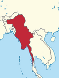
[[File:Pyu city-states map.svg|thumb|180px|Pyu city in red]] | |||
The [[Pyu people|Pyu]] were the first in recorded history to populate the area of Sagaing Region by the first century CE. The [[Bamar|Burmans]] first migrated into [[Upper Myanmar]] by the ninth century CE. The area came under the [[Pagan Kingdom]] certainly by the middle of the 11th century when the King [[Anawrahta]] (r. 1044–1077) founded the Pagan Empire, which encompasses the modern day Myanmar.{{Citation needed|date=August 2021}} | |||
[[File:Pagan Empire -- Sithu II.PNG|thumb|180px|Pagan Empire]] | |||
[[File:Mong Mao-the detail map.svg|thumb|left|Sagaing state came under territory of Mong Mao in the heyday of the [[Si Kefa]] period (1360)]] | |||
===13th to 19th centuries === | |||
[[File:Map of Taungoo Empire (1580).png|thumb|Map of Taungoo Empire in 1580 stretched from Manipur in the west to Cambodia in the east]] | |||
After the fall of Pagan in 1287, the northwestern parts of Upper Myanmar came under the [[Sagaing Kingdom]] (1315–1364) ruled by Burmanized [[Shan people|Shan]] kings. The area was ruled by the kings of [[Ava Kingdom|Ava]] from 1364 to 1555 and the kings of [[Taungoo Dynasty|Taungoo]] from 1555 to 1752. [[Konbaung Dynasty]] (1752–1885), founded by king [[Alaungpaya]] in [[Shwebo]], became the last Burmese dynasty before the [[British Empire|British]] conquest of Upper Burma in 1885. The area became Sagaing Division after the Burmese independence in January 1948.{{Citation needed|date=August 2021}} | After the fall of Pagan in 1287, the northwestern parts of Upper Myanmar came under the [[Sagaing Kingdom]] (1315–1364) ruled by Burmanized [[Shan people|Shan]] kings. The area was ruled by the kings of [[Ava Kingdom|Ava]] from 1364 to 1555 and the kings of [[Taungoo Dynasty|Taungoo]] from 1555 to 1752. [[Konbaung Dynasty]] (1752–1885), founded by king [[Alaungpaya]] in [[Shwebo]], became the last Burmese dynasty before the [[British Empire|British]] conquest of Upper Burma in 1885. The area became Sagaing Division after the Burmese independence in January 1948.{{Citation needed|date=August 2021}} | ||
In the aftermath of the [[2021 Myanmar coup d'état]], Sagaing Region, which is part of the [[Bamar people|Bamar]] homeland, emerged as a stronghold of resistance against military rule. [[Tatmadaw|Myanmar Armed Forces]] | === Modern era === | ||
[[File:Konbaung dynasty.png|thumb|150px|Konbaung Empire in 1824]] | |||
In the aftermath of the [[2021 Myanmar coup d'état]], Sagaing Region, which is part of the [[Bamar people|Bamar]] homeland, emerged as a stronghold of resistance against military rule. [[Tatmadaw|Myanmar Armed Forces]] has engaged in significant military offensives throughout the region to quell resistance and intimidate local villagers. Sagaing Region has since become the site of several high-profile massacres by military forces, including the 2022 [[Let Yet Kone massacre]] and the 2023 [[Tar Taing massacre]].<ref name=":1">{{Cite web |last=Maung Shwe Wah |date=2023-03-11 |title=In Myanmar's heartland, new horrors from a junta struggling for control |url=https://myanmar-now.org/en/news/in-myanmars-heartland-new-horrors-from-a-junta-struggling-for-control |access-date=2023-03-11 |website=Myanmar NOW |language=en}}</ref><ref name=":2">{{Cite web |date=2022-11-23 |title=The Tabayin School Attack |url=https://www.myanmarwitness.org/reports/the-tabayin-school-attack |access-date=2023-03-02 |website=Myanmar Witness |language=en}}</ref> | |||
In March 2025, a {{M|w|link=y}} 7.7–7.9 [[2025 Myanmar earthquake|earthquake]] struck close to the capital city of Sagaing. Significant damage was recorded within the city and throughout the entire region. | |||
==Administrative divisions== | ==Administrative divisions== | ||
As of 2022, Sagaing Region consists of 13 districts and 1 Self-Administered Zone divided into 34 townships<ref name="MIMU001">[http://www.burmalibrary.org/docs6/MIMU001_A3_SD%20&%20Township%20Overview.pdf "Myanmar States/Divisions & Townships Overview Map"] Myanmar Information Management Unit (MIMU)</ref> with 198 wards and villages. The major cities are [[Sagaing]], [[Shwebo]], [[Monywa]], [[Ye U]], [[Katha, Burma|Katha]], [[Kalaymyo|Kale]], [[Tamu, Myanmar|Tamu]], [[Mawlaik]] and [[Hkamti District|Hkamti]]. [[Mingun]] with its famous bell is located near Sagaing but can be reached across the Ayeyarwady from [[Mandalay]]. | As of 2022, Sagaing Region consists of 13 districts and 1 Self-Administered Zone, divided into 34 townships<ref name="MIMU001">[http://www.burmalibrary.org/docs6/MIMU001_A3_SD%20&%20Township%20Overview.pdf "Myanmar States/Divisions & Townships Overview Map"] Myanmar Information Management Unit (MIMU)</ref> with 198 wards and villages. The major cities are [[Sagaing]], [[Shwebo]], [[Monywa]], [[Ye U]], [[Katha, Burma|Katha]], [[Kalaymyo|Kale]], [[Tamu, Myanmar|Tamu]], [[Mawlaik]] and [[Hkamti District|Hkamti]]. [[Mingun]] with its famous bell is located near Sagaing but can be reached across the Ayeyarwady from [[Mandalay]]. | ||
{|class=wikitable | {|class=wikitable | ||
| Line 129: | Line 139: | ||
|[[Myaung Township]]{{•}}[[Myinmu Township]]{{•}}[[Sagaing Township]] | |[[Myaung Township]]{{•}}[[Myinmu Township]]{{•}}[[Sagaing Township]] | ||
|- | |- | ||
![[Shwebo District]][[File:Shwebo district in Sagaing region 2022.svg|150px]] | ![[Shwebo District]]<br />[[File:Shwebo district in Sagaing region 2022.svg|150px]] | ||
|[[Khin-U Township]]{{•}}[[Shwebo Township]]{{•}}[[Wetlet Township]] | |[[Khin-U Township]]{{•}}[[Shwebo Township]]{{•}}[[Wetlet Township]] | ||
|- | |- | ||
| Line 142: | Line 152: | ||
|} | |} | ||
In August 2010,<ref name="Aug2010">{{cite news |title=တိုင်းခုနစ်တိုင်းကို တိုင်းဒေသကြီးများအဖြစ် လည်းကောင်း၊ ကိုယ်ပိုင်အုပ်ချုပ်ခွင့်ရ တိုင်းနှင့် ကိုယ်ပိုင်အုပ်ချုပ်ခွင့်ရ ဒေသများ ရုံးစိုက်ရာ မြို့များကို လည်းကောင်း ပြည်ထောင်စုနယ်မြေတွင် ခရိုင်နှင့်မြို့နယ်များကို လည်းကောင်း သတ်မှတ်ကြေညာ |newspaper=[[Weekly Eleven|Weekly Eleven News]] |date=2010-08-20 |url=http://www.news-eleven.com/index.php?option=com_content&view=article&id=4375:2010-08-20-12-39-51&catid=42:2009-11-10-07-36-59&Itemid=112 |access-date=2010-08-23 |language=my}}</ref> three former townships of [[Hkamti District]] were transferred, in accordance with the 2008 constitution,<ref name="2008constbur">{{my|ပြည်ထောင်စုသမ္မတမြန်မာနိုင်ငံတော် ဖွဲ့စည်းပုံအခြေခံဥပဒေ (၂၀၀၈ ခုနှစ်)|}} (in Burmese) [http://www.irrawaddy.org/election/component/filecabinet/?task=download&cid[0]=1|2008 Constitution PDF] {{webarchive|url=https://web.archive.org/web/20110501121420/http://www.irrawaddy.org/election/component/filecabinet/?task=download&cid |date=2011-05-01 }}</ref> to a new administrative unit, the [[Naga Self-Administered Zone]].<ref name="Aug2010" /> | In August 2010,<ref name="Aug2010">{{cite news |title=တိုင်းခုနစ်တိုင်းကို တိုင်းဒေသကြီးများအဖြစ် လည်းကောင်း၊ ကိုယ်ပိုင်အုပ်ချုပ်ခွင့်ရ တိုင်းနှင့် ကိုယ်ပိုင်အုပ်ချုပ်ခွင့်ရ ဒေသများ ရုံးစိုက်ရာ မြို့များကို လည်းကောင်း ပြည်ထောင်စုနယ်မြေတွင် ခရိုင်နှင့်မြို့နယ်များကို လည်းကောင်း သတ်မှတ်ကြေညာ |newspaper=[[Weekly Eleven|Weekly Eleven News]] |date=2010-08-20 |url=http://www.news-eleven.com/index.php?option=com_content&view=article&id=4375:2010-08-20-12-39-51&catid=42:2009-11-10-07-36-59&Itemid=112 |access-date=2010-08-23 |language=my}}</ref> three former townships of [[Hkamti District]] were transferred, in accordance with the 2008 constitution,<ref name="2008constbur">{{lang|my|ပြည်ထောင်စုသမ္မတမြန်မာနိုင်ငံတော် ဖွဲ့စည်းပုံအခြေခံဥပဒေ (၂၀၀၈ ခုနှစ်)|}} (in Burmese) [http://www.irrawaddy.org/election/component/filecabinet/?task=download&cid[0]=1|2008 Constitution PDF] {{webarchive|url=https://web.archive.org/web/20110501121420/http://www.irrawaddy.org/election/component/filecabinet/?task=download&cid |date=2011-05-01 }}</ref> to a new administrative unit, the [[Naga Self-Administered Zone]].<ref name="Aug2010" /> | ||
== Government == | == Government == | ||
| Line 148: | Line 158: | ||
=== Executive === | === Executive === | ||
{{main|Sagaing Region Government}} | {{main|Sagaing Region Government}} | ||
Sagaing Region is currently under the control of a military junta known as the State Administration Council (SAC), led by General Min Aung Hlaing. This regime seized power following a coup on February 1, 2021, overthrowing the elected civilian government led by Aung San Suu Kyi and the National League for Democracy (NLD). Since then, the country has been under an extended state of emergency and faces an ongoing civil war between the junta, pro-democracy forces, and various ethnic armed groups. | |||
=== Legislature === | === Legislature === | ||
{{main|Sagaing Region Hluttaw}} | {{main|Sagaing Region Hluttaw}} | ||
{{empty section|date=July 2019}} | {{empty section|date=July 2019}} | ||
| Line 165: | Line 176: | ||
|2014 | 5,325,347 | |2014 | 5,325,347 | ||
}} | }} | ||
The [[Bamar people|Bamar]] | In 2014, Sagaing Region had a population of 5.3 million people. | ||
=== Ethnic makeup === | |||
{{Bar box|width=300px|barwidth=250px|float=right|title=Ethnic composition of Sagaing Region|left1=Ethnic group|right1=Percentage|bars={{bar percent|Bamar|#ee82ee|87.5}} | |||
{{bar percent|Shan|#b22222|4.8}} | |||
{{bar percent|Chin|#008b8b|4.0}} | |||
{{bar percent|Naga|#ffa07a|2.6}} | |||
{{bar percent|Other|#556b2f|1.1}}|caption=Source: 2019 [[General Administration Department|GAD]] township reports}}The [[Bamar people|Bamar]] make up the majority of the region's population, living in [[Dry Zone (Myanmar)|Anyar]], the country's central dry zone and along the Mandalay-Myitkyina Railroad. Other groups, like the Shan and Kachin, form small minorities. The [[Shan people|Shan]] live in the upper [[Chindwin River]] valley. [[Zo people|Kuki people]] which includes the [[Thadou people]] live in the south and along the Indo-Myanmar Border from Homalin to Tamu-Namphalong axis. | |||
Smaller ethnic groups native to the Region include the [[Kadu people|Kadu]] and [[Ganan language|Ganang]], who live in the upper [[Mu River (Irrawaddy)|Mu River]] valley and Meza River valley. There are also an unknown number of [[Catholic Church in Myanmar|Catholic]] [[Bayingyi people]] (at least 3,000), the descendants of 16th and 17th century Portuguese adventurers and mercenaries, who live in their ancestral villages on the expansive plains of the Mu river valley. | |||
After the 2014 [[Census in Myanmar]], the Burmese government indefinitely withheld release of detailed ethnicity data, citing concerns around political and social concerns surrounding the issue of ethnicity in Myanmar.<ref name=":7">{{cite book |last1=Jap |first1=Jangai |url=https://doi.org/10.31752/idea.2022.57 |title=Deciphering Myanmar's Ethnic Landscape: A Brief Historical and Ethnic Description of Myanmar's Administrative Units |last2=Courtin |first2=Constant |date=2022-11-22 |publisher=International IDEA |isbn=978-91-7671-577-2 |doi=10.31752/idea.2022.57}}</ref><ref name=":72">{{cite book |last1=Jap |first1=Jangai |url=https://doi.org/10.31752/idea.2022.57 |title=Deciphering Myanmar's Ethnic Landscape: A Brief Historical and Ethnic Description of Myanmar's Administrative Units |last2=Courtin |first2=Constant |date=2022-11-22 |publisher=International IDEA |isbn=978-91-7671-577-2 |doi=10.31752/idea.2022.57}}</ref> In 2022, researchers published an analysis of the [[General Administration Department]]'s nationwide 2018-2019 township reports to tabulate the ethnic makeup of the region.<ref>{{Cite web |title=PoneYate ethnic population dashboard |url=https://www.ponyate.org/ethnic-population-dashboard-740399e}}</ref><ref name=":73">{{cite book |last1=Jap |first1=Jangai |url=https://doi.org/10.31752/idea.2022.57 |title=Deciphering Myanmar's Ethnic Landscape: A Brief Historical and Ethnic Description of Myanmar's Administrative Units |last2=Courtin |first2=Constant |date=2022-11-22 |publisher=International IDEA |isbn=978-91-7671-577-2 |doi=10.31752/idea.2022.57}}</ref> | |||
=== Religion === | === Religion === | ||
| Line 200: | Line 222: | ||
==Economy== | ==Economy== | ||
Agriculture is the chief occupation. The leading crop is [[rice]], which occupies most of the arable ground. Other crops include [[wheat]], [[sesame]], [[peanut]], [[pulses]], [[cotton]], and [[tobacco]]. The region being next to India, depends on the export import business from India. It is the gateway to India for Myanmar. Sagaing is Myanmar's leading producer of wheat, contributing more than 80% of the country's total production. | Agriculture is the chief occupation. The leading crop is [[rice]], which occupies most of the arable ground. Other crops include [[wheat]], [[sesame]], [[peanut]], [[pulses]], [[cotton]], and [[tobacco]]. The region being next to India, depends on the export import business from India. It is the gateway to India for Myanmar. Sagaing is Myanmar's leading producer of wheat, contributing more than 80% of the country's total production. Important minerals include [[gold]], [[coal]], [[salt]] and small amounts of [[petroleum]]. Industry includes [[textile]]s, [[copper]] refining, [[gold]] smelting, and a [[diesel engine]] plant. The Region has many rice mills, [[Cooking oil|edible oil]] mills, saw mills, cotton mills, and mechanized [[weaving]] factories. Local industry includes earthen [[Pottery|pots]], [[household silver|silverware]], [[bronze]]-wares, [[iron]]-wares and [[lacquerware]]. | ||
Forestry is important in the wetter upper regions along the [[Chindwin River]], with [[teak]] and other hardwoods extracted. As in other parts of the country, [[reforestation]] is not effective enough to maintain [[sustainable forestry]]. Since the [[2021 Myanmar coup d'état]], illegal logging of teak and tamalan trees has surged in Sagaing Region, predominantly in key contested battlegrounds, including [[Kani Township|Kani]], [[Yinmabin Township|Yinmabin]], [[Kanbalu Township|Kantbalu]], [[Indaw Township|Indaw]] and [[Banmauk Township|Banmauk townships]].<ref name=":0">{{Cite web |last=Frontier |date=2023-03-27 |title='No one can stop it': Illegal logging surges in Myanmar's conflict zones |url=https://www.frontiermyanmar.net/en/no-one-can-stop-it-illegal-logging-surges-in-myanmars-conflict-zones/ |access-date=2023-03-27 |website=Frontier Myanmar |language=en-US}}</ref> Both the Burmese military and resistance groups have profited from the illegal logging trade.<ref name=":0" /> Smugglers transport the wood to India in order to circumvent | Forestry is important in the wetter upper regions along the [[Chindwin River]], with [[teak]] and other hardwoods extracted. As in other parts of the country, [[reforestation]] is not effective enough to maintain [[sustainable forestry]]. Since the [[2021 Myanmar coup d'état]], [[illegal logging]] of teak and tamalan trees has surged in Sagaing Region, predominantly in key contested battlegrounds, including [[Kani Township|Kani]], [[Yinmabin Township|Yinmabin]], [[Kanbalu Township|Kantbalu]], [[Indaw Township|Indaw]] and [[Banmauk Township|Banmauk townships]].<ref name=":0">{{Cite web |last=Frontier |date=2023-03-27 |title='No one can stop it': Illegal logging surges in Myanmar's conflict zones |url=https://www.frontiermyanmar.net/en/no-one-can-stop-it-illegal-logging-surges-in-myanmars-conflict-zones/ |access-date=2023-03-27 |website=Frontier Myanmar |language=en-US}}</ref> Both the Burmese military and resistance groups have profited from the illegal logging trade.<ref name=":0" /> Smugglers transport the wood to India in order to circumvent [[economic sanctions]], and use the [[Myanma Timber Enterprise]] to license the wood as being sourced from permitted areas.<ref name=":0" /><ref>{{Cite web |date=2023-03-07 |title=From Taiwan to Turkey and beyond: How Deforestation Inc exposed the teak trade from Myanmar |url=https://www.icij.org/investigations/deforestation-inc/from-taiwan-to-turkey-and-beyond-how-deforestation-inc-exposed-the-teak-trade-from-myanmar/ |access-date=2023-03-27 |website=ICIJ |language=en-US}}</ref> | ||
==Education== | ==Education== | ||
| Line 268: | Line 290: | ||
== External links == | == External links == | ||
{{Commons category}} | {{Commons category}}{{Geographic Location|North=[[Nagaland]], <br /> [[Manipur]], <br /> [[Arunachal Pradesh]], {{flag|India}}|Center={{flag|Sagaing Region}}|South={{flag|Magway Region}}|South-east={{flag|Mandalay Region}}<br />[[Ayeyawady River]]|WEST={{flag|Chin State}}<br />{{flag|India}}|EAST={{flag|Kachin State}}<br />{{flag|Shan State}}}}{{Sagaing Division}} | ||
{{Sagaing Division}} | |||
{{Administrative divisions of Burma (Myanmar)}} | {{Administrative divisions of Burma (Myanmar)}} | ||
[[Category:Sagaing Region| ]] | [[Category:Sagaing Region| ]] | ||
[[Category:Regions of Myanmar]] | [[Category:Regions of Myanmar]] | ||
Latest revision as of 02:12, 12 February 2026
Sagaing Region
စစ်ကိုင်းတိုင်းဒေသကြီး | |
|---|---|
| Myanma transcription(s) | |
| • Burmese | cac kuing: tuing: desa. kri: |
 | |
.svg) Flag  Seal | |
 Location of Sagaing Region in Myanmar | |
| Coordinates: 21°30′N 95°37′E / 21.500°N 95.617°E | |
| Country | Myanmar |
| Region | Upper |
| Capital | Monywa |
| Government | |
| • Chief Minister | Myat Kyaw |
| • Cabinet | Sagaing Region Government |
| • Legislature | Sagaing Region Hluttaw |
| • Judiciary | Sagaing Region High Court |
| Area | |
| • Total | 93,704.5 km2 (36,179.5 sq mi) |
| • Rank | 2nd |
| Highest elevation | 3,841 m (12,602 ft) |
| Population | |
| • Total | 5,325,347 |
| • Rank | 5th |
| • Density | 57/km2 (150/sq mi) |
| Demonym | Sagainggese |
| Demographics | |
| • Ethnicities | |
| • Religions | Buddhism 92.2% Christianity 6.5% Islam 1.1% Hinduism 0.1% Animism 0.1%[2] |
| Time zone | UTC+06:30 (MST) |
| ISO 3166 code | MM-01 |
| HDI (2017) | 0.547[3] low · 9th |
| Website | sagaingregion |
Sagaing Region (Burmese: စစ်ကိုင်းတိုင်းဒေသကြီး, pronounced [zəɡáɪ̯ɰ̃ táɪ̯ɰ̃ dèθa̰ dʑí]; formerly Sagaing Division) is an administrative region of Myanmar, located in the north-western part of the country between latitude 21° 30' north and longitude 94° 97' east. It is bordered by Chin State and India's Nagaland, Manipur, and Arunachal Pradesh states to the west and north, Kachin State, Shan State, and Mandalay Region to the east and Mandalay Region and Magway Region to the south. The Ayeyarwady River forms a greater part of its eastern and also southern boundary. Sagaing Region has an area of 93,527 square kilometres (36,111 sq mi), making it the second-largest subdivision of Myanmar. In 1996, it had a population of over 5,300,000, while its population in 2012 was 6,600,000. The urban population 2012 was 1,230,000, and the rural population was 5,360,000.[4] The namesake of Sagaing Region is Sagaing but the administrative capital and largest city is Monywa.[5][6][7]
History[edit | edit source]
1st to 13th centuries[edit | edit source]

The Pyu were the first in recorded history to populate the area of Sagaing Region by the first century CE. The Burmans first migrated into Upper Myanmar by the ninth century CE. The area came under the Pagan Kingdom certainly by the middle of the 11th century when the King Anawrahta (r. 1044–1077) founded the Pagan Empire, which encompasses the modern day Myanmar.[citation needed]


13th to 19th centuries[edit | edit source]
.png)
After the fall of Pagan in 1287, the northwestern parts of Upper Myanmar came under the Sagaing Kingdom (1315–1364) ruled by Burmanized Shan kings. The area was ruled by the kings of Ava from 1364 to 1555 and the kings of Taungoo from 1555 to 1752. Konbaung Dynasty (1752–1885), founded by king Alaungpaya in Shwebo, became the last Burmese dynasty before the British conquest of Upper Burma in 1885. The area became Sagaing Division after the Burmese independence in January 1948.[citation needed]
Modern era[edit | edit source]

In the aftermath of the 2021 Myanmar coup d'état, Sagaing Region, which is part of the Bamar homeland, emerged as a stronghold of resistance against military rule. Myanmar Armed Forces has engaged in significant military offensives throughout the region to quell resistance and intimidate local villagers. Sagaing Region has since become the site of several high-profile massacres by military forces, including the 2022 Let Yet Kone massacre and the 2023 Tar Taing massacre.[8][9]
In March 2025, a Mw 7.7–7.9 earthquake struck close to the capital city of Sagaing. Significant damage was recorded within the city and throughout the entire region.
Administrative divisions[edit | edit source]
As of 2022, Sagaing Region consists of 13 districts and 1 Self-Administered Zone, divided into 34 townships[10] with 198 wards and villages. The major cities are Sagaing, Shwebo, Monywa, Ye U, Katha, Kale, Tamu, Mawlaik and Hkamti. Mingun with its famous bell is located near Sagaing but can be reached across the Ayeyarwady from Mandalay.


In August 2010,[11] three former townships of Hkamti District were transferred, in accordance with the 2008 constitution,[12] to a new administrative unit, the Naga Self-Administered Zone.[11]
Government[edit | edit source]
Executive[edit | edit source]
Sagaing Region is currently under the control of a military junta known as the State Administration Council (SAC), led by General Min Aung Hlaing. This regime seized power following a coup on February 1, 2021, overthrowing the elected civilian government led by Aung San Suu Kyi and the National League for Democracy (NLD). Since then, the country has been under an extended state of emergency and faces an ongoing civil war between the junta, pro-democracy forces, and various ethnic armed groups.
Legislature[edit | edit source]
![[icon]](/wiki/File:Wiki_letter_w_cropped.svg) | This section is empty. You can help by adding to it. (July 2019) |
Judiciary[edit | edit source]
| This section is empty. You can help by adding to it. (July 2019) |
Demographics[edit | edit source]
| Year | Pop. | ±% |
|---|---|---|
| 1973 | 3,119,054 | — |
| 1983 | 3,862,172 | +23.8% |
| 2014 | 5,325,347 | +37.9% |
| Source: 2014 Myanmar Census[1] | ||
In 2014, Sagaing Region had a population of 5.3 million people.
Ethnic makeup[edit | edit source]
The Bamar make up the majority of the region's population, living in Anyar, the country's central dry zone and along the Mandalay-Myitkyina Railroad. Other groups, like the Shan and Kachin, form small minorities. The Shan live in the upper Chindwin River valley. Kuki people which includes the Thadou people live in the south and along the Indo-Myanmar Border from Homalin to Tamu-Namphalong axis.
Smaller ethnic groups native to the Region include the Kadu and Ganang, who live in the upper Mu River valley and Meza River valley. There are also an unknown number of Catholic Bayingyi people (at least 3,000), the descendants of 16th and 17th century Portuguese adventurers and mercenaries, who live in their ancestral villages on the expansive plains of the Mu river valley.
After the 2014 Census in Myanmar, the Burmese government indefinitely withheld release of detailed ethnicity data, citing concerns around political and social concerns surrounding the issue of ethnicity in Myanmar.[13][14] In 2022, researchers published an analysis of the General Administration Department's nationwide 2018-2019 township reports to tabulate the ethnic makeup of the region.[15][16]
Religion[edit | edit source]
- Buddhism (92.2%)
- Christianity (6.50%)
- Islam (1.10%)
- Other religion (0.10%)
- Hinduism (0.10%)
According to the 2014 Myanmar Census, Buddhists, who make up 92.2% of Sagaing Region's population, form the largest religious community there.[18] Minority religious communities include Christians (6.6%), Muslims (1.1%), and Hindus (0.1%) who collectively comprise the remainder of Sagaing Region's population.[18] 0.1% of the population listed no religion, other religions, or were otherwise not enumerated.[18]
According to the State Sangha Maha Nayaka Committee’s 2016 statistics, 55,041 Buddhist monks were registered in Sagaing Region, comprising 10.3% of Myanmar's total Sangha membership, which includes both novice samanera and fully-ordained bhikkhu.[19] The majority of monks belong to the Thudhamma Nikaya (83.8%), followed by Shwegyin Nikaya (16.1%), with the remainder of monks belonging to other small monastic orders.[19] 9,915 thilashin were registered in Sagaing Region, comprising 16.4% of Myanmar's total thilashin community.[19]
Ecology[edit | edit source]
There are a number of protected areas in Sagaing Region, among them are Alaungdaw Kathapa National Park, Chatthin Wildlife Sanctuary,[20] Mahamyaing Wildlife Sanctuary,[21][22] and Htamanthi Wildlife Sanctuary in Homalin Township.[23]
Transport[edit | edit source]

Hemmed in by two great rivers of Myanmar, the Irrawaddy and the Chindwin, river transport is a common way to move people and cargo. Much of the inland Sagaing Region relies on roads and rail in poor condition.
Economy[edit | edit source]
Agriculture is the chief occupation. The leading crop is rice, which occupies most of the arable ground. Other crops include wheat, sesame, peanut, pulses, cotton, and tobacco. The region being next to India, depends on the export import business from India. It is the gateway to India for Myanmar. Sagaing is Myanmar's leading producer of wheat, contributing more than 80% of the country's total production. Important minerals include gold, coal, salt and small amounts of petroleum. Industry includes textiles, copper refining, gold smelting, and a diesel engine plant. The Region has many rice mills, edible oil mills, saw mills, cotton mills, and mechanized weaving factories. Local industry includes earthen pots, silverware, bronze-wares, iron-wares and lacquerware.
Forestry is important in the wetter upper regions along the Chindwin River, with teak and other hardwoods extracted. As in other parts of the country, reforestation is not effective enough to maintain sustainable forestry. Since the 2021 Myanmar coup d'état, illegal logging of teak and tamalan trees has surged in Sagaing Region, predominantly in key contested battlegrounds, including Kani, Yinmabin, Kantbalu, Indaw and Banmauk townships.[24] Both the Burmese military and resistance groups have profited from the illegal logging trade.[24] Smugglers transport the wood to India in order to circumvent economic sanctions, and use the Myanma Timber Enterprise to license the wood as being sourced from permitted areas.[24][25]
Education[edit | edit source]
Educational opportunities in Myanmar are extremely limited outside the main cities of Yangon and Mandalay. According to official statistics, less than 10% of primary school students in Sagaing Region reach high school.[26]
| AY 2002–2003 | Primary | Middle | High |
|---|---|---|---|
| Schools | 3854 | 190 | 84 |
| Teachers | 16,100 | 5000 | 1600 |
| Students | 550,000 | 140,000 | 49,000 |
Sagaing Region has three national "professional" universities in the Monywa University of Economics, Sagaing University of Education and the Sagaing Institute of Education. Monywa University is the main liberal arts university in the region. Sagaing Institute of Education also known Sagaing University of Education is the one of two senior universities of education in Myanmar.
Healthcare[edit | edit source]
The general state of healthcare in Myanmar is poor. The military government spends anywhere from 0.5% to 3% of the country's GDP on health care, consistently ranking among the lowest in the world.[27][28] Although healthcare is nominally free, in reality, patients have to pay for medicine and treatment, even in public clinics and hospitals. Public hospitals lack many of the basic facilities and equipment. Moreover, the healthcare infrastructure outside of Yangon and Mandalay is extremely poor. In 2003, Sagaing Region had less than a quarter of the number of hospital beds counted in Yangon Region, with a similar size of population.[29]
| 2002–2003 | # Hospitals | # Beds |
|---|---|---|
| Specialist hospitals | 0 | 0 |
| General hospitals with specialist services | 2 | 400 |
| General hospitals | 38 | 1168 |
| Health clinics | 48 | 768 |
| Total | 88 | 2336 |
References[edit | edit source]
- ↑ 1.0 1.1 "The 2014 Myanmar Population and Housing Census Highlights of the Main Results Census Report Volume 2 – A" (PDF). The 2014 Myanmar Population and Housing Census - The Union Report - Census Report Volume 2 [EN/MY]. Department of Population Ministry of Immigration and Population. 29 May 2015. p. 6. Retrieved 2022-09-01.
- ↑ "The 2014 Myanmar Population and Housing Census- The Union Report: Religion" (PDF). myanmar.unfpa.org. Department of Population Ministry of Labour, Immigration and Population MYANMAR. Archived from the original (PDF) on 29 March 2018. Retrieved 5 May 2021.
- ↑ "Sub-national HDI - Area Database - Global Data Lab". hdi.globaldatalab.org. Retrieved 2018-09-13.
- ↑ http://www.mrtv3.net.mm/newpaper/68newsm.pdf[permanent dead link] Page 3 Col 1
- ↑ "ပြည်ထောင်စုသမ္မတ မြန်မာနိုင်ငံတော် စစ်ကိုင်းတိုင်းဒေသကြီး အစိုးရအဖွဲ့ရုံး" [Union of the Republic of Myanmar Sagaing Region Government Office]. Retrieved 3 April 2025.
- ↑ Ko Ko Thett (30 August 2018). "Ask a Local: Ko Ko Thett, Sagaing, Myanmar". The Common.
- ↑ "Conflict in Upper Myanmar reaches outskirts of Sagaing capital". Myanmar Now. 14 June 2023.
- ↑ Maung Shwe Wah (2023-03-11). "In Myanmar's heartland, new horrors from a junta struggling for control". Myanmar NOW. Retrieved 2023-03-11.
- ↑ "The Tabayin School Attack". Myanmar Witness. 2022-11-23. Retrieved 2023-03-02.
- ↑ "Myanmar States/Divisions & Townships Overview Map" Myanmar Information Management Unit (MIMU)
- ↑ 11.0 11.1 "တိုင်းခုနစ်တိုင်းကို တိုင်းဒေသကြီးများအဖြစ် လည်းကောင်း၊ ကိုယ်ပိုင်အုပ်ချုပ်ခွင့်ရ တိုင်းနှင့် ကိုယ်ပိုင်အုပ်ချုပ်ခွင့်ရ ဒေသများ ရုံးစိုက်ရာ မြို့များကို လည်းကောင်း ပြည်ထောင်စုနယ်မြေတွင် ခရိုင်နှင့်မြို့နယ်များကို လည်းကောင်း သတ်မှတ်ကြေညာ". Weekly Eleven News (in မြန်မာဘာသာ). 2010-08-20. Retrieved 2010-08-23.
- ↑ ပြည်ထောင်စုသမ္မတမြန်မာနိုင်ငံတော် ဖွဲ့စည်းပုံအခြေခံဥပဒေ (၂၀၀၈ ခုနှစ်) (in Burmese) [0]=1|2008 Constitution PDF Archived 2011-05-01 at the Wayback Machine
- ↑ Jap, Jangai; Courtin, Constant (2022-11-22). Deciphering Myanmar's Ethnic Landscape: A Brief Historical and Ethnic Description of Myanmar's Administrative Units. International IDEA. doi:10.31752/idea.2022.57. ISBN 978-91-7671-577-2.
- ↑ Jap, Jangai; Courtin, Constant (2022-11-22). Deciphering Myanmar's Ethnic Landscape: A Brief Historical and Ethnic Description of Myanmar's Administrative Units. International IDEA. doi:10.31752/idea.2022.57. ISBN 978-91-7671-577-2.
- ↑ "PoneYate ethnic population dashboard".
- ↑ Jap, Jangai; Courtin, Constant (2022-11-22). Deciphering Myanmar's Ethnic Landscape: A Brief Historical and Ethnic Description of Myanmar's Administrative Units. International IDEA. doi:10.31752/idea.2022.57. ISBN 978-91-7671-577-2.
- ↑ Department of Population Ministry of Labour, Immigration and Population MYANMAR (July 2016). The 2014 Myanmar Population and Housing Census Census Report Volume 2-C. Department of Population Ministry of Labour, Immigration and Population MYANMAR. pp. 12–15.
- ↑ 18.0 18.1 18.2 The 2014 Myanmar Population and Housing Census Census Report Volume 2-C (PDF). Department of Population Ministry of Labour, Immigration and Population. July 2016. pp. 12–15.
- ↑ 19.0 19.1 19.2 "The Account of Wazo Monks and Nuns in 1377 (2016 year)". State Sangha Maha Nayaka Committee. 2016. Retrieved 2021-01-19.
- ↑ Aung, Myint (2001) "Ecology and Social Organization of a Tropical Deer (Cervus Eldi Thamin)" Journal of Mammalogy 82(3): pp. 836–847, doi:10.1644/1545-1542(2001)082<0836:EASOOA>2.0.CO;2
- ↑ "Mahamyaing Wildlife Sanctuary" BirdLife IBA Factsheet
- ↑ Brockelman, Warren Y. et al. (2009) "Chapter 20: Census of Eastern Hoolock Gibbons (Hoolock leuconedys) in Mahamyaing Wildlife Sanctuary, Sagaing Region, Myanmar" pp. 435–451 In Lappan, Susan and Whittaker, Danielle (eds.) (2009) The Gibbons: New Perspectives on Small Ape Socioecology and Population Biology Springer, New York, ISBN 978-0-387-88603-9, doi:10.1007/978-0-387-88604-6_20
- ↑ "Htamanthi Wildlife Sanctuary" BirdLife IBA Factsheet
- ↑ 24.0 24.1 24.2 Frontier (2023-03-27). "'No one can stop it': Illegal logging surges in Myanmar's conflict zones". Frontier Myanmar. Retrieved 2023-03-27.
- ↑ "From Taiwan to Turkey and beyond: How Deforestation Inc exposed the teak trade from Myanmar". ICIJ. 2023-03-07. Retrieved 2023-03-27.
- ↑ "Education statistics by level and by State and Division". Myanmar Central Statistical Organization. Archived from the original on 2011-09-29. Retrieved 2009-04-09.
- ↑ "PPI: Almost Half of All World Health Spending is in the United States". 2007-01-17. Archived from the original on 2008-02-05.
- ↑ Yasmin Anwar (2007-06-28). "Burma junta faulted for rampant diseases". UC Berkeley News.
- ↑ "Hospitals and Dispensaries by State and Division". Myanmar Central Statistical Organization. Archived from the original on 2011-09-29. Retrieved 2009-04-11.
External links[edit | edit source]
Places adjacent to Sagaing Region | |
|---|---|


