


Ajay Kumar (talk | contribs) Created a new article |
cleanup |
||
| Line 1: | Line 1: | ||
{{Short description|Province of Papua New Guinea}} | {{Short description|Province of Papua New Guinea}} | ||
{{More citations needed|date=October 2007}} | |||
{{Infobox settlement | {{Infobox settlement | ||
| name | | name = New Ireland | ||
| native_name | | native_name = {{nativename|tpi|Niu Ailan}} | ||
| settlement_type | | settlement_type = [[Provinces of Papua New Guinea|Province]] | ||
| image_flag | | image_flag = Flag of New Ireland.svg | ||
| flag_size | | flag_size = 130px | ||
| flag_link | | flag_link = Flag of New Ireland | ||
| image_shield | | image_shield = | ||
| shield_size | | shield_size = 110px | ||
| shield_link | | shield_link = Coat of arms of New Ireland | ||
| nickname | | nickname = | ||
| motto | | motto = | ||
| image_map | | image_map = New Ireland in Papua New Guinea.svg | ||
| mapsize | | mapsize = 300 | ||
| map_caption | | map_caption = Location of New Ireland in [[Papua New Guinea]] | ||
| coordinates | | coordinates = | ||
| subdivision_name | | subdivision_name = {{flag|Papua New Guinea}} | ||
| established_title | | established_title = [[German colonial empire|Colony]] of [[German Empire]] | ||
| established_date | | established_date = 3 November 1884 | ||
| established_title1 | | established_title1 = [[Territory of New Guinea#World War I to League of Nations mandate|Australian occupation]] | ||
| established_date1 | | established_date1 = 17 September 1914 | ||
| established_title2 | | established_title2 = [[League of Nations mandate|Mandate]] of [[Australia]] | ||
| established_date2 | | established_date2 = 1920/21 | ||
| established_title3 | | established_title3 = [[Papua and New Guinea Act 1949|Union with the Territory of Papua]] | ||
| established_date3 | | established_date3 = 1 July 1949 | ||
| established_title4 | | established_title4 = [[Papua New Guinea Independence Act 1975|Province of Papua New Guinea]] | ||
| established_date4 | | established_date4 = 9 September 1975 | ||
| seat_type | | seat_type = Capital and largest city | ||
| seat | | seat = [[Kavieng]] | ||
| parts_type | | parts_type = Administration | ||
| parts_style | | parts_style = para | ||
| p1 | | p1 = [[#Districts and LLGs|10 local level government areas]] | ||
| government_type | | government_type = [[Constitutional monarchy]]<br>[[Parliamentary democracy]] | ||
| governing_body | | governing_body = [[#Provincial leaders|New Ireland Provincial Government]] | ||
| leader_title | | leader_title = [[#Provincial leaders|Governor]] | ||
| leader_name | | leader_name = [[Walter Schnaubelt]] | ||
| leader_title1 | | leader_title1 = [[#Provincial leaders|Deputy Governor]] | ||
| leader_name1 | | leader_name1 = [[Sammy Missen]] | ||
| government_blank1_title | | government_blank1_title = [[Legislature]] | ||
* [[Unicameral house]] | * [[Unicameral house]] | ||
| government_blank1 | | government_blank1 = [[Parliament of New Ireland]] | ||
{{nowrap|[[Legislative Assembly of New Ireland|Legislative Assembly]] (10 seats)}} | {{nowrap|[[Legislative Assembly of New Ireland|Legislative Assembly]] (10 seats)}} | ||
| government_blank2_title | | government_blank2_title = | ||
| government_blank2 | | government_blank2 = | ||
| government_blank3_title | | government_blank3_title = Federal representation | ||
| government_blank3 | | government_blank3 = [[National Parliament of Papua New Guinea]] | ||
* [[Unicameral house]] 2/111 | * [[Unicameral house]] 2/111 | ||
| government_blank4_title | | government_blank4_title = | ||
| government_blank4 | | government_blank4 = | ||
| area_total_km2 | | area_total_km2 = | ||
| area_land_km2 | | area_land_km2 = 9557 | ||
| area_water_km2 | | area_water_km2 = | ||
| area_rank | | area_rank = | ||
| elevation_max_m | | elevation_max_m = 2340 | ||
| elevation_max_point | | elevation_max_point = [[Mount Taron]] | ||
| population_footnotes | | population_footnotes = <ref>{{cite web |url=https://www.adi.org.au/about-new-ireland/ |title=About New Ireland – Papua New Guinea |last= |first= |date=2021 |publisher=Australian Doctors International (ADI) |access-date= |quote= }}</ref> | ||
| population_as_of | | population_as_of = 2021 | ||
| population_total | | population_total = 243035 | ||
| population_rank | | population_rank = 18th | ||
| population_density_km2 | | population_density_km2 = auto | ||
| population_density_rank | | population_density_rank = 6th | ||
| population_demonym | | population_demonym = ''New Irelander'' | ||
| timezone1 | | timezone1 = [[UTC+10]] ([[Time in Papua New Guinea|PGT]]) | ||
| postal_code_type | | postal_code_type = | ||
| postal_code | | postal_code = | ||
| iso_code | | iso_code = PG-NIK | ||
| blank_name_sec1 | | blank_name_sec1 = | ||
| blank_info_sec1 | | blank_info_sec1 = | ||
| blank1_name_sec1 | | blank1_name_sec1 = | ||
| blank1_info_sec1 | | blank1_info_sec1 = | ||
| blank2_name_sec1 | | blank2_name_sec1 = | ||
| blank2_info_sec1 | | blank2_info_sec1 = | ||
| blank3_name_sec1 | | blank3_name_sec1 = [[Human Development Index|HDI]] (2019) | ||
| blank3_info_sec1 | | blank3_info_sec1 = 0.598<ref name="GlobalDataLab">{{Cite web|url=https://hdi.globaldatalab.org/areadata/shdi/|title=Sub-national HDI - Area Database |publisher=Global Data Lab |language=en|access-date=2020-04-18}}</ref><br/>{{color|#fc0|medium}} · [[List of provinces of Papua New Guinea by Human Development Index|4th of 22]] | ||
| website | | website = | ||
| module | | module = | ||
}} | }} | ||
'''New Ireland Province''', formerly '''New Mecklenburg''' ({{ | |||
'''New Ireland Province''', formerly '''New Mecklenburg''' ({{langx|de|Neu-Mecklenburg}}), and '''Nova Hibernia''', is the northeasternmost [[Provinces of Papua New Guinea|province]] of [[Papua New Guinea]]. | |||
==Physical geography== | ==Physical geography== | ||
The largest island of the province is [[New Ireland (island)|New Ireland]]. | The largest island of the province is [[New Ireland (island)|New Ireland]]. | ||
Also part of the province are numerous smaller islands, including [[Saint Matthias Group]] ([[Mussau Island|Mussau]], [[Emirau Island|Emirau]]), [[New Hanover Island|New Hanover]], [[Dyaul Island|Djaul]], [[Tabar Group]] ([[Tabar Island|Tabar]], [[Tatau Island|Tatau]], [[Simberi Island|Simberi]]), [[Lihir Island|Lihir]], [[Tanga Group]] (Malendok, Boang) | Also part of the province are numerous smaller islands, including [[Saint Matthias Group]] ([[Mussau Island|Mussau]], [[Emirau Island|Emirau]]), [[New Hanover Island|New Hanover]], [[Dyaul Island|Djaul]], [[Tabar Group]] ([[Tabar Island|Tabar]], [[Tatau Island|Tatau]], [[Simberi Island|Simberi]]), [[Lihir Island|Lihir]], [[Tanga Group]] (Malendok, Boang) and [[Feni Islands]] ([[Ambitle]], [[Babase]]) commonly called Anir Islands. | ||
The land area of the province is around | The land area of the province is around {{Convert|9560|km2|sqmi|abbr=on}}. The sea area within the [[Exclusive Economic Zone]] (EEZ) of New Ireland Province is around {{Convert|230,000|km2|sqmi|abbr=on}}. | ||
==Ecology== | ==Ecology== | ||
| Line 90: | Line 92: | ||
==History== | ==History== | ||
There have been at least three waves of [[Migration (human)|migration]] into New Ireland over the last 40,000 years. The | There have been at least three waves of [[Migration (human)|migration]] into New Ireland over the last 40,000 years. The [[Lapita culture|Lapita]] pottery culture was present around 3,300 years ago. | ||
Chinese and South-East Asian contact appears to have been longstanding, though the evidence is thin. | Chinese and South-East Asian contact appears to have been longstanding, though the evidence is thin. | ||
| Line 103: | Line 105: | ||
[[Missionary]] activity did not begin until 1877, and New Ireland was colonised by [[Germany]] in 1886 under the name '''Neu-Mecklenburg''', as part of the German partition comprising the northern half of present-day Papua New Guinea. | [[Missionary]] activity did not begin until 1877, and New Ireland was colonised by [[Germany]] in 1886 under the name '''Neu-Mecklenburg''', as part of the German partition comprising the northern half of present-day Papua New Guinea. | ||
[[Blackbirding]], the removal, often by force, of local young men to work on plantations in northern Australia and other Pacific islands, was widespread in New Ireland in the late 19th century, especially from [[Lihir Island]] and [[Tanga Islands]]. | [[Blackbirding]], the removal, often by force, of local young men to work on plantations in northern Australia and other Pacific islands, was widespread in New Ireland in the late 19th century, especially from [[Lihir Island]] and the [[Tanga Islands]]. | ||
Australia took control in 1914, in the early stages of [[World War I]], and renamed the island '''New Ireland''' after the island of [[Ireland]]. It became part of the Mandated Territory of New Guinea declared in 1921 by the League of Nations and administered by Australia. | Australia took control in 1914, in the early stages of [[World War I]], and renamed the island '''New Ireland''' after the island of [[Ireland]]. It became part of the Mandated Territory of New Guinea declared in 1921 by the League of Nations and administered by Australia. | ||
| Line 111: | Line 113: | ||
Australian colonial administration continued until Papua New Guinea became independent in September 1975. | Australian colonial administration continued until Papua New Guinea became independent in September 1975. | ||
The core of New Ireland's economy is agriculture, livestock, and forestry and marine products.<ref name="GGGI">{{ | The core of New Ireland's economy is agriculture, livestock, and forestry and marine products.<ref name="GGGI">{{Cite report |title=Provincial Scoping Review Report New Ireland Province |publisher=Global Green Growth Institute |date=November 2020 |page=22 |url=https://gggi.org/wp-content/uploads/2021/03/Provincial-Scoping-Review-Report-New-Ireland-Province-5.pdf |access-date=18 February 2023}}</ref> Additionally, there is significant gold mining activity, particularly in Lihir and Simberi.<ref name="GGGI" /> | ||
== Human geography == | == Human geography == | ||
[[File:New Ireland Languages.jpg|thumb|350px|Languages of New Ireland Province]] | [[File:New Ireland Languages.jpg|thumb|350px|Languages of New Ireland Province]] | ||
The population during the year 2000 census was 118,350 people, the vast majority of whom (about 90%) live in small rural villages. The population is very young, with a median age of 18.7 years. Over 40% of the population is under the age of 15 years, whereas only 3% is above 65 years old.<ref>(PNG Census 2000)</ref> | The population during the year 2000 census was 118,350 people, the vast majority of whom (about 90%) live in small rural villages. The population is very young, with a median age of 18.7 years. Over 40% of the population is under the age of 15 years, whereas only 3% is above 65 years old.<ref>(PNG Census 2000)</ref>{{Full citation needed|date=March 2025}} | ||
The provincial capital is [[Kavieng]], located on the main island's northern tip. [[Namatanai]] is another small town two-thirds of the way along the island. The [[Boluminski Highway]] runs down the east coast, linking the two towns. | The provincial capital is [[Kavieng]], located on the main island's northern tip. [[Namatanai]] is another small town two-thirds of the way along the island. The [[Boluminski Highway]] runs down the east coast, linking the two towns. | ||
| Line 143: | Line 145: | ||
| [[Tikana Rural LLG|Tikana Rural]] | | [[Tikana Rural LLG|Tikana Rural]] | ||
|- | |- | ||
! rowspan=" | ! rowspan="6" | [[Namatanai District]] | ||
! rowspan=" | ! rowspan="6" | [[Namatanai]] | ||
| [[Konoagil Rural LLG|Konoagil Rural]] | | [[Konoagil Rural LLG|Konoagil Rural]] | ||
|- | |- | ||
| [[Namatanai Rural LLG|Namatanai Rural]] | | [[Namatanai Rural LLG|Namatanai Rural]] | ||
[[Matalai Rural LLG|Matalai Rural]] | |- | ||
| [[Matalai Rural LLG|Matalai Rural]] | |||
|- | |- | ||
| [[Nimamar Rural LLG|Nimamar Rural]] | | [[Nimamar Rural LLG|Nimamar Rural]] | ||
| Line 155: | Line 158: | ||
|- | |- | ||
| [[Tanir Rural LLG|Tanir Rural]] | | [[Tanir Rural LLG|Tanir Rural]] | ||
|- | |||
|} | |} | ||
| Line 167: | Line 171: | ||
! '''Term''' | ! '''Term''' | ||
|- | |- | ||
| [[Robert Seeto]] || 1977–1986 | |||
|- | |- | ||
| [[Pedi Anis]] || 1987–1990 | |||
|- | |- | ||
| [[Demas Kavuvu]] || 1990–1993 | |||
|- | |- | ||
| [[Samson Gila]] || 1993–1995 | |||
|- | |- | ||
|} | |} | ||
| Line 183: | Line 187: | ||
! '''Term''' | ! '''Term''' | ||
|- | |- | ||
| [[Wilson Peni]] || 1995–1997 | |||
|- | |||
| [[Paul Tohian]] || 1997–2002 | |||
|- | |- | ||
| [[Ian Ling-Stuckey]] || 2002–2007 | |||
|- | |- | ||
|| [[ | | [[Julius Chan]] || 2007–2025 | ||
|- | |||
| [[Walter Schnaubelt]] || 2025–present | |||
|- | |- | ||
|} | |} | ||
| Line 210: | Line 217: | ||
==See also== | ==See also== | ||
* [[Borpop Airfield]], Japanese facility during World War Two | * [[Borpop Airfield]], Japanese facility during World War Two | ||
* [[Matatai]] | |||
==References== | ==References== | ||
{{Reflist}} | {{Reflist}} | ||
== External links == | |||
* {{Commons category-inline|New Ireland Province}} | |||
{{ | |||
{{Provinces of Papua New Guinea}} | {{Provinces of Papua New Guinea}} | ||
| Line 226: | Line 230: | ||
[[Category:New Ireland Province| ]] | [[Category:New Ireland Province| ]] | ||
[[Category:Islands Region | [[Category:Islands Region]] | ||
[[Category:Provinces of Papua New Guinea]] | [[Category:Provinces of Papua New Guinea]] | ||
Latest revision as of 17:34, 5 November 2025
 | This article needs more citations. (October 2007) |
New Ireland
| |
|---|---|
 Location of New Ireland in Papua New Guinea | |
| Colony of German Empire | 3 November 1884 |
| Australian occupation | 17 September 1914 |
| Mandate of Australia | 1920/21 |
| Union with the Territory of Papua | 1 July 1949 |
| Province of Papua New Guinea | 9 September 1975 |
| Capital and largest city | Kavieng |
| Administration | 10 local level government areas |
| Government | |
| • Type | Constitutional monarchy Parliamentary democracy |
| • Body | New Ireland Provincial Government |
| • Governor | Walter Schnaubelt |
| • Deputy Governor | Sammy Missen |
| Legislature | Parliament of New Ireland Legislative Assembly (10 seats) |
| Federal representation | National Parliament of Papua New Guinea
|
| Area | |
| • Land | 9,557 km2 (3,690 sq mi) |
| Highest elevation | 2,340 m (7,680 ft) |
| Population (2021)[1] | |
| • Total | 243,035 |
| • Rank | 18th |
| • Rank | 6th |
| Demonym | New Irelander |
| Time zone | UTC+10 (PGT) |
| ISO 3166 code | PG-NIK |
| HDI (2019) | 0.598[2] medium · 4th of 22 |

New Ireland Province, formerly New Mecklenburg (German: Neu-Mecklenburg), and Nova Hibernia, is the northeasternmost province of Papua New Guinea.
Physical geography[edit | edit source]
The largest island of the province is New Ireland.
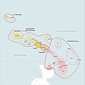
Also part of the province are numerous smaller islands, including Saint Matthias Group (Mussau, Emirau), New Hanover, Djaul, Tabar Group (Tabar, Tatau, Simberi), Lihir, Tanga Group (Malendok, Boang) and Feni Islands (Ambitle, Babase) commonly called Anir Islands.
The land area of the province is around 9,560 km2 (3,690 sq mi). The sea area within the Exclusive Economic Zone (EEZ) of New Ireland Province is around 230,000 km2 (89,000 sq mi).
Ecology[edit | edit source]
In the early days of the French Revolution while searching for a lost scientific expedition the vessel La Recherche passed by New Ireland. On board was the prominent botanist Jacques-Julien Houtou de Labillardière who noted in his journal fine stands of teak (Tectona grandis) trees growing at the southern end of the island. This marks the easternmost occurrence of teak, an important timber tree that extends naturally from India to Thailand on the Asian mainland and also is present on Java in the Indonesian archipelago.
History[edit | edit source]
There have been at least three waves of migration into New Ireland over the last 40,000 years. The Lapita pottery culture was present around 3,300 years ago.
Chinese and South-East Asian contact appears to have been longstanding, though the evidence is thin.
Dutch explorers made the first European contact in 1616. It was initially believed by Europeans to be part of New Britain, but the British explorer Philip Carteret established in 1767 that the island was physically separate, and gave it the name Nova Hibernia, Latin for 'New Ireland'.
In the 1870s and 1880s, Marquis de Rays, a French nobleman, attempted to establish a French colony on the island called La Nouvelle France. He sent four ill-fated expeditions to the island, the most notable of which was the third attempt, now known simply as the De Rays Expedition, which caused the death of 123 of the 350 or so settlers.[3]


Missionary activity did not begin until 1877, and New Ireland was colonised by Germany in 1886 under the name Neu-Mecklenburg, as part of the German partition comprising the northern half of present-day Papua New Guinea.
Blackbirding, the removal, often by force, of local young men to work on plantations in northern Australia and other Pacific islands, was widespread in New Ireland in the late 19th century, especially from Lihir Island and the Tanga Islands.
Australia took control in 1914, in the early stages of World War I, and renamed the island New Ireland after the island of Ireland. It became part of the Mandated Territory of New Guinea declared in 1921 by the League of Nations and administered by Australia.
During World War II, New Ireland was occupied by Japanese forces from January 1942 to September 1945.
Australian colonial administration continued until Papua New Guinea became independent in September 1975.
The core of New Ireland's economy is agriculture, livestock, and forestry and marine products.[4] Additionally, there is significant gold mining activity, particularly in Lihir and Simberi.[4]
Human geography[edit | edit source]

The population during the year 2000 census was 118,350 people, the vast majority of whom (about 90%) live in small rural villages. The population is very young, with a median age of 18.7 years. Over 40% of the population is under the age of 15 years, whereas only 3% is above 65 years old.[5][full citation needed]
The provincial capital is Kavieng, located on the main island's northern tip. Namatanai is another small town two-thirds of the way along the island. The Boluminski Highway runs down the east coast, linking the two towns.
Around twenty languages are spoken in New Ireland, and the number of dialects and subdialects totals perhaps 45. All are in the New Ireland languages group within the Austronesian language family, except for one language isolate, Kuot.
Culture[edit | edit source]
New Ireland, like much of Papua New Guinea, has a mixture of the old and the new: traditional cultural practices ("custom") are widespread and almost universally respected, yet society is changing as a result of church activity, urbanisation, and various aspects of global contemporary culture making their mark.
Probably the most famous cultural system of New Ireland is "Malagan", a Nalik word for an ancient and revered set of practices and ceremonies practised throughout much of the main island. Malagan is also an art where the dead are remembered through the various depictions that are carved on Malagan masks. The Malagan masks have a symbolic meaning as the dead must be remembered through the masks and ceremonies. They are the practical means of capturing the spirits of recent dead relatives or clan members. During the colonial era, significant quantities of Malagan masks were collected by European administrators and can be seen in museums all over Europe.
Districts and LLGs[edit | edit source]

Each province in Papua New Guinea has one or more districts, and each district has one or more Local Level Government (LLG) areas. For census purposes, the LLG areas are subdivided into wards and those into census units.[6]
| District | District Capital | LLG Name |
|---|---|---|
| Kavieng District | Kavieng | Kavieng Urban |
| Lavongai Rural | ||
| Murat Rural | ||
| Tikana Rural | ||
| Namatanai District | Namatanai | Konoagil Rural |
| Namatanai Rural | ||
| Matalai Rural | ||
| Nimamar Rural | ||
| Sentral Niu Ailan Rural | ||
| Tanir Rural |
Provincial leaders[edit | edit source]
The province was governed by a decentralised provincial administration, headed by a Premier, from 1977 to 1995. Following reforms taking effect that year, the national government reassumed some powers, and the role of Premier was replaced by the position of Governor, to be held by the winner of the province-wide seat in the National Parliament of Papua New Guinea.[7][8]
Premiers (1977–1995)[edit | edit source]
| Premier | Term |
|---|---|
| Robert Seeto | 1977–1986 |
| Pedi Anis | 1987–1990 |
| Demas Kavuvu | 1990–1993 |
| Samson Gila | 1993–1995 |
Governors (1995–present)[edit | edit source]
| Governor | Term |
|---|---|
| Wilson Peni | 1995–1997 |
| Paul Tohian | 1997–2002 |
| Ian Ling-Stuckey | 2002–2007 |
| Julius Chan | 2007–2025 |
| Walter Schnaubelt | 2025–present |
Members of the National Parliament[edit | edit source]
The province and each district are represented by a Member of the National Parliament. There is one provincial electorate, and each district is an open electorate.
| Electorate | Member |
|---|---|
| New Ireland Provincial | Julius Chan |
| Kavieng Open | Ian Ling-Stuckey |
| Namatanai Open | Walter Schnaubelt |
See also[edit | edit source]
- Borpop Airfield, Japanese facility during World War Two
- Matatai
References[edit | edit source]
- ↑ "About New Ireland – Papua New Guinea". Australian Doctors International (ADI). 2021.
- ↑ "Sub-national HDI - Area Database". Global Data Lab. Retrieved 2020-04-18.
- ↑ http://www.kmb-associates.com/familysearchitalyrayhistory.htm | History and Passenger Lists of the Marquis de Ray Expedition to New Ireland in 1880
- ↑ 4.0 4.1 Provincial Scoping Review Report New Ireland Province (PDF) (Report). Global Green Growth Institute. November 2020. p. 22. Retrieved 18 February 2023.
- ↑ (PNG Census 2000)
- ↑ National Statistical Office of Papua New Guinea
- ↑ May, R. J. "8. Decentralisation: Two Steps Forward, One Step Back". State and society in Papua New Guinea: the first twenty-five years. Australian National University. Retrieved 31 March 2017.
- ↑ "Provinces". rulers.org. Retrieved 31 March 2017.
External links[edit | edit source]
Template:Provinces of Papua New Guinea Template:Districts of New Ireland Province