
No edit summary |
quick update |
||
| Line 1: | Line 1: | ||
{{Short description|Mountain in Bangladesh}} | |||
'''Keokradong''' is a | {{Infobox mountain | ||
| name = Keokradong | |||
| photo = Goodmorning Keokaradang (6830453822).jpg | |||
| photo_caption = Keokradong | |||
| elevation_m = 986 | |||
| elevation_ref = | |||
| prominence_m = 400 | |||
| prominence_ref = <ref>[[SRTM]] data</ref> | |||
| map = Bangladesh | |||
| map_caption = Location in Bangladesh, near the border with Myanmar | |||
| label_position = left | |||
| listing = [[List of mountains of Bangladesh]] | |||
| location = [[Ruma Upazila]], [[Bandarban]] | |||
| range = | |||
| coordinates = {{coord|21|56|59|N|92|30|51|E|type:mountain_region:BD_scale:100000|format=dms|display=inline,title}} | |||
| range_coordinates = | |||
| coordinates_ref = | |||
| topo = | |||
| type = [[Mountain]] | |||
| age = | |||
| first_ascent = | |||
| easiest_route = | |||
}} | |||
'''Keokradong''' ({{langx|bn|কেওক্রাডং}}) is a peak located in [[Bandarban]], [[Bangladesh]], with an elevation of {{convert|986|m}}.<ref>[https://web.archive.org/web/20070613003330/https://www.cia.gov/library/publications/the-world-factbook/fields/2020.html Elevation extremes], CIA: the World Factbook.</ref> Some sources claim it as the highest point of Bangladesh. | |||
On the top of Keokradong there is a small shelter and a signboard put up by Bangladesh Army proclaiming the elevation to be {{convert|967|m}}. Meanwhile, the height measured by handheld GPS shows it is {{convert|986|m}} with 3m accuracy.<ref>{{usurped|1=[https://web.archive.org/web/20110725042031/http://www.banglatrek.org/?p=223 Keokradong, Banglatrek]}}, Banglatrek.org.</ref> | |||
There is a debate over the highest point of Bangladesh, and some sources indicate [[Saka Haphong]] as the most elevated peak of the country.<ref>{{cite peakbagger|pid=10949|title=Mowdok Mual, Bangladesh}}</ref> However, [[Tazing Dong]] is officially recognized as the highest point of Bangladesh. | |||
Keokradong is a popular tourist attraction in [[Bangladesh]] for mountaineers.<ref>{{Cite news |date=2016-03-17|title=A Hiker's Guide to Keokradong|url=https://www.thedailystar.net/shout/hikers-guide-keokradong-792409|access-date=2020-08-21|work=The Daily Star|language=en}}</ref> Keokradong is one of the cloudiest places in Bangladesh.{{Citation needed|date=January 2025}} | |||
==Gallery== | |||
<gallery mode="packed"> | |||
File:Keokradong.jpg|Eastern face of Keokradong | |||
File:Keokradong, Ruma, Bandarban, Bangladesh (cropped).jpg|Panorama from the top of '''Keokradong'''.|alt= | |||
File:Keokaradong Milestone (6822592268).jpg|Keokradong Milestone | |||
</gallery> | |||
==See also== | |||
* [[Geography of Bangladesh]] | |||
* [[List of mountains of Bangladesh]] | |||
==References== | ==References== | ||
{{reflist}} | {{reflist}} | ||
{{ | ==External links== | ||
* {{commons category-inline}} | |||
[[Category:Mountains of Bangladesh|Keokradong]] | |||
[[Category:Bandarban District]] | |||
{{Chittagong-geo-stub}} | |||
Latest revision as of 09:44, 16 June 2025
| Keokradong | |
|---|---|
.jpg) Keokradong | |
| Highest point | |
| Elevation | 986 m (3,235 ft) |
| Prominence | 400 m (1,300 ft) [1] |
| Listing | List of mountains of Bangladesh |
| Coordinates | 21°56′59″N 92°30′51″E / 21.94972°N 92.51417°E |
| Geography | |
  Keokradong Location in Bangladesh, near the border with Myanmar | |
| Location | Ruma Upazila, Bandarban |
| Geology | |
| Mountain type | Mountain |
Keokradong (Script error: The function "langx" does not exist.) is a peak located in Bandarban, Bangladesh, with an elevation of 986 metres (3,235 ft).[2] Some sources claim it as the highest point of Bangladesh.
On the top of Keokradong there is a small shelter and a signboard put up by Bangladesh Army proclaiming the elevation to be 967 metres (3,173 ft). Meanwhile, the height measured by handheld GPS shows it is 986 metres (3,235 ft) with 3m accuracy.[3]
There is a debate over the highest point of Bangladesh, and some sources indicate Saka Haphong as the most elevated peak of the country.[4] However, Tazing Dong is officially recognized as the highest point of Bangladesh.
Keokradong is a popular tourist attraction in Bangladesh for mountaineers.[5] Keokradong is one of the cloudiest places in Bangladesh.[citation needed]
Gallery[edit | edit source]
-
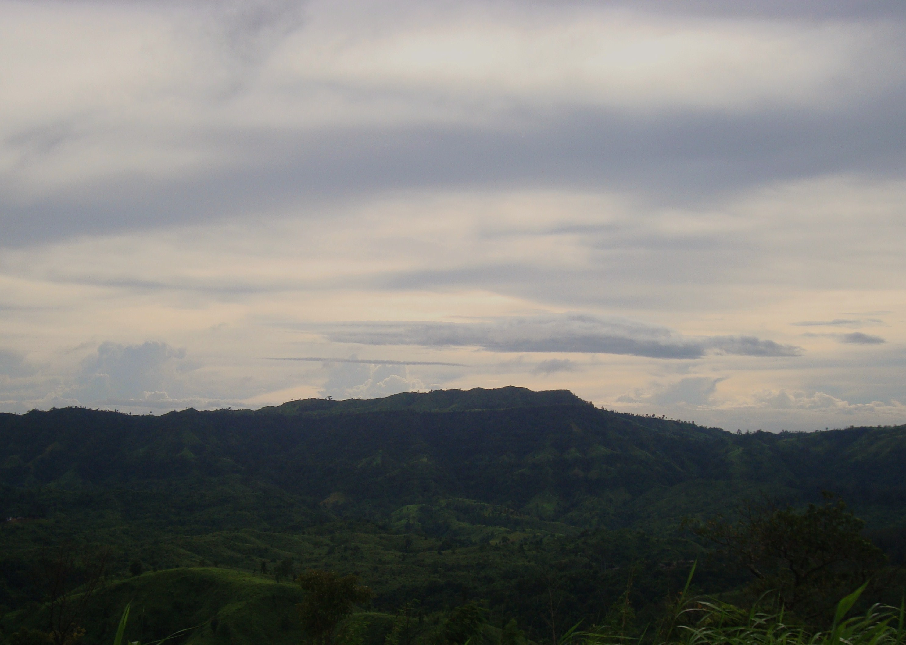 Eastern face of Keokradong
 -
 Panorama from the top of Keokradong.
 -
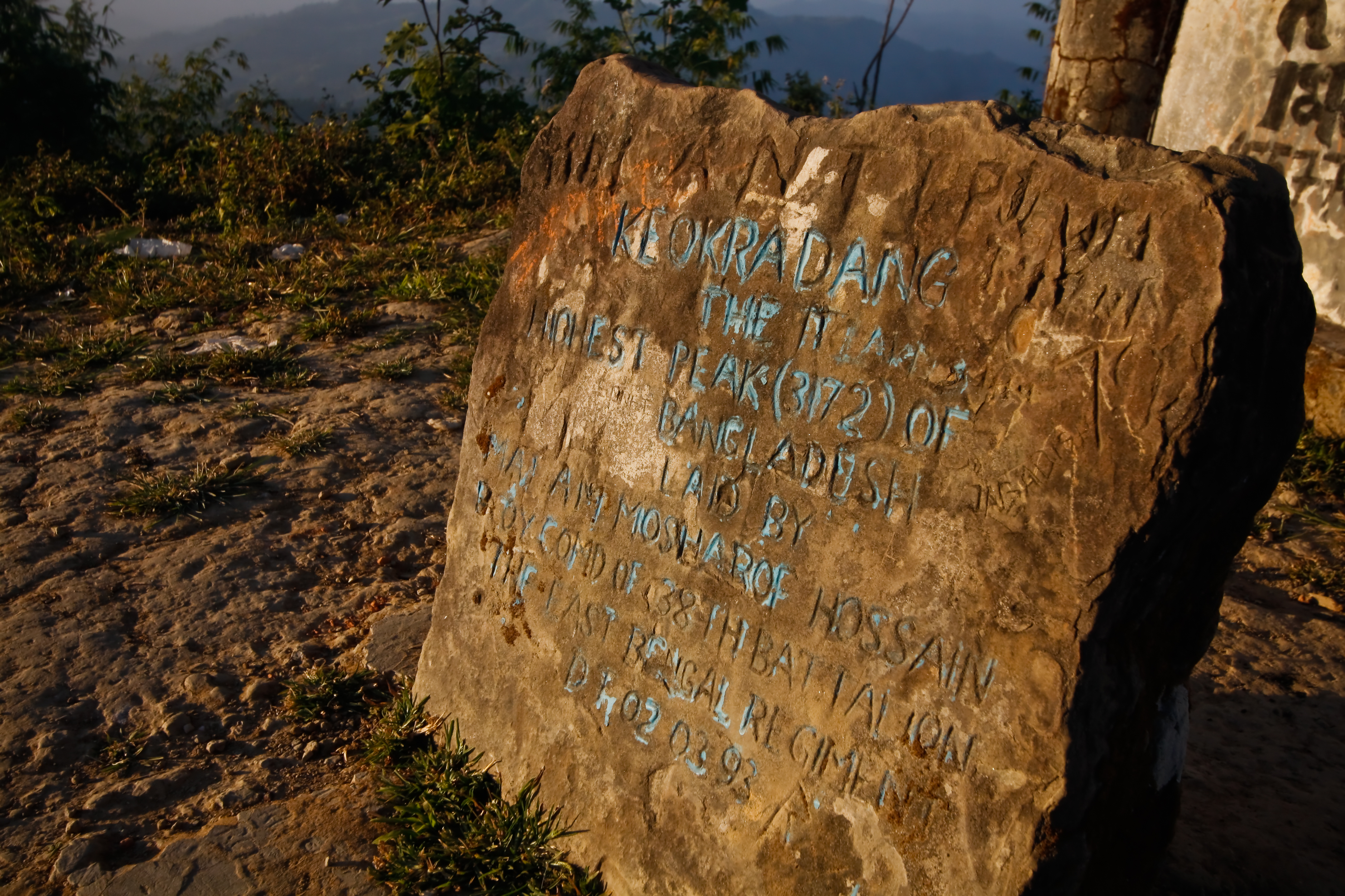 Keokradong Milestone

.jpg)
.jpg)
See also[edit | edit source]
References[edit | edit source]
- ↑ SRTM data
- ↑ Elevation extremes, CIA: the World Factbook.
- ↑ Keokradong, Banglatrek[usurped], Banglatrek.org.
- ↑ "Mowdok Mual, Bangladesh". Peakbagger.com.
- ↑ "A Hiker's Guide to Keokradong". The Daily Star. 2016-03-17. Retrieved 2020-08-21.