

>Naseefcse |
revised |
||
| Line 9: | Line 9: | ||
| other_name = | | other_name = | ||
| native_name = দিনাজপুর | | native_name = দিনাজপুর | ||
| image_skyline = {{multiple image | |||
| total_width = 270 | |||
| perrow = 1/2/2 | |||
| image1 = Fishing in Ramsagor.jpg | |||
| image2 = Library Building.JPG | |||
| image3 = Dinajpur DinajpurMondir 11Oct12 IMG 3627.jpg | |||
| image4 = Eid Congregation 07.jpg | |||
| image5 = Dinajpur Rail-station.jpg | |||
| footer = | |||
}} | |||
| nickname = | | nickname = | ||
| imagesize = | | imagesize = | ||
| image_caption = Dinajpur Rajbari | | image_caption = {{ubl|''Clockwise from the top:''|[[Ramsagar National Park]], Dinajpur Rajbari Temple, Dinajpur Railway Station, Gor-e-Shahid Eidgah and [[Hajee Mohammad Danesh Science and Technology University]]}} | ||
| image_flag = | | image_flag = | ||
| flag_size = | | flag_size = | ||
| Line 25: | Line 34: | ||
| pushpin_mapsize = | | pushpin_mapsize = | ||
| pushpin_map_caption = | | pushpin_map_caption = | ||
| coordinates = {{Coord|25 | | coordinates = {{Coord|25.629|N|88.637|E|format=dms|display=inline,title}} | ||
| subdivision_type = [[ | | subdivision_type = [[List of sovereign states|Country]] | ||
| subdivision_name = {{flag|Bangladesh}} | | subdivision_name = {{flag|Bangladesh}} | ||
| subdivision_type1 = [[Divisions of Bangladesh|Division]] | | subdivision_type1 = [[Divisions of Bangladesh|Division]] | ||
| subdivision_name1 = [[Rangpur Division]] | | subdivision_name1 = [[Rangpur Division|Rangpur]] | ||
| subdivision_type2 = [[Districts of | | subdivision_type2 = [[Districts of Bangladesh|District]] | ||
| subdivision_name2 = [[Dinajpur District, Bangladesh|Dinajpur | | subdivision_name2 = [[Dinajpur District, Bangladesh|Dinajpur]] | ||
| subdivision_type3 = | | subdivision_type3 = [[Upazila]] | ||
| subdivision_name3 = | | subdivision_name3 = [[Dinajpur Sadar Upazila|Dinajpur Sadar]] | ||
| subdivision_type4 = | | subdivision_type4 = | ||
| subdivision_name4 = | | subdivision_name4 = | ||
| Line 40: | Line 49: | ||
| governing_body = Dinajpur Municipality | | governing_body = Dinajpur Municipality | ||
| leader_title = [[Mayor|Paura Mayor]] | | leader_title = [[Mayor|Paura Mayor]] | ||
| leader_name = | | leader_name = <ref>{{cite web |url=http://www.dinajpur.gov.bd/site/page/7354ee40-18fd-11e7-9461-286ed488c766/%E0%A6%AE%E0%A7%87%E0%A6%AF%E0%A6%BC%E0%A6%B0%E0%A7%87%E0%A6%B0%20%E0%A6%AC%E0%A6%BE%E0%A6%B0%E0%A7%8D%E0%A6%A4%E0%A6%BE|title= Mayor Dinajpur city's civic body-Dinajpur Municipality |access-date= 12 September 2019}}</ref> | ||
| established_date = | | established_date = | ||
| established_title2 = Municipality | | established_title2 = Municipality | ||
| Line 63: | Line 72: | ||
| area_blank1_km2 = | | area_blank1_km2 = | ||
| area_blank1_sq_mi = | | area_blank1_sq_mi = | ||
| population_total = | | population_total = 212275 | ||
| population_density_km2 = auto | | population_density_km2 = auto | ||
| population_as_of = | | population_as_of = [[2022 Bangladeshi census|2022]] | ||
| population_footnotes = | | population_footnotes = <ref name="2022census"/> | ||
| population_note = | | population_note = | ||
| population_density_sq_mi = | | population_density_sq_mi = | ||
| Line 76: | Line 85: | ||
| population_density_urban_sq_mi = | | population_density_urban_sq_mi = | ||
| population_blank1_title = Ethnicities | | population_blank1_title = Ethnicities | ||
| population_blank1 = | | population_blank1 = [[Bengalis|Bengali]] | ||
| population_blank2_title = Religions | | population_blank2_title = Religions | ||
| timezone = [[India Standard Time|Bangladesh Time]] | | timezone = [[India Standard Time|Bangladesh Time]] | ||
| Line 89: | Line 98: | ||
| website = {{URL|www.dinajpur.gov.bd}} | | website = {{URL|www.dinajpur.gov.bd}} | ||
}} | }} | ||
== Geography and | '''Dinajpur''' ({{langx|bn|দিনাজপুর}} {{IPA|bn|dinad͡ʒpur|}}) is a city and the district headquarters of [[Dinajpur District, Bangladesh|Dinajpur district]] situated in [[Rangpur Division]], [[Bangladesh]]. It was founded in 1786. It is located 413 km north-west of [[Dhaka]]. It is bounded on the north by Suihari, Katapara, Bangi Bechapara, Pulhat, and Koshba on the south; on the east by Shekpura; and by the river [[Punarbhaba River|Punarbhaba]] on the west. About 213,000 people live here which makes this city the [[List of cities and towns in Bangladesh|21st largest city]] in [[Bangladesh]]. | ||
Dinajpur is located | |||
== Geography and climate == | |||
[[File:Winter morning in Bangladesh.jpg|thumb|left|Winter morning in Dinajpur]] | |||
Dinajpur is located in the north-western part of the country. It covers an area of 20.7 square kilometers (8.0 sq mi). | |||
It is situated at 25°37′N 88°39′E on the eastern bank of the [[Punarbhaba River|river Punarbhaba]]. Dinajpur has a [[humid subtropical climate]] (Cwa) that borders a [[tropical climate]] and has humid, hot summers, characterized monsoon season and mild, dry winters. | |||
{{Dinajpur weatherbox}} | |||
==Demographics== | |||
{{ | {{bar box | ||
| | |title=Religions in Dinajpur Paurashava (2022)<ref name="2022census"/> | ||
|titlebar=#Fcd116 | |||
| | |left1=Religion | ||
| | |right1=Percent | ||
| | |float=left | ||
| | |bars= | ||
| | {{bar percent|[[Islam in Bangladesh|Islam]]|green|86.39}} | ||
| | {{bar percent|[[Hinduism in Bangladesh|Hinduism]]|darkorange|12.08}} | ||
| | {{bar percent|[[Christianity in Bangladesh|Christianity]]|dodgerblue|1.43}} | ||
| | {{bar percent|Other or not stated|black|0.10}} | ||
| | |||
| | |||
| | |||
| | |||
| | |||
| | |||
| | |||
| | |||
| | |||
| | |||
| | |||
| | |||
}} | }} | ||
== | According to the [[2022 Bangladeshi census|2022 Bangladesh census]], Dinajpur Paurashava had 51,479 households and a population of 212,288. Dinajpur had a literacy rate of 88.79%: 90.79% for males and 86.70% for females, and a sex ratio of 104.67 males per 100 females. 7.30% of the population was under 5 years of age. Ethnic population was 2,097 (0.99%) of which 1242 were [[Santal people|Santal]] and 501 [[Kurukh people|Oraon]].<ref name="2022census">{{Cite book |url=http://203.112.218.101/storage/files/1/Publications/PHC_2021%20Community%20Report/RANGPUR%20DIVISION/Community%20Report%20Dinajpur.pdf |title=Population and Housing Census 2022 - Community Report: Dinajpur |date=June 2024 |publisher=[[Bangladesh Bureau of Statistics]] |isbn=978-984-475-326-6 |series=Community Report |location=[[Dhaka]] |pages= }}</ref> | ||
According to the [[2011 Bangladeshi census|2011 Bangladesh census]], Dinajpur city had 40,929 households and a population of 186,727. 31,320 (16.77%) were under 10 years of age. Dinajpur had a literacy rate (age 7 and over) of 75.37%, compared to the national average of 51.8%, and a sex ratio of 942 females per 1,000 males. The ethnic population was 2,402 (1.29%), of which 1,385 were [[Santal people|Santal]] and 777 [[Kurukh people|Oraon]].<ref name="census2011">{{cite web |title=Population & Housing Census 2011 (Zila Series & Community Series) |url=https://bbs.gov.bd/site/page/47856ad0-7e1c-4aab-bd78-892733bc06eb/- |website= |publisher=[[Bangladesh Bureau of Statistics]]}}</ref> | |||
== Education == | == Education == | ||
| Line 149: | Line 133: | ||
[[Hajee Mohammad Danesh Science & Technology University]] is located 13 km north of Dinajpur town and is one of the prominent institutions in North Bengal. It offers various undergraduate programs such as computer science, BBA, agriculture, fisheries, veterinary medicine and postgraduate programs like agronomy, horticulture and soil science. | [[Hajee Mohammad Danesh Science & Technology University]] is located 13 km north of Dinajpur town and is one of the prominent institutions in North Bengal. It offers various undergraduate programs such as computer science, BBA, agriculture, fisheries, veterinary medicine and postgraduate programs like agronomy, horticulture and soil science. | ||
Established in 1992, | Established in 1992, M Abdur Rahim Medical College (former Dinajpur Medical College) is one of the 36 government financed medical institutions located at historical Ananda sagar area in Dinajpur City. Currently, it offers a five-year MBBS Program, along with a one-year compulsory post-graduation internship program. In 2009, Dinajpur city began an English version of education. Some notable English Version schools are: Bethel Int'l School, Dinajpur Ridge School, Dinajpur Laboratory School, Dinajpur Public School, South Point School and Green International School. [[Dinajpur Polytechnic Institute]], Textile Institute Dinajpur, Saint Philip's High School & College, Saint Joseph School Dinajpur, [[Dinajpur Zila School|Dinajpur Zilla school]], Dinajpur Govt. Girls High School, Dinajpur High School, Dinajpur Police Line School, Dinajpur Collectorate School & College, Dinajpur Govt. College, is one of the best institutions in Dinajpur. | ||
Tenth educational board of Bangladesh has been established in Dinajpur in 2007. From 2009 S.S.C. (Secondary School Certificate) and H.S.C. (Higher Secondary School Certificate) exams have been started to be taken. In S.S.C. exam for the first time it stood 2nd in the country in the G.P.A. 5 list. | Tenth educational board of Bangladesh has been established in Dinajpur in 2007. From 2009 S.S.C. (Secondary School Certificate) and H.S.C. (Higher Secondary School Certificate) exams have been started to be taken. In S.S.C. exam for the first time it stood 2nd in the country in the G.P.A. 5 list. | ||
== | == History == | ||
At first, after its formation in 1856, the Dinajpur Municipality used to be run by a town committee presided over by the Deputy Magistrate. This was among the first 40 municipalities in Bengal at that time. Later in 1868, the 'District Town Act' commissioned a chairman of the municipality who replaced the Deputy Magistrate and given a similar rank as a District Magistrate. Mr. Patterson was appointed the first chairman of Dinajpur Municipality in 1869. Now present | At first, after its formation in 1856, the Dinajpur Municipality used to be run by a town committee presided over by the Deputy Magistrate. This was among the first 40 municipalities in Bengal at that time. Later in 1868, the 'District Town Act' commissioned a chairman of the municipality who replaced the Deputy Magistrate and given a similar rank as a District Magistrate. Mr. Patterson was appointed the first chairman of Dinajpur Municipality in 1869. Now present Mayor is Syed Jahangir Alam. It is indicative of how the demography of Dinajpur is largely diversified. People from Maldah, Bihar, Jalpaiguri and Rajsthan state of India can be easily seen sattled here throughout the district and city as well.<ref>Mehrab Ali, "History of Dinajpur Pourasava"</ref> | ||
== Agriculture == | |||
Dinajpur is famous for agriculture. Specially Dinajpur is famous for its [[Lychee|Litchi]] and aromatic rice (Katarivog). | |||
==Sister towns== | |||
* {{flagicon|United States}} [[Pembroke Park, Florida]]<ref>{{Cite web |last=নিউজ |first=সময় |title=দিনাজপুর পৌরসভা ও যুক্তরাষ্ট্রের ফ্লোরিডার পার্ক পেমব্রোক সিটির চুক্তি {{!}} বাংলাদেশ |url=https://www.somoynews.tv/news/2025-07-31/ATRCYtGS |access-date=2025-08-06 |website=Somoy News |language=bn}}</ref> | |||
==Notable people== | ==Notable people== | ||
* Air Vice-Marshal [[Momtaz Uddin Ahmed]], Seventh Chief of Air Staff of Bangladesh Air Force | |||
* [[Narayan Gangopadhyay]], novelist, poet, essayist, and short-story writer | |||
* [[Haji Mohammad Danesh]], politician and communist activist | |||
* [[Swami Atmasthananda]], fifteenth president of the Ramakrishna Math and the Ramakrishna Mission | |||
* [[Debojyoti Mishra]], Indian music director and film composer | |||
* [[Liton Das]], cricketer | |||
* [[Shawkat Ali (novelist)|Shawkat Ali]], Prominent novelist | |||
* [[Mohammad Farhad]], popularly known as "Comrade Farhad", guerrilla force commander during the Bangladesh independence war, and the President of [[Communist Party of Bangladesh]] and former member of [[Jatiya Sangsad]] | |||
* Air Vice-Marshal | |||
* [[Narayan Gangopadhyay]], | |||
* [[Atmasthananda]], fifteenth president of the Ramakrishna Math and the Ramakrishna Mission | |||
* [[Debojyoti Mishra]], | |||
* [[Liton Das]], | |||
*[[Shawkat Ali (novelist)|Shawkat Ali]], Prominent novelist | |||
*[[Mohammad Farhad]], popularly known as "Comrade Farhad", | |||
== | ==Gallery== | ||
<gallery> | <gallery> | ||
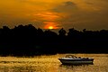
File:The lonely cyclist.jpg|Sukh Sagor | File:The lonely cyclist.jpg|Sukh Sagor | ||
File:Matasagor, Dinajpur.jpg|Matasagor | File:Matasagor, Dinajpur.jpg|Matasagor | ||
File:Vigorous touch of the morning, Dinajpur, Bangladesh.JPG|Bangibechar Hat | File:Vigorous touch of the morning, Dinajpur, Bangladesh.JPG|Bangibechar Hat | ||
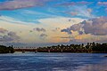
File: | File:Dinajpur Railway Bridge.jpg|Dinajpur Railway Bridge | ||
File:Punorvoba River.jpg|Punarbhaba River | |||
</gallery> | </gallery> | ||
| Line 198: | Line 172: | ||
* {{Official website|http://www.dinajpurmunicipality.com|name= Website of Dinajpur Municipality}} | * {{Official website|http://www.dinajpurmunicipality.com|name= Website of Dinajpur Municipality}} | ||
{{ | {{Bangladesh cities}} | ||
{{Authority control}} | {{Authority control}} | ||
Latest revision as of 22:18, 1 March 2026
 | This article needs more citations. (November 2014) |
Dinajpur
দিনাজপুর | |
|---|---|
City and Municipality | |
| |
| Lua error in Module:Location_map at line 851: Unable to find the specified location map definition: "Module:Location map/data/Bangladesh Rangpur division" does not exist. | |
| Coordinates: Lua error in package.lua at line 80: module 'Module:ISO 3166/data/BD' not found. | |
| Country |  Bangladesh Bangladesh |
| Division | Rangpur |
| District | Dinajpur |
| Upazila | Dinajpur Sadar |
| Government | |
| • Type | Mayor–Council |
| • Body | Dinajpur Municipality |
| • Paura Mayor | [1] |
| Area | |
| • Total | 22.8 km2 (8.8 sq mi) |
| Population | |
| • Total | 212,275 |
| • Density | 9,300/km2 (24,000/sq mi) |
| • Ethnicities | Bengali |
| Time zone | UTC+6 (Bangladesh Time) |
| National Dialing Code | +880 |
| Website | www |


Dinajpur (Bengali: দিনাজপুর [dinad͡ʒpur]) is a city and the district headquarters of Dinajpur district situated in Rangpur Division, Bangladesh. It was founded in 1786. It is located 413 km north-west of Dhaka. It is bounded on the north by Suihari, Katapara, Bangi Bechapara, Pulhat, and Koshba on the south; on the east by Shekpura; and by the river Punarbhaba on the west. About 213,000 people live here which makes this city the 21st largest city in Bangladesh.
Geography and climate[edit | edit source]

Dinajpur is located in the north-western part of the country. It covers an area of 20.7 square kilometers (8.0 sq mi).
It is situated at 25°37′N 88°39′E on the eastern bank of the river Punarbhaba. Dinajpur has a humid subtropical climate (Cwa) that borders a tropical climate and has humid, hot summers, characterized monsoon season and mild, dry winters.
Demographics[edit | edit source]
According to the 2022 Bangladesh census, Dinajpur Paurashava had 51,479 households and a population of 212,288. Dinajpur had a literacy rate of 88.79%: 90.79% for males and 86.70% for females, and a sex ratio of 104.67 males per 100 females. 7.30% of the population was under 5 years of age. Ethnic population was 2,097 (0.99%) of which 1242 were Santal and 501 Oraon.[2]
According to the 2011 Bangladesh census, Dinajpur city had 40,929 households and a population of 186,727. 31,320 (16.77%) were under 10 years of age. Dinajpur had a literacy rate (age 7 and over) of 75.37%, compared to the national average of 51.8%, and a sex ratio of 942 females per 1,000 males. The ethnic population was 2,402 (1.29%), of which 1,385 were Santal and 777 Oraon.[3]
Education[edit | edit source]
Over the last 25 years, Dinajpur has attracted some prominent educational institutions, all of which are government financed. They are as follows:
Hajee Mohammad Danesh Science & Technology University is located 13 km north of Dinajpur town and is one of the prominent institutions in North Bengal. It offers various undergraduate programs such as computer science, BBA, agriculture, fisheries, veterinary medicine and postgraduate programs like agronomy, horticulture and soil science.
Established in 1992, M Abdur Rahim Medical College (former Dinajpur Medical College) is one of the 36 government financed medical institutions located at historical Ananda sagar area in Dinajpur City. Currently, it offers a five-year MBBS Program, along with a one-year compulsory post-graduation internship program. In 2009, Dinajpur city began an English version of education. Some notable English Version schools are: Bethel Int'l School, Dinajpur Ridge School, Dinajpur Laboratory School, Dinajpur Public School, South Point School and Green International School. Dinajpur Polytechnic Institute, Textile Institute Dinajpur, Saint Philip's High School & College, Saint Joseph School Dinajpur, Dinajpur Zilla school, Dinajpur Govt. Girls High School, Dinajpur High School, Dinajpur Police Line School, Dinajpur Collectorate School & College, Dinajpur Govt. College, is one of the best institutions in Dinajpur.
Tenth educational board of Bangladesh has been established in Dinajpur in 2007. From 2009 S.S.C. (Secondary School Certificate) and H.S.C. (Higher Secondary School Certificate) exams have been started to be taken. In S.S.C. exam for the first time it stood 2nd in the country in the G.P.A. 5 list.
History[edit | edit source]
At first, after its formation in 1856, the Dinajpur Municipality used to be run by a town committee presided over by the Deputy Magistrate. This was among the first 40 municipalities in Bengal at that time. Later in 1868, the 'District Town Act' commissioned a chairman of the municipality who replaced the Deputy Magistrate and given a similar rank as a District Magistrate. Mr. Patterson was appointed the first chairman of Dinajpur Municipality in 1869. Now present Mayor is Syed Jahangir Alam. It is indicative of how the demography of Dinajpur is largely diversified. People from Maldah, Bihar, Jalpaiguri and Rajsthan state of India can be easily seen sattled here throughout the district and city as well.[4]
Agriculture[edit | edit source]
Dinajpur is famous for agriculture. Specially Dinajpur is famous for its Litchi and aromatic rice (Katarivog).
Sister towns[edit | edit source]

Notable people[edit | edit source]
- Air Vice-Marshal Momtaz Uddin Ahmed, Seventh Chief of Air Staff of Bangladesh Air Force
- Narayan Gangopadhyay, novelist, poet, essayist, and short-story writer
- Haji Mohammad Danesh, politician and communist activist
- Swami Atmasthananda, fifteenth president of the Ramakrishna Math and the Ramakrishna Mission
- Debojyoti Mishra, Indian music director and film composer
- Liton Das, cricketer
- Shawkat Ali, Prominent novelist
- Mohammad Farhad, popularly known as "Comrade Farhad", guerrilla force commander during the Bangladesh independence war, and the President of Communist Party of Bangladesh and former member of Jatiya Sangsad
Gallery[edit | edit source]
-
 Sukh Sagor
 -
 Matasagor
 -
 Bangibechar Hat
 -
 Dinajpur Railway Bridge
 -
 Punarbhaba River


References[edit | edit source]
- ↑ "Mayor Dinajpur city's civic body-Dinajpur Municipality". Retrieved 12 September 2019.
- ↑ 2.0 2.1 2.2 Population and Housing Census 2022 - Community Report: Dinajpur (PDF). Community Report. Dhaka: Bangladesh Bureau of Statistics. June 2024. ISBN 978-984-475-326-6.
- ↑ "Population & Housing Census 2011 (Zila Series & Community Series)". Bangladesh Bureau of Statistics.
- ↑ Mehrab Ali, "History of Dinajpur Pourasava"
- ↑ নিউজ, সময়. "দিনাজপুর পৌরসভা ও যুক্তরাষ্ট্রের ফ্লোরিডার পার্ক পেমব্রোক সিটির চুক্তি | বাংলাদেশ". Somoy News (in Bengali). Retrieved 6 August 2025.