




robot: Update article (please report if you notice any mistake or error in this edit) |
m typo fix |
||
| Line 1: | Line 1: | ||
{{short description|Neoproterozoic to Cretaceous landmass}} | {{short description|Neoproterozoic to Cretaceous landmass}} | ||
{{About|the supercontinent|the region in India|Gondwana (India)|other uses}} | {{About|the supercontinent|the region in India|Gondwana (India)|other uses}} | ||
{{Use | {{Use dmy dates|date=August 2022}} | ||
{{ | {{EngvarB|date=August 2022}} | ||
{{ | {{Infobox historical continent | ||
|name = Gondwana | |||
|image = Gondwana 420 Ma.png | |||
|caption = Gondwana 420 million years ago (Late Silurian) | |||
|formation_year = 600 Mya | |||
|type = [[Supercontinent]] | |||
|today = [[Africa]]<br />[[North America]]<br />[[South America]]<br />[[Australia (continent)|Australia]]<br />[[Indian subcontinent|India]]<br />[[Arabia]]<br />[[Antarctica]]<br />[[Balkan Peninsula|Balkans]] | |||
|smaller_continents = [[South America]]<br />[[Africa]]<br />[[Australia (continent)|Australia]]<br />[[Antarctica]]<br />[[Zealandia (continent)|Zealandia]] | |||
|plate = [[African Plate]]<br />[[Antarctic Plate]]<br />[[Indo-Australian Plate]]<br />[[South American Plate]] | |||
}} | }} | ||
'''Gondwana''' ({{IPAc-en|ɡ|ɒ|n|ˈ|d|w|ɑː|n|ə}}<ref>{{cite LPD|3|page=347}}</ref> {{respell|gond-WAHN-ə}};<ref>{{Cite web|title= Gondwana|url= http://dictionary.reference.com/browse/gondwana|website= [[Reference.com|Dictionary.com]]|publisher= Lexico Publishing Group|access-date= 18 January 2010|archive-date= 3 March 2016|archive-url= https://web.archive.org/web/20160303214206/http://dictionary.reference.com/browse/gondwana|url-status= live}}</ref> {{IPA|sa|goːɳɖɐʋɐnɐ|lang}}) was a large landmass, sometimes referred to as a [[supercontinent]]. The remnants of Gondwana make up around two-thirds of today's continental area, including [[South America]], [[Africa]], [[Antarctica]], [[Australia (continent)|Australia]], [[Zealandia]], [[Arabian Peninsula|Arabia]], and the [[Indian subcontinent]]. | |||
'''Gondwana''' ({{IPAc-en | |||
Gondwana was formed by the [[Accretion (geology)|accretion]] of several [[craton|cratons]] (large stable blocks of the Earth's crust), beginning {{Circa}} {{Ma|800|650|{{Abbr|Ma|million years ago}}}} with the [[East African Orogeny]], the collision of [[India]] and [[Madagascar]] with [[East Africa]], and culminating in {{Circa}} {{Ma|600|530|Ma}} with the overlapping [[Brasiliano orogeny|Brasiliano]] and [[Kuunga orogeny|Kuunga]] orogenies, the collision of South America with Africa, and the addition of Australia and Antarctica, respectively.<ref>{{Harvnb|Meert|Van der Voo|1997|loc=Abstract}}</ref> Eventually, Gondwana became the largest piece of [[continental crust]] of the [[Paleozoic]] Era, covering an area of some {{Convert|100,000,000|km2|abbr=on}},<ref>{{Harvnb|Torsvik|Cocks|2013|loc=Abstract}}</ref> about one-fifth of the Earth's surface. It fused with [[Laurasia]] during the [[Carboniferous]] to form [[Pangaea]]. | |||
Gondwana began to separate from northern Pangea ([[Laurasia]]) during the [[Triassic]], and started to fragment during the Early [[Jurassic]] (around 180 million years ago). The final stages of break-up saw the fragmentation of the [[Antarctic land bridge]] (involving the separation of Antarctica from South America and Australia, forming the [[Drake Passage|Drake]] and [[Tasmanian Passage|Tasmanian Passages]]), which occurred during the [[Paleogene]] (from around {{Ma|66|23}} (Ma)). Gondwana was not considered a supercontinent by the earliest definition, since the landmasses of [[Baltica]], [[Laurentia]], and [[Siberia (continent)|Siberia]] were separated from it.<ref name="Bradley-2011">{{Cite journal |last=Bradley |first=D.C. |date=2011 |title=Secular Trends in the Geologic Record and the Supercontinent Cycle |journal=Earth-Science Reviews |volume=108 |issue=1–2 |pages=16–33 |doi=10.1016/j.earscirev.2011.05.003|bibcode=2011ESRv..108...16B |citeseerx=10.1.1.715.6618 |s2cid=140601854 }}</ref> To differentiate it from the Indian region of the same name (see {{section link||Name}}), it is also commonly called '''Gondwanaland'''.<ref>{{Cite web|title=Gondwanaland|url=http://www.merriam-webster.com/dictionary/gondwana|access-date=18 January 2010|publisher=[[Webster's Dictionary|Merriam-Webster Online Dictionary]]|archive-date=29 October 2020|archive-url=https://web.archive.org/web/20201029234618/https://www.merriam-webster.com/dictionary/Gondwana|url-status=live}}</ref> | |||
Regions that were part of Gondwana shared [[Flora|floral]] and [[Fauna|faunal]] elements that persist to the present day. | |||
== Name == | |||
[[File:Wegener fossils-mapped.png|thumb|249x249px|Distribution of four [[Permian]] and [[Triassic]] fossil groups used as biogeographic evidence for continental drift, land bridging.]] | |||
The continent of Gondwana was named by the Austrian scientist [[Eduard Suess]] after the [[Gondwana (India)|Indian region of the same name]], which is derived from [[Sanskrit]] {{lang|sa|गोण्डवन}} {{transliteration|sa|goṇḍavana}} ('forest of the [[Gondi people|Gonds]]').<ref>{{cite journal |last1=Chakrabarti |first1=Pratik |title=Gondwana and the Politics of Deep Past |journal=Past & Present |date=2019 |issue=242 |pages=119–153 |doi=10.1093/pastj/gty016|doi-access=free }}</ref> The name had been previously used in a geological context, first by [[Henry Benedict Medlicott|H. B. Medlicott]] in 1872,<ref>{{Harvnb|Suess|1885|p=768}}: [https://archive.org/stream/dasantlitzderer02suesgoog#page/n760/mode/1up "Wir nennen es Gondwána-Land, nach der gemeinsamen alten Gondwána-Flora, … "(We name it Gondwána-Land, after the common ancient flora of Gondwána …)]</ref> from which the Gondwana sedimentary sequences ([[Permian]]-[[Triassic]]) are also described.<ref>{{Cite journal |last=Carrillo |first=Emilio |last2=Barragán |first2=Roberto |last3=Hurtado |first3=Christian |last4=Calderón |first4=Ysabel |last5=Martín |first5=Germán |last6=Vázquez-Taset |first6=Yaniel |last7=Parra |first7=Mauricio |last8=Rivera |first8=Ariana |last9=Cadena |first9=Fanny Mariela |last10=Sarmiento |first10=Luis |date=2021-07-06 |title=Depositional sequences in northern Peru: new insights on the palaeogeographic and palaeotectonic reconstruction of western Gondwana during late Permian and Triassic |url=https://doi.org/10.1144/jgs2020-186 |journal=Journal of the Geological Society |volume=178 |issue=6 |doi=10.1144/jgs2020-186 |issn=0016-7649|url-access=subscription }}</ref> | |||
The continent of Gondwana was named by the Austrian scientist [[Eduard Suess]] | |||
Some scientists prefer the term "Gondwanaland" for the supercontinent to make a clear distinction between the region and the supercontinent.<ref name="McLoughlin 2001">{{Harvnb|McLoughlin|2001|loc=Gondwana or Gondwanaland?, pp. 272–273}}</ref> | |||
==Formation== | ==Formation== | ||
[[File:Kuunga2.png|thumb|left | [[File:Kuunga2.png|thumb|left|Eastern Gondwana. {{Ma|620|550|Ma}} post-collisional extension of the East African Orogeny in blue and {{Ma|570|530|Ma}} collisional metamorphism of the Kuunga orogeny in red.<ref>{{Harvnb|Meert|2003|loc=Fig. 10, p. 19}}</ref>|207x207px]] | ||
The assembly of Gondwana was a protracted process during the Neoproterozoic and Paleozoic, which | The assembly of Gondwana was a protracted process during the [[Neoproterozoic]] and [[Paleozoic]], which remains incompletely understood because of the lack of paleo-magnetic data. Several [[Orogeny|orogenies]], collectively known as the [[Pan-African orogeny]], caused the continental fragments of a much older supercontinent, [[Rodinia]], to amalgamate. One of those orogenic belts, the [[Mozambique Belt]], formed {{Ma|800|650|Ma}} and was originally interpreted as the [[Suture (geology)|suture]] between East (India, Madagascar, Antarctica, Australia) and West Gondwana (Africa and South America). Three orogenies were recognised during the 1990s as a result of data sets compiled on behalf of oil and mining companies:<ref>{{Cite journal |last=Fairhead |first=J.D. |date=2023-03-01 |title=The Mesozoic West and Central Africa Rift System (WCARS) and the older Kandi Shear Zone (KSZ): Rifting and tectonics of North Africa and South America and fragmentation of Gondwana based on geophysical investigations |journal=Journal of African Earth Sciences |volume=199 |article-number=104817 |doi=10.1016/j.jafrearsci.2022.104817 |issn=1464-343X|doi-access=free |bibcode=2023JAfES.19904817F }}</ref> the [[East African Orogeny]] ({{Ma|650|800|Ma}}) and [[Kuunga orogeny]] (including the [[Malagasy orogeny]] in southern Madagascar) ({{Ma|550|Ma}}), the collision between East Gondwana and East Africa in two steps, and the [[Brasiliano orogeny]] ({{Ma|660|530|Ma}}), the successive collision between South American and African [[craton]]s.<ref>{{Harvnb|Meert|Van der Voo|1997|loc=Introduction, pp. 223–226}}</ref> | ||
The last stages of Gondwanan assembly overlapped with the opening of the [[Iapetus Ocean]] between [[Laurentia]] and western Gondwana.<ref>{{Harvnb|Miashita|Yamamoto|1996}}</ref> During this interval, the [[Cambrian explosion]] occurred. Laurentia was docked against the western shores of a united Gondwana for a | The last stages of Gondwanan assembly overlapped with the opening of the [[Iapetus Ocean]] between [[Laurentia]] and western Gondwana.<ref>{{Harvnb|Miashita|Yamamoto|1996}}</ref> During this interval, the [[Cambrian explosion]] occurred. Laurentia was docked against the western shores of a united Gondwana for a brief period near the Precambrian and Cambrian boundary, forming the short-lived and still disputed supercontinent [[Pannotia]].<ref>{{Harvnb|Meert|Van der Voo|1997|p=229}}</ref> | ||
The [[Mozambique Ocean]] separated the [[Congo | The [[Mozambique Belt|Mozambique Ocean]] separated the [[Congo craton|Congo]]–[[Tanzania craton|Tanzania]]–[[Bangweulu Block]] of central Africa from Neoproterozoic India (India, the [[Antongil Bay|Antongil]] Block in far eastern Madagascar, the [[Seychelles]], and the Napier and Rayner Complexes in [[East Antarctica]]). The [[Azania]] continent<ref>Defined but not named in {{Harvnb|Collins|Pisarevsky|2005}}: "Azania" was a Greek name for the East African coast</ref> (much of central [[Madagascar]], the [[Horn of Africa]] and parts of [[Yemen]] and Arabia) was an island in the Mozambique Ocean. | ||
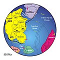
[[File:Positions of ancient continents, 550 million years ago.jpg|thumb | [[File:Positions of ancient continents, 550 million years ago.jpg|thumb|[[Plate reconstruction|Reconstruction]] showing final stages of assembly of Gondwana, 550 Mya|259x259px]] | ||
The | The continents of Australia and [[East Antarctic Shield|East Antarctica]] were still separated from India, eastern Africa, and Kalahari by {{Circa}} {{Ma|600|Ma}}, when most of western Gondwana had already been amalgamated. By {{Circa}} 550 Ma, India had reached its Gondwanan position, which initiated the Kuunga orogeny (also known as the Pinjarra orogeny). Meanwhile, on the other side of the newly forming Africa, Kalahari collided with Congo and Rio de la Plata which closed the [[Adamastor Ocean]]. {{Circa}} 540–530 Ma, the closure of the Mozambique Ocean brought India next to Australia–East Antarctica, and both North China and South China were in proximity to Australia.<ref>{{Harvnb|Li|Bogdanova|Collins|Davidson|2008|loc=The birth of Gondwanaland (600–530 Ma), p. 201}}</ref> | ||
As the rest of Gondwana formed, a complex series of orogenic events assembled the eastern parts of Gondwana (eastern Africa, Arabian-Nubian Shield, Seychelles, Madagascar, India, Sri Lanka, East Antarctica, | As the rest of Gondwana formed, a complex series of orogenic events assembled the eastern parts of Gondwana (eastern Africa, Arabian-Nubian Shield, Seychelles, Madagascar, India, Sri Lanka, East Antarctica, Australia) {{Circa}} {{Ma|750|530|Ma}}. First, the Arabian-Nubian Shield collided with eastern Africa (in the Kenya-Tanzania region) in the East African Orogeny {{Circa}}{{Ma|750|620|Ma}}. Then Australia and East Antarctica were merged with the remaining Gondwana {{Circa}} {{Ma|570|530|Ma}} in the Kuunga Orogeny.<ref>{{Harvnb|Meert|2003|loc=Abstract}}</ref> | ||
The later Malagasy orogeny at about 550–515 Mya affected Madagascar, eastern East Africa and southern India. In it, Neoproterozoic India collided with the already combined Azania and Congo–Tanzania–Bangweulu Block, suturing along the Mozambique Belt.<ref>{{Harvnb|Grantham|Maboko|Eglington|2003}}</ref> | The later Malagasy orogeny at about 550–515 Mya affected Madagascar, eastern East Africa and southern India. In it, Neoproterozoic India collided with the already combined Azania and Congo–Tanzania–Bangweulu Block, suturing along the Mozambique Belt.<ref>{{Harvnb|Grantham|Maboko|Eglington|2003}}</ref> | ||
| Line 42: | Line 49: | ||
==Peri-Gondwana development: Paleozoic rifts and accretions == | ==Peri-Gondwana development: Paleozoic rifts and accretions == | ||
Many terranes were accreted to Eurasia during Gondwana's existence, but the Cambrian or Precambrian origin of many of these terranes remains uncertain. For example, some Paleozoic terranes and microcontinents that now make up Central Asia, often called the "Kazakh" and "Mongolian terranes", were progressively amalgamated into the continent [[Kazakhstania]] in the late [[Silurian]]. Whether these blocks originated on the shores of Gondwana is not known.<ref>{{Harvnb|Torsvik|Cocks|2013|loc=Marginal microcontinents and terranes, p. 1008}}</ref> | |||
In the Early | In the Early Paleozoic, the [[Armorican terrane]], which today form large parts of France, was part of Peri-Gondwana; the Rheic Ocean closed in front of it and the Paleo-Tethys Ocean opened behind it. Precambrian rocks from the [[Iberian Peninsula]] suggest that it, too, formed part of core Gondwana before its detachment as an [[orocline]] in the [[Variscan orogeny]] close to the Carboniferous–Permian boundary.<ref>{{Harvnb|Torsvik|Cocks|2013|loc=Southern Europe, pp. 1008–1009}}</ref> | ||
South-east Asia | {{Multiple image | total_width = 400 | align = right | perrow = 2 | ||
| image1 = Geology of Asia 450.Ma.jpg | |||
| image2 = Geology of Asia 350Ma.jpg | |||
| image3 = Geology of Asia 300Ma.jpg | |||
| image4 = Geology of Asia 200Ma.jpg | |||
| footer = Journey of the Asian blocks from Gondwana to Laurasia, [[Late Ordovician]] to [[Early Jurassic]] (450, 350, 300, and 200 Mya).<br />View centred on 0°S,105°E. | |||
}} | |||
South-east Asia was made of Gondwanan and [[Cathaysia]]n continental fragments that were assembled during the Mid-Paleozoic and Cenozoic. This process can be divided into three phases of rifting along Gondwana's northern margin: first, in the Devonian, [[North China craton|North]] and [[South China craton|South China]], together with [[Tarim Basin|Tarim]] and Quidam (north-western China) rifted, opening the Paleo-Tethys behind them. These terranes accreted to Asia during Late Devonian and Permian. Second, in the Late Carboniferous to Early Permian, [[Cimmeria (continent)|Cimmerian terranes]] opened Meso-Tethys Ocean; [[Shan–Thai terrane|Sibumasu]] and [[Qiangtang terrane|Qiangtang]] were added to south-east Asia during [[Lopingian|Late Permian]] and Early Jurassic. Third, in the Late Triassic to Late Jurassic, [[Lhasa terrane|Lhasa]], [[Burma terrane|Burma]], [[Woyla]] terranes opened the Neo-Tethys Ocean; Lhasa collided with Asia during the Early Cretaceous, and Burma and Woyla during the Late Cretaceous.<ref>{{Harvnb|McLoughlin|2001|loc=Cimmerian terranes, p. 278}}</ref> | |||
Gondwana's long, northern margin | Gondwana's long, northern margin remained a mostly passive margin throughout the Paleozoic. The Early Permian opening of the Neo-Tethys Ocean along this margin produced a long series of terranes, many of which were and still are being deformed in the [[Geology of the Himalayas|Himalayan orogeny]]. These terranes are, from Turkey to north-eastern India: the Taurides in southern Turkey; the Lesser Caucasus Terrane in Georgia; the Sanand, Alborz, and Lut terranes in Iran; the Mangysglak Terrane in the Caspian Sea; the Afghan Terrane; the Karakorum Terrane in northern Pakistan; and the Lhasa and Qiangtang terranes in Tibet. The Permian–Triassic widening of the Neo-Tethys pushed all these terranes across the Equator and over to Eurasia.<ref>{{Harvnb|Torsvik|Cocks|2013|loc=South-central and eastern Asia}}</ref> | ||
===Southwestern accretions=== | ===Southwestern accretions=== | ||
During the Neoproterozoic to | During the Neoproterozoic to Paleozoic phase of the [[Terra Australis Orogen]], a series of terranes were rafted from the proto-Andean margin when the Iapetus Ocean opened, to be added back to Gondwana during the closure of that ocean.<ref>{{Harvnb|Cawood|2005|loc=Peri-Gondwanan continental basement assemblages, pp. 15–16}}</ref> During the Paleozoic, some blocks which helped to form parts of the [[Southern Cone]] of South America, include a piece transferred from Laurentia when the west edge of Gondwana scraped against southeast Laurentia in the [[Ordovician]].<ref>{{Harvnb|Rapalini|2001}}; {{Harvnb|Rapalini|1998|pp=105–106}}</ref> This is the [[Cuyania]] or Precordillera [[terrane]] of the [[Famatinian orogeny]] in northwest Argentina which may have continued the line of the [[Appalachian Mountains|Appalachians]] southwards.<ref>{{Harvnb|Dalla Salda|de Luchi|Cingolani|Varela|1998|loc=Abstract}}; {{Harvnb|Vujovich|van Staal|Davis|2004|loc=Conclusions, p. 1053}}</ref> [[Chilenia]] terrane accreted later against Cuyania.<ref>{{cite journal |last1=Ramos |first1=V.A.|author-link=Víctor Alberto Ramos |last2=Jordan |first2=T.E.|last3=Allmendinger |first3=R.W.|last4=Mpodozis |first4=C.|author-link4=Constantino Mpodozis|last5=Kay |first5=S.M.|last6=Cortés |first6=J.M. |last7=Palma |first7=M. |date=October 1986 |title=Paleozoic terranes of the central Argentina-Chilean Andes |url=https://www.researchgate.net/publication/252991522 |journal=Tectonics |volume=5 |issue=6 |pages=855–880 |doi= 10.1029/TC005i006p00855|bibcode=1986Tecto...5..855R}}</ref> The collision of the Patagonian terrane with the southwestern Gondwanan occurred in the late Paleozoic. Subduction-related igneous rocks from beneath the [[North Patagonian Massif]] have been dated at 320–330 million years old, indicating that the subduction process initiated in the early Carboniferous.<ref name="Pankhurst-2006">{{Cite journal|last1=Pankhurst|first1=R. J.|last2=Rapela|first2=C. W.|last3=Fanning|first3=C. M.|last4=Márquez|first4=M.|date=1 June 2006|title=Gondwanide continental collision and the origin of Patagonia|journal=Earth-Science Reviews|volume=76|issue=3–4|pages=235–257|doi=10.1016/j.earscirev.2006.02.001|bibcode=2006ESRv...76..235P|url=http://nora.nerc.ac.uk/id/eprint/211/1/Pankhurst_EARTH1090_Text.pdf|access-date=18 August 2019|archive-date=19 July 2018|archive-url=https://web.archive.org/web/20180719183250/http://nora.nerc.ac.uk/id/eprint/211/1/Pankhurst_EARTH1090_Text.pdf|url-status=live}}</ref> This was relatively short-lived (lasting about 20 million years), and initial contact of the two landmasses occurred in the mid-Carboniferous,<ref name="Pankhurst-2006" /><ref name="Ramos-2008" /> with broader collision during the early Permian.<ref name="Ramos-2008">{{Cite journal|last=Ramos|first=Victor A.|date=1 November 2008|title=Patagonia: A paleozoic continent adrift?|journal=[[Journal of South American Earth Sciences]]|volume=26|issue=3|pages=235–251 |doi=10.1016/j.jsames.2008.06.002|bibcode=2008JSAES..26..235R|hdl=11336/92748|hdl-access=free}}</ref> In the Devonian, an [[island arc]] named [[Chaitenia]] accreted to Patagonia in what is now south-central Chile.<ref name="Hervé-2018">{{cite journal |last1=Hervé |first1=Francisco|author-link1=Francisco Hervé |last2=Calderón |first2=Mauricio |last3=Fanning |first3=Mark |last4=Pankhurst |first4=Robert|author-link4=Robert John Pankhurst |last5=Rapela |first5=Carlos W. |last6=Quezada |first6=Paulo |date=2018 |title=The country rocks of Devonian magmatism in the North Patagonian Massif and Chaitenia |journal=[[Andean Geology]] |volume=45 |issue=3 |pages=301–317 |doi=10.5027/andgeoV45n3-3117 |bibcode=2018AndGe..45..301H |doi-access=free |hdl=11336/81577 |hdl-access=free }}</ref> | ||
==Gondwana as part of Pangaea: Late Paleozoic to Early Mesozoic== | ==Gondwana as part of Pangaea: Late Paleozoic to Early Mesozoic== | ||
{{Main|Pangaea}} | |||
[[File:Laurasia-Gondwana.svg|thumb|Gondwana formed part of Pangaea for {{Circa}} 150 Ma<ref>{{Harvnb|Li|Bogdanova|Collins|Davidson|2008|loc=Abstract}}</ref>]] | [[File:Laurasia-Gondwana.svg|thumb|Gondwana formed part of Pangaea for {{Circa}} 150 Ma<ref>{{Harvnb|Li|Bogdanova|Collins|Davidson|2008|loc=Abstract}}</ref>]] | ||
Gondwana and [[Laurasia]] formed the [[Pangaea]] supercontinent during the Carboniferous. Pangaea began to break up in the Mid-Jurassic when the [[Central Atlantic magmatic province|Central Atlantic opened]].<ref>{{Harvnb|Torsvik|Van der Voo|2002|loc=Data selection and reconstruction fits, p. 772}}</ref> | |||
Gondwana and [[Laurasia]] formed the Pangaea supercontinent during the Carboniferous. Pangaea began to break up in the Mid-Jurassic when the [[Central Atlantic magmatic province|Central Atlantic opened]].<ref>{{Harvnb|Torsvik|Van | |||
In the western end of Pangaea, the collision between Gondwana and Laurasia closed the [[Rheic Ocean|Rheic]] and [[Paleo-Tethys Ocean| | In the western end of Pangaea, the collision between Gondwana and Laurasia closed the [[Rheic Ocean|Rheic]] and [[Paleo-Tethys Ocean|Paleo-Tethys]] oceans. The obliquity of this closure resulted in the docking of some northern terranes in the [[Marathon Uplift|Marathon]], [[Ouachita orogeny|Ouachita]], [[Alleghanian orogeny|Alleghanian]], and [[Variscan orogeny|Variscan]] orogenies, respectively. Southern terranes, such as [[Chortis Block|Chortis]] and [[Oaxaca]], on the other hand, remained largely unaffected by the collision along the southern shores of Laurentia. Some Peri-Gondwanan terranes, such as [[Maya Block|Yucatán]] and [[Florida Platform|Florida]], were buffered from collisions by major promontories. Other terranes, such as [[Carolina terrane|Carolina]] and [[Meguma terrane|Meguma]], were directly involved in the collision. The final collision resulted in the Variscan-[[Appalachian Mountains]], stretching from present-day Mexico to southern Europe. Meanwhile, [[Baltica]] collided with [[Siberia (continent)|Siberia]] and [[Kazakhstania]] which resulted in the [[Uralian orogeny]] and [[Laurasia]]. Pangaea was finally amalgamated in the Late Carboniferous-Early Permian, but the oblique forces continued until Pangaea began to rift in the Triassic.<ref>{{Harvnb|Blakey|2003|loc=Assembly of Western Pangaea: Carboniferous–Permian, pp. 453–454}}</ref> | ||
In the eastern end collisions occurred slightly later. The [[North China | In the eastern end, collisions occurred slightly later. The [[North China craton|North China]], [[South China craton|South China]], and [[Sunda plate|Indochina]] blocks rifted from Gondwana during the middle Paleozoic and opened the [[Proto-Tethys Ocean]]. North China docked with Mongolia and Siberia during the Carboniferous–Permian, followed by South China. The [[Cimmeria (continent)|Cimmerian]] blocks then rifted from Gondwana to form the [[Paleo-Tethys Ocean|Paleo-Tethys]] and [[Tethys Ocean|Neo-Tethys]] oceans in the Late Carboniferous, and docked with Asia during the Triassic and Jurassic. Western Pangaea began to rift while the eastern end was still being assembled.<ref>{{Harvnb|Blakey|2003|loc=Assembly of Eastern Pangaea: Late Permian–Jurassic, p. 454}}</ref> | ||
The formation of Pangaea and its mountains had a tremendous impact on global climate and sea levels, which resulted in glaciations and continent-wide sedimentation. In North America, the base of the [[Absaroka sequence]] coincides with the Alleghanian and Ouachita orogenies and are indicative of a large-scale change in the mode of deposition far away from the Pangaean orogenies. Ultimately, these changes contributed to the [[Permian–Triassic extinction event]] and left large deposits of hydrocarbons, coal, evaporite, and metals.<ref>{{Harvnb|Blakey|2003|loc=Summary: significance of Pangaean events, pp. 454–455}}</ref> | The formation of [[Pangaea]] and its mountains had a tremendous impact on global climate and sea levels, which resulted in glaciations and continent-wide sedimentation. In North America, the base of the [[Absaroka sequence]] coincides with the Alleghanian and Ouachita orogenies and are indicative of a large-scale change in the mode of deposition far away from the Pangaean orogenies. Ultimately, these changes contributed to the [[Permian–Triassic extinction event]] and left large deposits of hydrocarbons, coal, evaporite, and metals.<ref>{{Harvnb|Blakey|2003|loc=Summary: significance of Pangaean events, pp. 454–455}}</ref> | ||
The | The breakup of Pangaea began with the [[Central Atlantic magmatic province]] (CAMP) between South America, Africa, North America, and Europe. CAMP covered more than seven million square kilometres over a few million years, reached its peak at {{Circa}} {{Ma|200|Ma}}, and coincided with the [[Triassic–Jurassic extinction event]].<ref>{{Harvnb|Marzoli|Renne|Piccirillo|Ernesto|1999|loc=Abstract}}</ref> The reformed Gondwanan continent was not precisely the same as that which had existed before Pangaea formed; for example, most of [[Florida]] and southern [[Georgia (U.S. state)|Georgia]] and [[Alabama]] is underlain by rocks that were originally part of Gondwana, but this region stayed attached to North America when the [[Atlantic Ocean#Central Atlantic|Central Atlantic opened]].<ref>{{Cite web | title = Gondwana Remnants in Alabama And Georgia: Uchee Is An 'Exotic' Peri-Gondwanan Arc Terrane, Not Part of Laurentia | work = ScienceDaily | date = 4 February 2008 | url = https://www.sciencedaily.com/releases/2008/02/080204212810.htm | access-date = 22 October 2011 | archive-date = 15 May 2019 | archive-url = https://web.archive.org/web/20190515080430/https://www.sciencedaily.com/releases/2008/02/080204212810.htm | url-status = live }}</ref> | ||
==Break-up== | ==Break-up== | ||
| Line 70: | Line 84: | ||
Antarctica, the centre of the supercontinent, shared boundaries with all other Gondwana continents and the fragmentation of Gondwana propagated clockwise around it. The break-up was the result of the eruption of the [[Karoo-Ferrar|Karoo-Ferrar igneous province]], one of the Earth's most extensive [[large igneous province]]s (LIP) {{Circa}} {{Ma|200|170|Ma}}, but the oldest [[Magnetic anomaly|magnetic anomalies]] between South America, Africa, and Antarctica are found in what is now the southern [[Weddell Sea]] where initial break-up occurred during the Jurassic {{Circa}} {{Ma|180|160|Ma}}.<ref>{{Harvnb|Jokat|Boebel|König|Meyer|2003|loc=Introduction, pp. 1–2}}</ref> | Antarctica, the centre of the supercontinent, shared boundaries with all other Gondwana continents and the fragmentation of Gondwana propagated clockwise around it. The break-up was the result of the eruption of the [[Karoo-Ferrar|Karoo-Ferrar igneous province]], one of the Earth's most extensive [[large igneous province]]s (LIP) {{Circa}} {{Ma|200|170|Ma}}, but the oldest [[Magnetic anomaly|magnetic anomalies]] between South America, Africa, and Antarctica are found in what is now the southern [[Weddell Sea]] where initial break-up occurred during the Jurassic {{Circa}} {{Ma|180|160|Ma}}.<ref>{{Harvnb|Jokat|Boebel|König|Meyer|2003|loc=Introduction, pp. 1–2}}</ref> | ||
====Opening of western Indian Ocean==== | ==== Opening of western Indian Ocean ==== | ||
{{Multiple image | {{Multiple image | ||
| width =180 | | width = 180 | ||
| image1 = Opening of western Indian Ocean 150 Ma.png | | image1 = Opening of western Indian Ocean 150 Ma.png | ||
| image2 = Opening of western Indian Ocean 70 Ma.png | | image2 = Opening of western Indian Ocean 70 Ma.png | ||
| footer = The | | footer = The oldest western Indian ocean floor formed between Madagascar and Africa c. 150 Ma (left) and between [[India]] and [[Madagascar]] c. 70 Ma (right). | ||
}} | }} | ||
The Madagascar block and the [[Mascarene Plateau]], stretching from the [[Seychelles]] to [[Réunion]], were broken off India | Gondwana began to break up in the early [[Jurassic]] following the extensive and fast emplacement of the [[Karoo-Ferrar]] [[flood basalt]]s {{Circa}} {{Ma|184|Ma}}. Before the Karoo plume initiated rifting between [[Africa]] and [[Antarctica]], it separated a series of smaller continental blocks from Gondwana's southern, Proto-Pacific margin (along what is now the [[Transantarctic Mountains]]): the [[Antarctic Peninsula]], [[Marie Byrd Land]], [[Zealandia]], and [[Thurston Island]]; the [[Falkland Islands]] and [[Ellsworth–Whitmore Mountains]] (in Antarctica) were rotated 90° in opposite directions; and South America south of the [[Gastre Fault]] (often referred to as [[Tectonic evolution of Patagonia|Patagonia]]) was pushed westward.<ref>{{Harvnb|Encarnación|Fleming|Elliot|Eales|1996|loc=Early rifting and Gondwana breakup, pp. 537–538}}</ref> The history of the Africa-Antarctica break-up can be studied in great detail in the fracture zones and magnetic anomalies flanking the [[Southwest Indian Ridge]].<ref>{{Harvnb|Royer|Patriat|Bergh|Scotese|1988|loc=Figg. 7 a–j, pp. 248–257}}</ref> | ||
The Madagascar block and the [[Mascarene Plateau]], stretching from the [[Seychelles]] to [[Réunion]], were broken off India, causing [[Geography of Madagascar|Madagascar]] and [[Insular India]] to be separate [[landmass|landmasses]]: elements of this break-up nearly coincide with the [[Cretaceous–Paleogene extinction event]]. The India–Madagascar–Seychelles separations appear to coincide with the eruption of the [[Deccan Traps|Deccan basalts]], whose eruption site may survive as the [[Réunion hotspot]]. The Seychelles and the [[Maldives]] are now separated by the [[Central Indian Ridge]].{{citation needed|date=October 2025}} | |||
During the initial break-up in the Early Jurassic a [[ | During the initial break-up in the Early Jurassic, a [[marine transgression]] swept over the [[Horn of Africa]] covering Triassic [[planation surface]]s with [[sandstone]], [[limestone]], [[shale]], [[marl]]s and [[evaporite]]s.<ref name="Abbate-2015">{{cite book |last1=Abbate |first1=Ernesto|last2=Bruni |first2=Piero|last3=Sagri |first3=Mario |date=2015|editor-last=Billi|editor-first=Paolo |title=Landscapes and Landforms of Ethiopia |chapter=Geology of Ethiopia: A Review and Geomorphological Perspectives|series=World Geomorphological Landscapes |pages=33–64 |isbn=978-94-017-8026-1 |doi=10.1007/978-94-017-8026-1_2}}</ref><ref name="Coltorti-2007">{{cite journal |last1=Coltorti |first1=M. |last2=Dramis |first2=F.|last3=Ollier |first3=C.D.|author-link3=Cliff Ollier |date=2007 |title=Planation surfaces in Northern Ethiopia |journal=[[Geomorphology (journal)|Geomorphology]] |volume=89 |issue= 3–4|pages=287–296 |doi= 10.1016/j.geomorph.2006.12.007|bibcode=2007Geomo..89..287C }}</ref> | ||
{{Clear|right}} | {{Clear|right}} | ||
| Line 91: | Line 106: | ||
| image2 = Opening of eastern Indian Ocean 80 Ma.png | | image2 = Opening of eastern Indian Ocean 80 Ma.png | ||
| image3 = Opening of eastern Indian Ocean 40 Ma.png | | image3 = Opening of eastern Indian Ocean 40 Ma.png | ||
| footer = The | | footer = The oldest eastern Indian ocean floor formed between India and Antarctica c. 120 Ma (left). The Kerguelen LIP began to form the Ninety East ridge c. 80 Ma (centre). The Indian and Australian plates merged c. 40 Ma (right). | ||
}} | }} | ||
East Gondwana, comprising Antarctica, Madagascar, India, and Australia, began to separate from Africa.<!-- w/o source --> East Gondwana then began to break up {{Circa}} {{Ma|132.5|96|Ma}} when India moved northwest from Australia-Antarctica.<ref>{{Harvnb|Powell|Roots|Veevers|1988|loc=Abstract}}</ref> The [[Indian | East Gondwana, comprising Antarctica, Madagascar, India, and Australia, began to separate from Africa.<!-- w/o source --> East Gondwana then began to break up {{Circa}} {{Ma|132.5|96|Ma}} when India moved northwest from Australia-Antarctica.<ref>{{Harvnb|Powell|Roots|Veevers|1988|loc=Abstract}}</ref> The [[Indian plate]] and the [[Australian plate]] are now separated by the [[Capricorn plate]] and its diffuse boundaries.<ref>{{Harvnb|DeMets|Gordon|Royer|2005|loc=Introduction; Fig. 1, p. 446}}</ref> During the opening of the Indian Ocean, the [[Kerguelen hotspot]] first formed the [[Kerguelen Plateau]] on the [[Antarctic plate]] {{Circa}} {{Ma|118|95|Ma}} and then the [[Ninety East Ridge]] on the [[Indian plate]] at {{Circa}} {{Ma|100|Ma}}.<ref>{{Harvnb|Müller|Royer|Lawver|1993|loc=Model results, pp. 277–278}}</ref> The Kerguelen Plateau and the [[Broken Ridge]], the southern end of the Ninety East Ridge, are now separated by the [[Southeast Indian Ridge]]. | ||
Separation between Australia and [[East Antarctica]] began {{Circa}} {{Ma|132|Ma}} with | Separation between Australia and [[East Antarctica]] began {{Circa}} {{Ma|132|Ma}} with seafloor spreading occurring {{Circa}} {{Ma|96|Ma}}. A shallow seaway developed over the [[South Tasman Rise]] during the Early [[Cenozoic]] and as [[oceanic crust]] started to separate the continents during the [[Eocene]] {{Circa}} {{Ma|35.5|Ma}} global ocean temperature dropped significantly.<ref>{{Harvnb|McLoughlin|2001|loc=East Antarctica–Australia, p. 280}}</ref> A dramatic shift from arc- to rift magmatism {{Circa}} {{Ma|100|Ma}} separated [[Zealandia]], including [[New Zealand]], the [[Campbell Plateau]], [[Chatham Rise]], [[Lord Howe Rise]], [[Norfolk Ridge]], and [[New Caledonia]], from [[West Antarctica]] {{Circa}} {{Ma|84|Ma}}.<ref>{{Harvnb|McLoughlin|2001|loc=West Antarctica–Tasmania, p. 280}}</ref> | ||
{{Clear|right}} | {{Clear|right}} | ||
| Line 106: | Line 121: | ||
| footer = At c. 126 Ma (left) the Falkland Plateau began to slide past southern Africa and the Paraná-Etendeka LIP had opened the Mid-Atlantic Ridge. At c. 83 Ma (right) the South Atlantic was fully opened and the Romanche Fracture Zone was forming near the Equator. | | footer = At c. 126 Ma (left) the Falkland Plateau began to slide past southern Africa and the Paraná-Etendeka LIP had opened the Mid-Atlantic Ridge. At c. 83 Ma (right) the South Atlantic was fully opened and the Romanche Fracture Zone was forming near the Equator. | ||
}} | }} | ||
The [[Atlantic Ocean#South Atlantic|opening of the South Atlantic Ocean]] divided West Gondwana (South America and Africa), but there is | The [[Atlantic Ocean#South Atlantic|opening of the South Atlantic Ocean]] divided West Gondwana (South America and Africa), but there is considerable debate over the exact timing of this break-up. Rifting propagated from south to north along Triassic–Early Jurassic lineaments, but intra-continental rifts also began to develop within both continents in Jurassic–Cretaceous sedimentary basins, subdividing each continent into three sub-plates. Rifting began {{Circa}} {{Ma|190|Ma}} at Falkland latitudes, forcing Patagonia to move relative to the still static remainder of South America and Africa, and this westward movement lasted until the Early Cretaceous {{Ma|126.7|Ma}}. From there rifting propagated northward during the Late Jurassic {{Circa}} {{Ma|150|Ma}} or Early Cretaceous {{Circa}} {{Ma|140|Ma}} most likely forcing dextral movements between sub-plates on either side. South of the [[Walvis Ridge]] and [[Rio Grande Rise]] the [[Paraná and Etendeka traps|Paraná and Etendeka magmatics]] resulted in further ocean-floor spreading {{Circa}} {{Ma|130|135|Ma}} and the development of rifts systems on both continents, including the [[West and Central African Rift System|Central African Rift System]] and the [[Central African Shear Zone]] which lasted until {{Circa}} {{Ma|85|Ma}}. At Brazilian latitudes spreading is more difficult to assess because of the lack of palaeo-magnetic data, but rifting occurred in Nigeria at the [[Benue Trough]] {{Circa}} {{Ma|118|Ma}}. North of the Equator the rifting began after {{Ma|120.4|Ma}} and continued until {{Circa}} {{Ma|100|96|Ma}}.<ref>{{Harvnb|Seton|Müller|Zahirovic|Gaina|2012|loc=South Atlantic, pp. 217–218}}</ref> Dinosaur footprints representing identical species assemblages are known from opposite sides of the South Atlantic (Brazil and [[Cameroon]]) dating to around {{Ma|120|3=Ma}}, suggesting that some form of land connection still existed between Africa and South America as recently as the early [[Aptian]].<ref>{{Cite web |title=Matching dinosaur footprints found on opposite sides of the Atlantic Ocean |url=https://www.smu.edu/news/research/matching-dinosaur-footprints-different-continents |access-date=2024-11-05 |website=www.smu.edu |language=en}}</ref> | ||
{{Clear|right}} | {{Clear|right}} | ||
====Early Andean orogeny==== | ====Early Andean orogeny==== | ||
The first phases of [[Andean orogeny]] in the [[Jurassic]] and [[Early Cretaceous]] were | The first phases of [[Andean orogeny]] in the [[Jurassic]] and [[Early Cretaceous]] were characterised by [[extensional tectonics]], [[rift]]ing, the development of [[back-arc basin]]s and the emplacement of large [[batholith]]s.<ref name="Ramos-2009">{{Harvnb|Ramos|2009|loc=Abstract}}</ref><ref name="Charrier-2006">{{Harvnb|Charrier|Pinto|Rodríguez|2006|pp=45–46}}</ref> This development is presumed to have been linked to the subduction of cold [[oceanic crust|oceanic]] [[lithosphere]].<ref name="Charrier-2006"/> During the mid to [[Late Cretaceous]] ({{circa|90 million years ago}}), the Andean orogeny changed significantly in character.<ref name="Ramos-2009"/><ref name="Charrier-2006"/> Warmer and younger oceanic lithosphere is believed to have started to be subducted beneath South America around this time. Such kind of subduction is held responsible not only for the intense contractional [[Deformation (engineering)|deformation]] that different lithologies were subject to, but also the [[Mountain formation|uplift]] and [[erosion]] known to have occurred from the Late Cretaceous onward.<ref name="Charrier-2006"/> [[Plate tectonics|Plate tectonic]] reorganisation since the mid-Cretaceous might also have been linked to the [[rift|opening]] of the [[Atlantic Ocean|South Atlantic Ocean]].<ref name="Ramos-2009"/> Another change related to mid-Cretaceous plate tectonic rearrangement was the change of subduction direction of the oceanic lithosphere that went from having south-east motion to having a north-east motion about 90 million years ago.<ref name="Hoffmann-2006">{{Harvnb|Hoffmann-Rothe|Kukowski|Dresen|Echtler|2006}}</ref> While subduction direction changed, it remained oblique (and not perpendicular) to the coast of South America, and the direction change affected several [[subduction|subduction zone]]-parallel faults including [[Atacama Fault|Atacama]], [[Domeyko Fault|Domeyko]] and [[Liquiñe-Ofqui Fault|Liquiñe-Ofqui]].<ref name="Charrier-2006"/><ref name="Hoffmann-2006"/> | ||
===Cenozoic=== | ===Cenozoic=== | ||
[[Insular India]] began to collide with Asia circa {{Ma|70|Ma}}, forming the [[Indian subcontinent]], since which more than {{Convert|1400|km|abbr=on}} of crust has been absorbed by the [[Himalayas|Himalayan]]-[[Tibet]]an orogen. During the Cenozoic, the orogen resulted in the construction of the [[Tibetan Plateau]] between the Tethyan Himalayas in the south and the [[Kunlun Mountains|Kunlun]] and [[Qilian Mountains|Qilian]] mountains in the north.<ref>{{Harvnb|Yin|Harrison|2000|loc=Abstract}}</ref> | |||
Later, South America was connected to North America via the [[Isthmus of Panama]], cutting off a circulation of warm water and thereby making the [[Arctic]] colder,<ref>{{Harvnb|Luyendyk|Forsyth|Phillips|1972|loc=Abstract}}</ref> as well as allowing the [[Great American Interchange]]. | Later, South America was connected to North America via the [[Isthmus of Panama]], cutting off a circulation of warm water and thereby making the [[Arctic]] colder,<ref>{{Harvnb|Luyendyk|Forsyth|Phillips|1972|loc=Abstract}}</ref> as well as allowing the [[Great American Interchange]]. | ||
The | The break-up of Gondwana can be said to continue in eastern Africa at the [[Afar triple junction]], which separates the [[Arabian plate|Arabian]], [[African plate|African]], and [[Somali plate|Somali]] plates, resulting in rifting in the [[Red Sea]] and [[East African Rift]].<ref>{{Harvnb|Jestin|Huchon|Gaulier|1994|loc=Abstract}}</ref> | ||
====Australia–Antarctica separation==== | ====Australia–Antarctica separation==== | ||
In the Early [[Cenozoic]] Australia was still connected to Antarctica {{Circa}} 35–40° south of its current location and both continents were largely unglaciated. A rift between the two developed but remained an embayment until the Eocene-Oligocene boundary when the Circumpolar Current developed and the glaciation of Antarctica began.<ref>{{Harvnb|Martin|2006|loc=Palaeogeography, pp. 538–539}}</ref> | In the Early [[Cenozoic]], Australia was still connected to Antarctica {{Circa}} 35–40° south of its current location and both continents were largely unglaciated.<ref name=":0" /> This was one end of the [[Antarctic land bridge]], the other connecting Antarctica to South America.<ref name=":1">{{Cite journal |last1=van den Ende |first1=Conrad |last2=White |first2=Lloyd T. |last3=van Welzen |first3=Peter C. |date=2017-04-01 |title=The existence and break-up of the Antarctic land bridge as indicated by both amphi-Pacific distributions and tectonics |url=https://linkinghub.elsevier.com/retrieve/pii/S1342937X16302829 |journal=Gondwana Research |volume=44 |pages=219–227 |doi=10.1016/j.gr.2016.12.006 |bibcode=2017GondR..44..219V |issn=1342-937X|url-access=subscription }}</ref> A rift between the two developed but remained an embayment until the Eocene-Oligocene boundary when the Circumpolar Current developed and the glaciation of Antarctica began.<ref name=":0">{{Harvnb|Martin|2006|loc=Palaeogeography, pp. 538–539}}</ref> | ||
Australia was warm and wet during the | Australia was warm and wet during the Paleocene and dominated by rainforests. The opening of the Tasman Gateway at the Eocene-Oligocene boundary ({{Ma|33|Ma}}) resulted in abrupt cooling but the Oligocene became a period of high rainfall with swamps in southeastern Australia. During the Miocene, a warm and humid climate developed with pockets of rainforests in central Australia, but before the end of the period, colder and drier climate severely reduced this rainforest. A brief period of increased rainfall in the [[Pliocene]] was followed by drier climate which favoured grassland. Since then, the fluctuation between wet interglacial periods and dry glacial periods has developed into the present arid regime. Australia has thus experienced various [[climate change]]s over a 15-million-year period with a gradual decrease in precipitation.<ref>{{Harvnb|Martin|2006|loc=Conclusions, pp. 557–558}}</ref> | ||
The Tasman Gateway between Australia and Antarctica began to open {{Circa}} {{Ma|40|30|Ma}}. Palaeontological | The Tasman Gateway between Australia and Antarctica began to open {{Circa}} {{Ma|40|30|Ma}}. Palaeontological evidence indicates the [[Antarctic Circumpolar Current]] (ACC) was established in the Late Oligocene {{Circa}} {{Ma|23|Ma}} with the full opening of the [[Drake Passage]] and the deepening of the Tasman Gateway. The oldest oceanic crust in the Drake Passage, however, is {{Ma|34|29|Ma}}-old which indicates that the spreading between the Antarctic and South American plates began near the Eocene-Oligocene boundary.<ref>{{Harvnb|Lagabrielle|Goddéris|Donnadieu|Malavieille|2009|loc=Timing of opening of the Drake Passage region, pp. 198–199}}</ref> Deep sea environments in [[Tierra del Fuego]] and the [[Scotia plate|North Scotia Ridge]] during the Eocene and Oligocene indicate a "Proto-ACC" opened during this period. Later, {{Ma|26|14|Ma}}, a series of events severally restricted the Proto-ACC: change to shallow marine conditions along the North Scotia Ridge; closure of the Fuegan Seaway, the deep sea that existed in Tierra del Fuego; and uplift of the Patagonian Cordillera. This, together with the reactivated [[Iceland hotspot|Iceland plume]], contributed to global warming. During the Miocene, the Drake Passage began to widen, and as water flow between South America and the [[Antarctic Peninsula]] increased, the renewed ACC resulted in cooler global climate.<ref>{{Harvnb|Lagabrielle|Goddéris|Donnadieu|Malavieille|2009|loc=Conclusions, p. 210}}</ref> | ||
Since the Eocene the northward movement of the Australian Plate has resulted in an [[arc-continent]] collision with the [[Philippine Sea | Since the Eocene, the northward movement of the Australian Plate has resulted in an [[Continental arc|arc-continent]] collision with the [[Philippine Sea plate|Philippine]] and [[Caroline plate|Caroline]] plates and the uplift of the [[New Guinea Highlands]].<ref>{{Harvnb|Hill|Hall|2003|loc=Abstract}}</ref> From the Oligocene to the late Miocene, the climate in Australia, dominated by warm and humid rainforests before this collision, began to alternate between open forest and rainforest before the continent became the arid or semiarid landscape it is today.<ref>{{Harvnb|Travouillon|Legendre|Archer|Hand|2009|loc=Abstract}}</ref> | ||
==Biogeography== | ==Biogeography== | ||
{{See also|Evolutionary history of plants}} | {{See also|Evolutionary history of plants}} | ||
[[File:Dryandra formosa-IMG 0335.jpg|thumb|left|''[[Banksia]]'', a [[Grevilleoideae|grevilleoid]] Proteaceae, is an example of a plant from a family with a Gondwanan distribution]] | [[File:Dryandra formosa-IMG 0335.jpg|thumb|left|''[[Banksia]]'', a [[Grevilleoideae|grevilleoid]] Proteaceae, is an example of a plant from a family with a Gondwanan distribution]] | ||
The adjective "Gondwanan" is in common use in [[biogeography]] when referring to patterns of distribution of living organisms, typically when the organisms are restricted to two or more of the now-discontinuous regions that were once part of Gondwana, including the [[Antarctic flora]].<ref name=" | The adjective "Gondwanan" is in common use in [[biogeography]] when referring to patterns of distribution of living organisms, typically when the organisms are restricted to two or more of the now-discontinuous regions that were once part of Gondwana, including the [[Antarctic flora]].<ref name="McLoughlin 2001" /> For example, the plant family [[Proteaceae]], known from all continents in the Southern Hemisphere, has a "Gondwanan distribution" and is often described as an archaic, or [[Relict (biology)|relict]], lineage. The distributions in the Proteaceae is, nevertheless, the result of both Gondwanan rafting and later oceanic dispersal.<ref>{{Harvnb|Barker|Weston|Rutschmann|Sauquet|2007|loc=Abstract}}</ref> | ||
===Post-Cambrian diversification=== | ===Post-Cambrian diversification=== | ||
During the | During the Silurian, Gondwana extended from the Equator (Australia) to the South Pole (North Africa and South America) whilst Laurasia was located on the Equator opposite to Australia. A short-lived [[Hirnantian glaciation|Late Ordovician glaciation]] was followed by a Silurian [[Greenhouse and icehouse Earth|Hot House]] period.<ref>{{Harvnb|Anderson|Anderson|Archangelsky|Bamford|1999|loc=SILURIAN: terrestrial life appears in the tropics, p. 148}}</ref> The [[Late Ordovician mass extinction|End-Ordovician extinction]], which resulted in 27% of marine invertebrate families and 57% of genera going extinct, occurred during this shift from Ice House to Hot House.<ref>{{Harvnb|Anderson|Anderson|Archangelsky|Bamford|1999|loc=The First Extinction, p. 151}}</ref> | ||
{{Multiple image | {{Multiple image | ||
| image1 = Cooksonia sp. - MUSE.jpg | width1 = 210 | | image1 = Cooksonia sp. - MUSE.jpg | width1 = 210 | ||
| image2 = Archaeopteris sp. - MUSE.jpg | width2 = 160 | | image2 = Archaeopteris sp. - MUSE.jpg | width2 = 160 | ||
| footer = Reconstructions of (left) a | | footer = Reconstructions of (left) a late Silurian ''[[Cooksonia]]'', the first known land plant, and (right) a Late Devonian ''[[Archaeopteris]]'', the first large tree | ||
}} | }} | ||
By the end of the Ordovician ''[[Cooksonia]]'', a slender, ground-covering plant, became the first vascular plant to establish itself on land. This first colonisation occurred exclusively around the Equator on landmasses then limited to Laurasia and, in Gondwana, to Australia. In the | By the end of the Ordovician, ''[[Cooksonia]]'', a slender, ground-covering plant, became the first known vascular plant to establish itself on land. This first colonisation occurred exclusively around the Equator on landmasses then limited to Laurasia and, in Gondwana, to Australia. In the late Silurian, two distinctive lineages, [[zosterophyll]]s and [[Rhyniophyte|rhyniophytes]], had colonised the tropics. The former evolved into the [[Lycopodiopsida|lycopods]] that were to dominate the Gondwanan vegetation over a long period, whilst the latter evolved into [[Equisetum|horsetails]] and [[gymnosperm]]s. Most of Gondwana was located far from the Equator during this period and remained a lifeless and barren landscape.<ref>{{Harvnb|Anderson|Anderson|Archangelsky|Bamford|1999|loc=The Silurian revolution, p. 151}}</ref> | ||
West Gondwana drifted north during the [[Devonian]] | West Gondwana drifted north during the [[Devonian]], bringing Gondwana and Laurasia close together. Global cooling contributed to the [[Late Devonian extinction]] (19% of marine families and 50% of genera went extinct) and glaciation occurred in South America. Before Pangaea had formed, terrestrial plants, such as [[pteridophyte]]s, began to diversify rapidly resulting in the colonisation of Gondwana. The [[Baragwanathia]] Flora, found only in the [[Yea Flora Fossil Site|Yea Beds]] of Victoria, Australia, occurs in two strata separated by {{Convert|1700|m|abbr=on}} or 30 Ma; the upper assemblage is more diverse and includes Baragwanathia, the first primitive [[Herbaceous plant|herbaceous]] lycopod to evolve from the zosterophylls. During the Devonian, [[Lepidodendron|giant club mosses]] replaced the Baragwanathia Flora, introducing the first trees, and by the Late Devonian this first forest was accompanied by the [[progymnosperm]]s, including the first large trees ''[[Archaeopteris]]''.<ref>{{Harvnb|Anderson|Anderson|Archangelsky|Bamford|1999|loc=DEVONIAN: colonising Gondwana; The Second Extinction; Global colonisation of plants, pp. 151, 153}}</ref> The Late Devonian extinction probably also resulted in [[Osteolepiformes|osteolepiform]] fishes [[Evolution of tetrapods|evolving into the amphibian tetrapods]], the earliest land vertebrates, in Greenland and Russia. The only traces of this evolution in Gondwana are amphibian footprints and a single jaw from Australia.<ref>{{Harvnb|Anderson|Anderson|Archangelsky|Bamford|1999|loc=Amphibian prelude, p. 153}}</ref> | ||
The closure of the Rheic Ocean and the formation of Pangaea in the Carboniferous resulted in the rerouting of ocean currents | The closure of the Rheic Ocean and the formation of Pangaea in the Carboniferous resulted in the rerouting of ocean currents that initiated an Ice House period. As Gondwana began to rotate clockwise, Australia shifted south to more temperate latitudes. An ice cap initially covered most of southern Africa and South America but spread to eventually cover most of the supercontinent, except northernmost Africa-South America. Giant lycopod and horsetail forests continued to evolve in tropical Laurasia together with a diversified assemblage of true insects. In Gondwana, in contrast, ice and, in Australia, volcanism decimated the Devonian flora to a low-diversity seed fern flora – the pteridophytes were increasingly replaced by the gymnosperms which were to dominate until the Mid-Cretaceous. Australia, however, was still located near the Equator during the Early Carboniferous, and during this period, [[Temnospondyli|temnospondyl]] and [[Lepospondyli|lepospondyl]] amphibians and the first [[amniote]] reptilians evolved, all closely related to the Laurasian fauna, but spreading ice eventually drove these animals away from Gondwana entirely.<ref>{{Harvnb|Anderson|Anderson|Archangelsky|Bamford|1999|loc=CARBONIFEROUS: competing with ice, pp. 153–154}}</ref> | ||
{{Multiple image | {{Multiple image | ||
| Line 159: | Line 174: | ||
| image3 = Araucaria (La Mer de sable) cone.jpg | | image3 = Araucaria (La Mer de sable) cone.jpg | ||
| image4 = Podocarpus macrophyllus (seed s3).jpg | | image4 = Podocarpus macrophyllus (seed s3).jpg | ||
| footer = Still extant Triassic conifers (''[[Agathis]]'', ''[[Wollemia]]'', ''[[ | | footer = Still extant Triassic conifers (''[[Agathis]]'', ''[[Wollemia]]'', ''[[Araucaria]]'', and ''[[Podocarpus]]'') that once dominated Gondwana | ||
}} | }} | ||
The Gondwana ice sheet melted and sea levels dropped during the Permian and Triassic global warming. | The Gondwana ice sheet melted, and sea levels dropped during the Permian and Triassic global warming. During this period, the extinct [[Glossopteridales|glossopterids]] colonised Gondwana and reached peak diversity in the Late Permian when coal-forming forests covered all of Gondwana. The period also saw the evolution of [[Voltziales]], one of the few plant orders to survive the [[Permian–Triassic extinction event|Permian–Triassic extinction]] (57% of marine families and 83% of genera went extinct) and which came to dominate in the Late Permian and from whom true [[conifer]]s evolved. Tall lycopods and [[Equisetidae|horsetails]] dominated the wetlands of Gondwana in the Early Permian. Insects co-evolved with glossopterids across Gondwana and diversified with more than 200 species in 21 orders by the Late Permian, many known from South Africa and Australia. Beetles and cockroaches remained minor elements in this fauna. [[Tetrapod]] fossils from the Early Permian have only been found in Laurasia but they became common in Gondwana later during the Permian. The arrival of the [[Therapsida|therapsids]] resulted in the first plant-vertebrate-insect ecosystem.<ref>{{Harvnb|Anderson|Anderson|Archangelsky|Bamford|1999|loc=PERMIAN: the glossopterid empire, pp. 153–154}}</ref> | ||
===Modern diversification=== | ===Modern diversification=== | ||
During the Mid- to Late Triassic, hot house conditions coincided with a peak in biodiversity | During the Mid- to Late Triassic, hot-house conditions coincided with a peak in biodiversity – the end-Permian extinction was enormous and so was the radiation that followed. Two families of conifers, [[Podocarpaceae]] and [[Araucariaceae]], dominated Gondwana in the Early Triassic, but ''[[Dicroidium]]'', an extinct genus of fork-leaved seed ferns, dominated woodlands and forests of Gondwana during most of the Triassic. Conifers evolved and radiated during the period, with six of eight extant families already present before the end of it. [[Bennettitales]] and [[Pentoxylales]], two now extinct orders of gymnospermous plants, evolved in the Late Triassic and became important in the Jurassic and Cretaceous. It is possible that gymnosperm biodiversity surpassed later angiosperm biodiversity and that the evolution of angiosperms began during the Triassic but, if so, in Laurasia rather than in Gondwana. Two Gondwanan classes, [[Lycophyte|lycophytes]] and [[Equisetidae|sphenophytes]], saw a gradual decline during the Triassic while ferns, though never dominant, managed to diversify.<ref>{{Harvnb|Anderson|Anderson|Archangelsky|Bamford|1999|loc=TRIASSIC: the gymnosperm heyday, pp. 155–156}}</ref> | ||
The brief period of | The brief period of icehouse conditions during the [[Triassic–Jurassic extinction event]] had a dramatic impact on dinosaurs but left plants largely unaffected. The Jurassic was mostly one of hot-house conditions and, while vertebrates managed to diversify in this environment, plants have left little evidence of such development, apart from [[Cheirolepidiaceae|Cheiroleidiacean]] conifers and [[Caytoniales]] and other groups of seed ferns. In terms of biomass, the Jurassic flora was dominated by conifer families and other gymnosperms that had evolved during the Triassic. The [[Pteridophyte]]s that had dominated during the Paleozoic were now marginalised, except for ferns. In contrast to Laurentia, very few insect fossils have been found in Gondwana, to a considerable extent because of widespread deserts and volcanism. While plants had a cosmopolitan distribution, dinosaurs evolved and diversified in a pattern that reflects the Jurassic break-up of Pangaea.<ref>{{Harvnb|Anderson|Anderson|Archangelsky|Bamford|1999|loc=JURASSIC: volcanism, conifers and bennettitaleans, pp. 156, 158}}</ref> | ||
The Cretaceous saw the arrival of the [[ | The Cretaceous saw the arrival of the [[Flowering plant|angiosperms]], or flowering plants, a group that probably evolved in western Gondwana (South America–Africa). From there the angiosperms diversified in two stages: the [[Monocotyledon|monocots]] and [[magnoliids]] evolved in the Early Cretaceous, followed by the [[Hamamelidaceae|hammamelid]] [[Dicotyledon|dicots]]. By the Mid-Cretaceous, angiosperms constituted half of the flora in northeastern Australia. There is, however, no obvious connection between this spectacular angiosperm radiation and any known extinction event nor with vertebrate/insect evolution. Insect orders associated with pollination, such as [[beetle]]s, [[Fly|flies]], [[Lepidoptera|butterflies and moths]], [[Hymenoptera|wasps, bees, ants]], radiated continuously from the Permian-Triassic, long before the arrival of the angiosperms. Well-preserved insect fossils have been found in the lake deposits of the [[Santana Group|Santana Formation]] in Brazil, the [[Koonwarra, Victoria#Koonwarra fossil bed|Koonwarra Lake fauna]] in Australia, and the [[Orapa diamond mine]] in Botswana.<ref name="Anderson-1999">{{Harvnb|Anderson|Anderson|Archangelsky|Bamford|1999|loc=Cretaceous: of flowers and pollination, pp. 158–159}}</ref> | ||
Dinosaurs continued to prosper but, as the angiosperm diversified, conifers, bennettitaleans and pentoxylaleans disappeared from Gondwana {{Circa}} 115 Ma together with the specialised herbivorous [[ornithischia]]ns, whilst generalist browsers, such as several families of [[Sauropodomorpha|sauropodomorph]] [[Saurischia]], prevailed. The [[Cretaceous–Paleogene extinction event]] killed off all dinosaurs except birds, but plant evolution in Gondwana was hardly affected.<ref name=" | Dinosaurs continued to prosper but, as the angiosperm diversified, conifers, bennettitaleans and pentoxylaleans disappeared from Gondwana {{Circa}} 115 Ma together with the specialised herbivorous [[ornithischia]]ns, whilst generalist browsers, such as several families of [[Sauropodomorpha|sauropodomorph]] [[Saurischia]], prevailed. The [[Cretaceous–Paleogene extinction event]] killed off all dinosaurs except birds, but plant evolution in Gondwana was hardly affected.<ref name="Anderson-1999" /> [[Gondwanatheria]] is an extinct group of non-[[theria]]n mammals with a Gondwanan distribution (South America, Africa, Madagascar, India, Zealandia and Antarctica) during the Late Cretaceous and Palaeogene.<ref>{{Harvnb|Gurovich|Beck|2009|loc=Introduction, pp. 25–26}}</ref> [[Xenarthra]] and [[Afrotheria]], two placental clades, are of Gondwanan origin and probably began to evolve separately {{Circa}} {{Ma|105|Ma}} when Africa and South America separated.<ref>{{Harvnb|Woodburne|Rich|Springer|2003|loc=Gondwana and early mammal evolution, p. 375}}</ref> | ||
[[File:Nothofagus demis.JPG|thumb|upright=1.35|The plant genus ''[[Nothofagus]]'' provides a good example of a taxon with a Gondwanan distribution, having originated in the supercontinent and existing in present-day Australia, New Zealand, New Caledonia, and South America's [[Southern Cone]]. Fossils have also been found in Antarctica.<ref>{{Harvnb|HaoMin|ZheKun|2007}}</ref>]] | [[File:Nothofagus demis.JPG|thumb|upright=1.35|The plant genus ''[[Nothofagus]]'' provides a good example of a taxon with a Gondwanan distribution, having originated in the supercontinent and existing in present-day Australia, New Zealand, New Caledonia, and South America's [[Southern Cone]]. Fossils have also been found in Antarctica.<ref>{{Harvnb|HaoMin|ZheKun|2007}}</ref>]] | ||
The [[laurel forest]]s of Australia, New Caledonia, and New Zealand have a number of species related to those of the [[laurissilva]] of Valdivia, through the connection of the [[Antarctic flora]]. These include gymnosperms and the deciduous species of ''Nothofagus'', as well as the New Zealand laurel, ''[[Corynocarpus laevigatus]]'', and ''[[Laurelia novae-zelandiae]]''. New Caledonia and New Zealand became separated from Australia by [[continental drift]] 85 million years ago. The islands still retain plants that originated in Gondwana and spread to the Southern Hemisphere continents later. | The [[laurel forest]]s of Australia, New Caledonia, and New Zealand have a number of species related to those of the [[Laurel forest|laurissilva]] of Valdivia, through the connection of the [[Antarctic flora]]. These include gymnosperms and the deciduous species of ''Nothofagus'', as well as the New Zealand laurel, ''[[Karaka (tree)|Corynocarpus laevigatus]]'', and ''[[Laurelia novae-zelandiae]]''. New Caledonia and New Zealand became separated from Australia by [[continental drift]] 85 million years ago. The islands still retain plants that originated in Gondwana and spread to the Southern Hemisphere continents later. | ||
==See also== | ==See also== | ||
* [[Continental drift]], the movement of the Earth's continents relative to each other | * [[Continental drift]], the movement of the Earth's continents relative to each other | ||
* [[Australasian realm]] | * [[Australasian realm]] | ||
* [[Gondwana Rainforests of Australia]] | * [[Gondwana Rainforests|Gondwana Rainforests of Australia]] | ||
* The [[Great Escarpment, Southern Africa|Great Escarpment]] of Southern Africa | * The [[Great Escarpment, Southern Africa|Great Escarpment]] of Southern Africa | ||
* [[Plate tectonics]], a theory which describes the large-scale motions of Earth's lithosphere | * [[Plate tectonics]], a theory which describes the large-scale motions of Earth's lithosphere | ||
* [[South Polar dinosaurs]], which proliferated during the Early Cretaceous (145–100 Mya) while Australia was still linked to Antarctica to form East Gondwana | * [[East Gondwana|South Polar dinosaurs]], which proliferated during the Early Cretaceous (145–100 Mya) while Australia was still linked to Antarctica to form East Gondwana | ||
* ''[[Gondwana Research]]'', a scholarly journal including Gondwana among its emphases | |||
==References== | ==References== | ||
| Line 202: | Line 218: | ||
| year = 1999 | journal = Journal of African Earth Sciences | volume = 28 | issue = 1 | pages = 145–167 | | year = 1999 | journal = Journal of African Earth Sciences | volume = 28 | issue = 1 | pages = 145–167 | ||
| url = https://www.researchgate.net/publication/223836817 | access-date = 25 November 2017 | | url = https://www.researchgate.net/publication/223836817 | access-date = 25 November 2017 | ||
| doi = 10.1016/S0899-5362(98)00083-9 | bibcode = 1999JAfES..28..145A}}<!-- {{Harvnb|Anderson|Anderson|Archangelsky|Bamford|1999}} --> | |||
* {{Cite journal | * {{Cite journal | ||
| last1 = Barker | first1 = N. P. | | last1 = Barker | first1 = N. P. | ||
| Line 208: | Line 224: | ||
| last3 = Rutschmann | first3 = F. | | last3 = Rutschmann | first3 = F. | ||
| last4 = Sauquet | first4 = H. | | last4 = Sauquet | first4 = H. | ||
| title = Molecular dating of the 'Gondwanan'plant family Proteaceae is only partially congruent with the timing of the | | title = Molecular dating of the 'Gondwanan'plant family Proteaceae is only partially congruent with the timing of the break-up of Gondwana | ||
| year = 2007 | journal = Journal of Biogeography | volume = 34 | issue = 12 | pages = 2012–2027 | | year = 2007 | journal = Journal of Biogeography | volume = 34 | issue = 12 | pages = 2012–2027 | ||
| url = https://www.researchgate.net/publication/227956567 | access-date = 3 September 2017 | | url = https://www.researchgate.net/publication/227956567 | access-date = 3 September 2017 | ||
| doi = 10.1111/j.1365-2699.2007.01749.x | bibcode = 2007JBiog..34.2012B | |||
| s2cid = 86156197 | |||
}}<!-- {{Harvnb|Barker|Weston|Rutschmann|Sauquet|2007|loc=Abstract}} --> | }}<!-- {{Harvnb|Barker|Weston|Rutschmann|Sauquet|2007|loc=Abstract}} --> | ||
* {{Cite book | * {{Cite book | ||
| Line 234: | Line 251: | ||
| editor2-last = Gibbons | editor2-first = Wes | | editor2-last = Gibbons | editor2-first = Wes | ||
| year = 2006 | publisher = Geological Society of London | pages = 21–114 | | year = 2006 | publisher = Geological Society of London | pages = 21–114 | ||
| isbn = | | isbn = 978-1-86239-219-9 }}<!-- {{Harvnb|Charrier|Pinto|Rodríguez|2006}} --> | ||
* {{Cite journal | * {{Cite journal | ||
| last1 = Collins | first1 = A. S. | | last1 = Collins | first1 = A. S. | ||
| Line 250: | Line 267: | ||
| year = 1998 | journal = Geological Society, London, Special Publications | volume = 142 | issue = 1 | pages = 219–234 | | year = 1998 | journal = Geological Society, London, Special Publications | volume = 142 | issue = 1 | pages = 219–234 | ||
| url = https://www.researchgate.net/publication/249550251 | access-date = 10 September 2017 | | url = https://www.researchgate.net/publication/249550251 | access-date = 10 September 2017 | ||
| doi = 10.1144/GSL.SP.1998.142.01.11 | bibcode = 1998GSLSP.142..219D| s2cid = 140562320 | |||
}}<!-- {{Harvnb|Dalla Salda|de Luchi|Cingolani|Varela|1998}} --> | }}<!-- {{Harvnb|Dalla Salda|de Luchi|Cingolani|Varela|1998}} --> | ||
* {{Cite journal | * {{Cite journal | ||
| last1 = DeMets | first1 = C. | | last1 = DeMets | first1 = C. | ||
| last2 = Gordon | first2 = R. G. | | last2 = Gordon | first2 = R. G. |author-link2=Richard G. Gordon | ||
| last3 = Royer | first3 = J. Y. | | last3 = Royer | first3 = J. Y. | ||
| title = Motion between the Indian, Capricorn and Somalian plates since 20 Ma: implications for the timing and magnitude of distributed lithospheric deformation in the equatorial Indian ocean | | title = Motion between the Indian, Capricorn and Somalian plates since 20 Ma: implications for the timing and magnitude of distributed lithospheric deformation in the equatorial Indian ocean | ||
| Line 275: | Line 292: | ||
| year = 2003 | journal = Geological Society, London, Special Publications | volume = 206 | issue = 1 | pages = 401–425 | | year = 2003 | journal = Geological Society, London, Special Publications | volume = 206 | issue = 1 | pages = 401–425 | ||
| url = https://www.researchgate.net/publication/249550774 | access-date = 3 September 2017 | | url = https://www.researchgate.net/publication/249550774 | access-date = 3 September 2017 | ||
| doi = 10.1144/GSL.SP.2003.206.01.19 | bibcode = 2003GSLSP.206..401G| s2cid = 128411554 | |||
}}<!-- {{Harvnb|Grantham|Maboko|Eglington|2003}} --> | }}<!-- {{Harvnb|Grantham|Maboko|Eglington|2003}} --> | ||
* {{Cite journal | * {{Cite journal | ||
| Line 283: | Line 300: | ||
| year = 2009 | journal = Journal of Mammalian Evolution | volume = 16 | issue = 1 | pages = 25–49 | | year = 2009 | journal = Journal of Mammalian Evolution | volume = 16 | issue = 1 | pages = 25–49 | ||
| url = https://www.researchgate.net/publication/226405808 | access-date = 11 February 2018 | | url = https://www.researchgate.net/publication/226405808 | access-date = 11 February 2018 | ||
| doi = 10.1007/s10914-008-9097-3 | s2cid = 42799370 | |||
}}<!-- {{Harvnb|Gurovich|Beck|2009}} --> | }}<!-- {{Harvnb|Gurovich|Beck|2009}} --> | ||
* {{Cite journal | * {{Cite journal | ||
| Line 291: | Line 308: | ||
| date = 1 September 2007 | journal = Science in China Series D: Earth Sciences | volume = 50 | issue = 10 | pages = 1525–1535 | | date = 1 September 2007 | journal = Science in China Series D: Earth Sciences | volume = 50 | issue = 10 | pages = 1525–1535 | ||
| url = https://engine.scichina.com/downloadPdf/qKgZDCyoGFgyNaybi | format = PDF | access-date = 10 September 2017 | | url = https://engine.scichina.com/downloadPdf/qKgZDCyoGFgyNaybi | format = PDF | access-date = 10 September 2017 | ||
| doi = 10.1007/s11430-007-0102-0 | bibcode = 2007ScChD..50.1525H | |||
| s2cid = 130395392 | | s2cid = 130395392 | ||
}}<!-- {{Harvnb|HaoMin|ZheKun|2007}} --> | | url-access = subscription }}<!-- {{Harvnb|HaoMin|ZheKun|2007}} --> | ||
* {{Cite book | * {{Cite book | ||
| last1 = Hill | first1 = K. C. | | last1 = Hill | first1 = K. C. | ||
| Line 303: | Line 320: | ||
| year = 2003 | publisher = Geological Society of America | | year = 2003 | publisher = Geological Society of America | ||
| chapter-url = http://searg.rhul.ac.uk/pubs/hill_hall_2003%20New%20Guinea%20margin%20evolution.pdf | access-date = 27 January 2018 | | chapter-url = http://searg.rhul.ac.uk/pubs/hill_hall_2003%20New%20Guinea%20margin%20evolution.pdf | access-date = 27 January 2018 | ||
| isbn = 978-0-8137-2372-3 }}<!-- {{Harvnb|Hill|Hall|2003}} --> | |||
* {{Cite book | * {{Cite book | ||
| last1 = Hoffmann-Rothe | first1 = Arne | | last1 = Hoffmann-Rothe | first1 = Arne | ||
| Line 313: | Line 330: | ||
| last7 = Scheuber | first7 = Ekkehard | | last7 = Scheuber | first7 = Ekkehard | ||
| last8 = Kellner | first8 = Antje | | last8 = Kellner | first8 = Antje | ||
| series = Frontiers in Earth Sciences | |||
| chapter = Oblique Convergence along the Chilean Margin: Partitioning, Margin-Parallel Faulting and Force Interaction at the Plate Interface | pages = 125–146 | | chapter = Oblique Convergence along the Chilean Margin: Partitioning, Margin-Parallel Faulting and Force Interaction at the Plate Interface | pages = 125–146 | ||
| title = The Andes: Active Subduction Orogeny | | title = The Andes: Active Subduction Orogeny | ||
| Line 325: | Line 343: | ||
| year = 2006 | publisher = Springer | location = Berlin, Heidelberg | | year = 2006 | publisher = Springer | location = Berlin, Heidelberg | ||
| chapter-url = https://www.researchgate.net/publication/226335790 | access-date = 27 January 2018 | | chapter-url = https://www.researchgate.net/publication/226335790 | access-date = 27 January 2018 | ||
| doi = 10.1007/978-3-540-48684-8_6 | isbn = 978-3-540-24329-8 }}<!-- {{Harvnb|Hoffmann-Rothe|Kukowski|Dresen|Echtler|2006}} --> | |||
* {{Cite journal | * {{Cite journal | ||
| last1 = Jestin | first1 = F. | | last1 = Jestin | first1 = F. | ||
| Line 332: | Line 350: | ||
| title = The Somalia plate and the East African Rift System: present-day kinematics | | title = The Somalia plate and the East African Rift System: present-day kinematics | ||
| year = 1994 | journal = Geophysical Journal International | volume = 116 | issue = 3 | pages = 637–654 | | year = 1994 | journal = Geophysical Journal International | volume = 116 | issue = 3 | pages = 637–654 | ||
| doi = 10.1111/j.1365-246X.1994.tb03286.x | bibcode = 1994GeoJI.116..637J| citeseerx = 10.1.1.876.4499 | | doi = 10.1111/j.1365-246X.1994.tb03286.x | doi-access = free | ||
| bibcode = 1994GeoJI.116..637J| citeseerx = 10.1.1.876.4499 | |||
}}<!-- {{Harvnb|Jestin|Huchon|Gaulier|1994}} --> | }}<!-- {{Harvnb|Jestin|Huchon|Gaulier|1994}} --> | ||
* {{Cite journal | * {{Cite journal | ||
| Line 341: | Line 360: | ||
| title = Timing and geometry of early Gondwana breakup | | title = Timing and geometry of early Gondwana breakup | ||
| year = 2003 | journal = Journal of Geophysical Research: Solid Earth | volume = 108 | issue = B9 | | year = 2003 | journal = Journal of Geophysical Research: Solid Earth | volume = 108 | issue = B9 | ||
| | | page = 2428 | ||
| url = https://www.researchgate.net/publication/242073718 | access-date = 1 October 2017 | | url = https://www.researchgate.net/publication/242073718 | access-date = 1 October 2017 | ||
| doi = 10.1029/2002JB001802 | bibcode = 2003JGRB..108.2428J| doi-access = free}}<!-- {{Harvnb|Jokat|Boebel|König|Meyer|2003}} --> | |||
* {{Cite journal | * {{Cite journal | ||
| last1 = Lagabrielle | first1 = Y. | | last1 = Lagabrielle | first1 = Y. | ||
| Line 352: | Line 371: | ||
| title = The tectonic history of Drake Passage and its possible impacts on global climate | | title = The tectonic history of Drake Passage and its possible impacts on global climate | ||
| year = 2009 | journal = Earth and Planetary Science Letters | volume = 279 | issue = 3 | pages = 197–211 | | year = 2009 | journal = Earth and Planetary Science Letters | volume = 279 | issue = 3 | pages = 197–211 | ||
| doi = 10.1016/j.epsl.2008.12.037 | bibcode = 2009E&PSL.279..197L| url = https://hal.archives-ouvertes.fr/hal-00413525/file/Lagabrielle2009.pdf | |||
}}<!-- {{Harvnb|Lagabrielle|Goddéris|Donnadieu|Malavieille|2009}} --> | |||
* {{Cite journal | * {{Cite journal | ||
| last1 = Li | first1 = Z. X. | | last1 = Li | first1 = Z. X. | ||
| Line 375: | Line 394: | ||
| year = 2008 | journal = Precambrian Research | volume = 160 | issue = 1 | pages = 179–210 | | year = 2008 | journal = Precambrian Research | volume = 160 | issue = 1 | pages = 179–210 | ||
| url = https://web.viu.ca/earle/geol305/labs/Lietal_IGCP440_map_2008.pdf | access-date = 30 September 2017 | | url = https://web.viu.ca/earle/geol305/labs/Lietal_IGCP440_map_2008.pdf | access-date = 30 September 2017 | ||
| doi = 10.1016/j.precamres.2007.04.021 | bibcode = 2008PreR..160..179L}}<!-- {{Harvnb|Li|Bogdanova|Collins|Davidson|2008}} --> | |||
* {{Cite journal | * {{Cite journal | ||
| last1 = Luyendyk | first1 = B. P. | | last1 = Luyendyk | first1 = B. P. | ||
| Line 382: | Line 401: | ||
| title = Experimental Approach to the Paleocirculation of the Oceanic Surface Waters | | title = Experimental Approach to the Paleocirculation of the Oceanic Surface Waters | ||
| year = 1972 | journal = Geological Society of America Bulletin | volume = 83 | issue = 9 | | year = 1972 | journal = Geological Society of America Bulletin | volume = 83 | issue = 9 | ||
| | | page = 2649 | ||
| url = http://www.gsapubs.org/gsabulletin/article-pdf/83/9/2649/912845/i0016-7606-83-9-2649.pdf | access-date = 1 September 2017 | | url = http://www.gsapubs.org/gsabulletin/article-pdf/83/9/2649/912845/i0016-7606-83-9-2649.pdf | access-date = 1 September 2017 | ||
| doi = 10.1130/0016-7606(1972)83[2649:eattpo]2.0.co;2 | bibcode = 1972GSAB...83.2649L | |||
}}<!-- {{Harvnb|Luyendyk|Forsyth|Phillips|1972}} --> | }}<!-- {{Harvnb|Luyendyk|Forsyth|Phillips|1972}} --> | ||
* {{Cite journal | * {{Cite journal | ||
| Line 391: | Line 410: | ||
| year = 2006 | journal = Journal of Arid Environments | volume = 66 | issue = 3 | pages = 533–563 | | year = 2006 | journal = Journal of Arid Environments | volume = 66 | issue = 3 | pages = 533–563 | ||
| url = http://www.southwestnrm.org.au/sites/default/files/uploads/ihub/martin-ha-2006-cenozoic-climatic-change-and-developme.pdf | access-date = 26 November 2017 | | url = http://www.southwestnrm.org.au/sites/default/files/uploads/ihub/martin-ha-2006-cenozoic-climatic-change-and-developme.pdf | access-date = 26 November 2017 | ||
| doi = 10.1016/j.jaridenv.2006.01.009 | bibcode = 2006JArEn..66..533M}}<!-- {{Harvnb|Martin|2006}} --> | |||
* {{Cite journal | * {{Cite journal | ||
| last1 = Marzoli | first1 = A. | | last1 = Marzoli | first1 = A. | ||
| Line 402: | Line 421: | ||
| year = 1999 | journal = Science | volume = 284 | issue = 5414 | pages = 616–618 | | year = 1999 | journal = Science | volume = 284 | issue = 5414 | pages = 616–618 | ||
| url = https://www.researchgate.net/publication/13084044 | access-date = 1 October 2017 | | url = https://www.researchgate.net/publication/13084044 | access-date = 1 October 2017 | ||
| doi = 10.1126/science.284.5414.616 | bibcode = 1999Sci...284..616M | pmid = 10213679}}<!-- {{Harvnb|Marzoli|Renne|Piccirillo|Ernesto|1999}} --> | |||
* {{Cite journal | * {{Cite journal | ||
| last = McLoughlin | first = S. | | last = McLoughlin | first = S. | ||
| Line 408: | Line 427: | ||
| year = 2001 | journal = Australian Journal of Botany | volume = 49 | issue = 3 | pages = 271–300 | | year = 2001 | journal = Australian Journal of Botany | volume = 49 | issue = 3 | pages = 271–300 | ||
| url = https://www.researchgate.net/publication/216695699 | access-date = 3 September 2017 | | url = https://www.researchgate.net/publication/216695699 | access-date = 3 September 2017 | ||
| doi = 10.1071/BT00023 | bibcode = 2001AuJB...49..271M | |||
}}<!-- {{Harvnb|McLoughlin|2001}} --> | |||
* {{Cite journal | * {{Cite journal | ||
| last = Meert | first = J. G. | | last = Meert | first = J. G. | ||
| Line 417: | Line 437: | ||
* {{Cite journal | * {{Cite journal | ||
| last1 = Meert | first1 = J. G. | | last1 = Meert | first1 = J. G. | ||
| last2 = Van | | last2 = Van der Voo | first2 = R. | ||
| title = The assembly of Gondwana 800-550 Ma | | title = The assembly of Gondwana 800-550 Ma | ||
| year = 1997 | journal = Journal of Geodynamics | volume = 23 | issue = 3–4 | pages = 223–235 | | year = 1997 | journal = Journal of Geodynamics | volume = 23 | issue = 3–4 | pages = 223–235 | ||
| url = https://www.researchgate.net/publication/235922202 | access-date = 3 September 2017 | | url = https://www.researchgate.net/publication/235922202 | access-date = 3 September 2017 | ||
| doi = 10.1016/S0264-3707(96)00046-4 | bibcode = 1997JGeo...23..223M}}<!-- {{Harvnb|Meert|Van Der Voo|1997}} --> | |||
* {{Cite journal | * {{Cite journal | ||
| last1 = Miashita | first1 = Y. | | last1 = Miashita | first1 = Y. | ||
| Line 436: | Line 456: | ||
| year = 1993 | journal = Geology | volume = 21 | issue = 3 | pages = 275–278 | | year = 1993 | journal = Geology | volume = 21 | issue = 3 | pages = 275–278 | ||
| url = https://www.researchgate.net/publication/235825256 | access-date = 1 September 2017 | | url = https://www.researchgate.net/publication/235825256 | access-date = 1 September 2017 | ||
| doi = 10.1130/0091-7613(1993)021<0275:RPMRTT>2.3.CO;2 | bibcode = 1993Geo....21..275D | |||
}}<!-- {{Harvnb|Müller|Royer|Lawver|1993}} --> | }}<!-- {{Harvnb|Müller|Royer|Lawver|1993}} --> | ||
* {{Cite journal | * {{Cite journal | ||
| last1 = Münker | first1 = C. | | last1 = Münker | first1 = C. | ||
| last2 = Crawford | first2 = A. J. | | last2 = Crawford | first2 = A. J. | ||
| title = Cambrian arc evolution along the SE Gondwana active margin: a synthesis from | | title = Cambrian arc evolution along the SE Gondwana active margin: a synthesis from Tasmania-New Zealand-Australia-Antarctica correlations | ||
| year = 2000 | journal = Tectonics | volume = 19 | issue = 3 | pages = 415–432 | | year = 2000 | journal = Tectonics | volume = 19 | issue = 3 | pages = 415–432 | ||
| doi = 10.1029/2000TC900002 | bibcode = 2000Tecto..19..415M| s2cid = 129154382 | | doi = 10.1029/2000TC900002 | bibcode = 2000Tecto..19..415M| s2cid = 129154382 | ||
}}<!-- {{Harvnb|Münker|Crawford|2000}} --> | | doi-access = free }}<!-- {{Harvnb|Münker|Crawford|2000}} --> | ||
* {{Cite journal | * {{Cite journal | ||
| last1 = Powell | first1 = C. | | last1 = Powell | first1 = C. | ||
| Line 457: | Line 477: | ||
| year = 2009 | journal = Geological Society of America Memoirs | volume = 204 | pages = 31–65 | | year = 2009 | journal = Geological Society of America Memoirs | volume = 204 | pages = 31–65 | ||
| url = http://memoirs.gsapubs.org/content/204/31.short | access-date = 15 December 2015 | | url = http://memoirs.gsapubs.org/content/204/31.short | access-date = 15 December 2015 | ||
| doi = 10.1130/2009.1204(02) | isbn = 978-0-8137-1204-8 | url-access = subscription }}<!-- {{Harvnb|Ramos|2009}} --> | |||
* {{Cite conference | * {{Cite conference | ||
| last = Rapalini | first = A. E. | | last = Rapalini | first = A. E. | ||
| Line 468: | Line 488: | ||
| year = 1998 | journal = [[Geological Society of London|Journal of the Geological Society]] | volume = 155 | issue = 1 | pages = 105–114 | | year = 1998 | journal = [[Geological Society of London|Journal of the Geological Society]] | volume = 155 | issue = 1 | pages = 105–114 | ||
| url = http://digital.bl.fcen.uba.ar/Download/paper/paper_00167649_v155_n1_p105_Rapalini.pdf | access-date = 10 September 2017 | | url = http://digital.bl.fcen.uba.ar/Download/paper/paper_00167649_v155_n1_p105_Rapalini.pdf | access-date = 10 September 2017 | ||
| doi = 10.1144/gsjgs.155.1.0105 | bibcode = 1998JGSoc.155..105R| s2cid = 140198760 | |||
}}<!-- {{Harvnb|Rapalini|1998}} --> | }}<!-- {{Harvnb|Rapalini|1998}} --> | ||
* {{Cite journal | * {{Cite journal | ||
| Line 478: | Line 498: | ||
| year = 1988 | journal = Tectonophysics | volume = 155 | issue = 1–4 | pages = 235–260 | | year = 1988 | journal = Tectonophysics | volume = 155 | issue = 1–4 | pages = 235–260 | ||
| url = https://www.researchgate.net/publication/223455386 | access-date = 31 July 2016 | | url = https://www.researchgate.net/publication/223455386 | access-date = 31 July 2016 | ||
| doi=10.1016/0040-1951(88)90268-5| bibcode = 1988Tectp.155..235R| s2cid = 128563461 | |||
}}<!-- {{Harvnb|Royer|Patriat|Bergh|Scotese|1988}} --> | |||
* {{Cite journal | * {{Cite journal | ||
| last1 = Seton | first1 = M. | | last1 = Seton | first1 = M. | ||
| Line 493: | Line 514: | ||
| year = 2012 | journal = Earth-Science Reviews | volume = 113 | issue = 3 | pages = 212–270 | | year = 2012 | journal = Earth-Science Reviews | volume = 113 | issue = 3 | pages = 212–270 | ||
| url = https://www.researchgate.net/publication/235762480 | access-date = 23 October 2016 | | url = https://www.researchgate.net/publication/235762480 | access-date = 23 October 2016 | ||
| doi = 10.1016/j.earscirev.2012.03.002 | bibcode = 2012ESRv..113..212S}}<!-- {{Harvnb|Seton|Müller|Zahirovic|Gaina|2012}} --> | |||
* {{Cite book | * {{Cite book | ||
| last = Suess | first = E. | author-link = Eduard Suess | | last = Suess | first = E. | author-link = Eduard Suess | ||
| Line 499: | Line 520: | ||
| year = 1885 | location = Leipzig, Germany | publisher = G. Freytag | language = de | volume = 1 | | year = 1885 | location = Leipzig, Germany | publisher = G. Freytag | language = de | volume = 1 | ||
| url = https://archive.org/stream/dasantlitzderer02suesgoog#page/n5/mode/2up | access-date = 3 September 2017 | | url = https://archive.org/stream/dasantlitzderer02suesgoog#page/n5/mode/2up | access-date = 3 September 2017 | ||
}}<!-- {{Harvnb|Suess|1885}} --> | |||
* {{Cite journal | * {{Cite journal | ||
| last1 = Torsvik | first1 = T. H. | | last1 = Torsvik | first1 = T. H. | ||
| Line 506: | Line 527: | ||
| year = 2013 | journal = Gondwana Research | volume = 24 | issue = 3 | pages = 999–1030 | | year = 2013 | journal = Gondwana Research | volume = 24 | issue = 3 | pages = 999–1030 | ||
| url = http://earthdynamics.org/papers-ED/in-press/2013-Torsvik-Cocks-GondwanaResearch-AM.pdf | access-date = 18 September 2013 | | url = http://earthdynamics.org/papers-ED/in-press/2013-Torsvik-Cocks-GondwanaResearch-AM.pdf | access-date = 18 September 2013 | ||
| doi = 10.1016/j.gr.2013.06.012 | bibcode = 2013GondR..24..999T}}<!-- {{Harvnb|Torsvik|Cocks|2013}} --> | |||
* {{Cite journal | * {{Cite journal | ||
| last1 = Torsvik | first1 = T. H. | | last1 = Torsvik | first1 = T. H. | ||
| last2 = Voo | first2 = R | | last2 = Van der Voo | first2 = R. | ||
| title = Refining Gondwana and Pangea Palaeogeography: Estimates of Phanerozoic | | title = Refining Gondwana and Pangea Palaeogeography: Estimates of Phanerozoic non-dipole (octupole) fields | ||
| year = 2002 | journal = Geophysical Journal International | volume = 151 | issue = 3 | pages = 771–794 | | year = 2002 | journal = Geophysical Journal International | volume = 151 | issue = 3 | pages = 771–794 | ||
| url = http://www.earthdynamics.org/torsvik/torsvik-papers/2002/2002-Torsvik-vdVoo-GJI.pdf | access-date = 16 September 2017 | | url = http://www.earthdynamics.org/torsvik/torsvik-papers/2002/2002-Torsvik-vdVoo-GJI.pdf | access-date = 16 September 2017 | ||
| doi = 10.1046/j.1365-246X.2002.01799.x | bibcode = 2002GeoJI.151..771T| doi-access = free }}<!-- {{Harvnb|Torsvik|Van Der Voo|2002}} --> | |||
* {{Cite journal | * {{Cite journal | ||
| last1 = Travouillon | first1 = K. J. | | last1 = Travouillon | first1 = K. J. | ||
| Line 530: | Line 551: | ||
| year = 2004 | journal = Gondwana Research | volume = 7 | issue = 4 | pages = 1041–1056 | | year = 2004 | journal = Gondwana Research | volume = 7 | issue = 4 | pages = 1041–1056 | ||
| url = http://aviris.gl.fcen.uba.ar/images/pdf/Vujovich%20et%20al%2004%20Age%20Constraints%20on%20the%20Tectonic%20Evolution%20and%20Provenance%20of%20the.pdf | access-date = 10 September 2017 | | url = http://aviris.gl.fcen.uba.ar/images/pdf/Vujovich%20et%20al%2004%20Age%20Constraints%20on%20the%20Tectonic%20Evolution%20and%20Provenance%20of%20the.pdf | access-date = 10 September 2017 | ||
| doi = 10.1016/S1342-937X(05)71083-2 | bibcode = 2004GondR...7.1041V| hdl = 11336/93714 | |||
}}<!-- {{Harvnb|Vujovich|van Staal|Davis|2004}} --> | |||
* {{Cite journal | * {{Cite journal | ||
| last1 = Woodburne | first1 = M. O. | | last1 = Woodburne | first1 = M. O. | ||
| Line 538: | Line 560: | ||
| year = 2003 | journal = Molecular Phylogenetics and Evolution | volume = 28 | issue = 2 | pages = 360–385 | | year = 2003 | journal = Molecular Phylogenetics and Evolution | volume = 28 | issue = 2 | pages = 360–385 | ||
| doi = 10.1016/S1055-7903(03)00113-1 | pmid = 12878472 | | doi = 10.1016/S1055-7903(03)00113-1 | pmid = 12878472 | ||
| bibcode = 2003MolPE..28..360W | |||
}}<!-- {{Harvnb|Woodburne|Rich|Springer|2003}} --> | }}<!-- {{Harvnb|Woodburne|Rich|Springer|2003}} --> | ||
* {{Cite journal | * {{Cite journal | ||
| Line 545: | Line 568: | ||
| year = 2000 | journal = Annual Review of Earth and Planetary Sciences | volume = 28 | issue = 1 | pages = 211–280 | | year = 2000 | journal = Annual Review of Earth and Planetary Sciences | volume = 28 | issue = 1 | pages = 211–280 | ||
| url = http://www2.ess.ucla.edu/~yin/05-Publications/papers/051-Yin&Harrison-2000-AREPS.pdf | access-date = 26 November 2017 | | url = http://www2.ess.ucla.edu/~yin/05-Publications/papers/051-Yin&Harrison-2000-AREPS.pdf | access-date = 26 November 2017 | ||
| doi = 10.1146/annurev.earth.28.1.211 | bibcode = 2000AREPS..28..211Y}}<!-- {{Harvnb|Yin|Harrison|2000}} --> | |||
{{Refend}} | {{Refend}} | ||
| Line 558: | Line 581: | ||
* [http://www.scotese.com/earth.htm Graphical subjects dealing with Tectonics and Paleontology] | * [http://www.scotese.com/earth.htm Graphical subjects dealing with Tectonics and Paleontology] | ||
* [http://www.searchanddiscovery.com/documents/97019/index.htm Gondwana Reconstruction and Dispersion] | * [http://www.searchanddiscovery.com/documents/97019/index.htm Gondwana Reconstruction and Dispersion] | ||
* [http://www.gondwana.geologia.ufrj.br/en/?page_id=41 The Gondwana Map Project]{{ | * [http://www.gondwana.geologia.ufrj.br/en/?page_id=41 The Gondwana Map Project] {{Webarchive|url=https://web.archive.org/web/20190920223629/http://www.gondwana.geologia.ufrj.br/en/?page_id=41 |date=20 September 2019 }} | ||
* {{cite journal |last1=van Hinsbergen |first1=Douwe J.J. |last2=Torsvik |first2=Trond H. |last3=Schmid |first3=Stefan M. |last4=Maţenco |first4=Liviu C. |last5=Maffione |first5=Marco |last6=Vissers |first6=Reinoud L.M. |last7=Gürer |first7=Derya |last8=Spakman |first8=Wim |title=Orogenic architecture of the Mediterranean region and kinematic reconstruction of its tectonic evolution since the Triassic |journal=Gondwana Research |date=September 2019 |volume=81 |pages=79–229 |doi=10.1016/j.gr.2019.07.009|doi-access=free }} | * {{cite journal |last1=van Hinsbergen |first1=Douwe J.J. |last2=Torsvik |first2=Trond H. |last3=Schmid |first3=Stefan M. |last4=Maţenco |first4=Liviu C. |last5=Maffione |first5=Marco |last6=Vissers |first6=Reinoud L.M. |last7=Gürer |first7=Derya |last8=Spakman |first8=Wim |title=Orogenic architecture of the Mediterranean region and kinematic reconstruction of its tectonic evolution since the Triassic |journal=Gondwana Research |date=September 2019 |volume=81 |pages=79–229 |doi=10.1016/j.gr.2019.07.009|bibcode=2020GondR..81...79V |doi-access=free |hdl=20.500.11850/390104 |hdl-access=free }} | ||
{{Continents of the world}} | {{Continents of the world}} | ||
| Line 575: | Line 598: | ||
[[Category:Geology of Australia]] | [[Category:Geology of Australia]] | ||
[[Category:Geology of South America]] | [[Category:Geology of South America]] | ||
[[Category: | [[Category:Prehistoric Antarctica]] | ||
[[Category:Paleozoic Africa]] | [[Category:Paleozoic Africa]] | ||
[[Category:Paleozoic Antarctica]] | [[Category:Paleozoic Antarctica]] | ||
Latest revision as of 10:18, 9 March 2026
 Gondwana 420 million years ago (Late Silurian) | |
| Historical continent | |
|---|---|
| Formed | 600 Mya |
| Type | Supercontinent |
| Today part of | Africa North America South America Australia India Arabia Antarctica Balkans |
| Smaller continents | South America Africa Australia Antarctica Zealandia |
| Tectonic plates | African Plate Antarctic Plate Indo-Australian Plate South American Plate |
Gondwana (/ɡɒnˈdwɑːnə/[1] gond-WAHN-ə;[2] Sanskrit: [goːɳɖɐʋɐnɐ]) was a large landmass, sometimes referred to as a supercontinent. The remnants of Gondwana make up around two-thirds of today's continental area, including South America, Africa, Antarctica, Australia, Zealandia, Arabia, and the Indian subcontinent.
Gondwana was formed by the accretion of several cratons (large stable blocks of the Earth's crust), beginning c. Template:Ma with the East African Orogeny, the collision of India and Madagascar with East Africa, and culminating in c. Template:Ma with the overlapping Brasiliano and Kuunga orogenies, the collision of South America with Africa, and the addition of Australia and Antarctica, respectively.[3] Eventually, Gondwana became the largest piece of continental crust of the Paleozoic Era, covering an area of some 100,000,000 km2 (39,000,000 sq mi),[4] about one-fifth of the Earth's surface. It fused with Laurasia during the Carboniferous to form Pangaea.
Gondwana began to separate from northern Pangea (Laurasia) during the Triassic, and started to fragment during the Early Jurassic (around 180 million years ago). The final stages of break-up saw the fragmentation of the Antarctic land bridge (involving the separation of Antarctica from South America and Australia, forming the Drake and Tasmanian Passages), which occurred during the Paleogene (from around Template:Ma (Ma)). Gondwana was not considered a supercontinent by the earliest definition, since the landmasses of Baltica, Laurentia, and Siberia were separated from it.[5] To differentiate it from the Indian region of the same name (see § Name), it is also commonly called Gondwanaland.[6]
Regions that were part of Gondwana shared floral and faunal elements that persist to the present day.
Name[edit | edit source]

The continent of Gondwana was named by the Austrian scientist Eduard Suess after the Indian region of the same name, which is derived from Sanskrit गोण्डवन goṇḍavana ('forest of the Gonds').[7] The name had been previously used in a geological context, first by H. B. Medlicott in 1872,[8] from which the Gondwana sedimentary sequences (Permian-Triassic) are also described.[9]
Some scientists prefer the term "Gondwanaland" for the supercontinent to make a clear distinction between the region and the supercontinent.[10]
Formation[edit | edit source]

The assembly of Gondwana was a protracted process during the Neoproterozoic and Paleozoic, which remains incompletely understood because of the lack of paleo-magnetic data. Several orogenies, collectively known as the Pan-African orogeny, caused the continental fragments of a much older supercontinent, Rodinia, to amalgamate. One of those orogenic belts, the Mozambique Belt, formed Template:Ma and was originally interpreted as the suture between East (India, Madagascar, Antarctica, Australia) and West Gondwana (Africa and South America). Three orogenies were recognised during the 1990s as a result of data sets compiled on behalf of oil and mining companies:[12] the East African Orogeny (Template:Ma) and Kuunga orogeny (including the Malagasy orogeny in southern Madagascar) (Template:Ma), the collision between East Gondwana and East Africa in two steps, and the Brasiliano orogeny (Template:Ma), the successive collision between South American and African cratons.[13]
The last stages of Gondwanan assembly overlapped with the opening of the Iapetus Ocean between Laurentia and western Gondwana.[14] During this interval, the Cambrian explosion occurred. Laurentia was docked against the western shores of a united Gondwana for a brief period near the Precambrian and Cambrian boundary, forming the short-lived and still disputed supercontinent Pannotia.[15]
The Mozambique Ocean separated the Congo–Tanzania–Bangweulu Block of central Africa from Neoproterozoic India (India, the Antongil Block in far eastern Madagascar, the Seychelles, and the Napier and Rayner Complexes in East Antarctica). The Azania continent[16] (much of central Madagascar, the Horn of Africa and parts of Yemen and Arabia) was an island in the Mozambique Ocean.

The continents of Australia and East Antarctica were still separated from India, eastern Africa, and Kalahari by c. Template:Ma, when most of western Gondwana had already been amalgamated. By c. 550 Ma, India had reached its Gondwanan position, which initiated the Kuunga orogeny (also known as the Pinjarra orogeny). Meanwhile, on the other side of the newly forming Africa, Kalahari collided with Congo and Rio de la Plata which closed the Adamastor Ocean. c. 540–530 Ma, the closure of the Mozambique Ocean brought India next to Australia–East Antarctica, and both North China and South China were in proximity to Australia.[17]
As the rest of Gondwana formed, a complex series of orogenic events assembled the eastern parts of Gondwana (eastern Africa, Arabian-Nubian Shield, Seychelles, Madagascar, India, Sri Lanka, East Antarctica, Australia) c. Template:Ma. First, the Arabian-Nubian Shield collided with eastern Africa (in the Kenya-Tanzania region) in the East African Orogeny c.Template:Ma. Then Australia and East Antarctica were merged with the remaining Gondwana c. Template:Ma in the Kuunga Orogeny.[18]
The later Malagasy orogeny at about 550–515 Mya affected Madagascar, eastern East Africa and southern India. In it, Neoproterozoic India collided with the already combined Azania and Congo–Tanzania–Bangweulu Block, suturing along the Mozambique Belt.[19]
The 18,000 km-long (11,000 mi) Terra Australis Orogen developed along Gondwana's western, southern, and eastern margins.[20] Proto-Gondwanan Cambrian arc belts from this margin have been found in eastern Australia, Tasmania, New Zealand, and Antarctica. Though these belts formed a continuous arc chain, the direction of subduction was different between the Australian-Tasmanian and New Zealand-Antarctica arc segments.[21]
Peri-Gondwana development: Paleozoic rifts and accretions[edit | edit source]
Many terranes were accreted to Eurasia during Gondwana's existence, but the Cambrian or Precambrian origin of many of these terranes remains uncertain. For example, some Paleozoic terranes and microcontinents that now make up Central Asia, often called the "Kazakh" and "Mongolian terranes", were progressively amalgamated into the continent Kazakhstania in the late Silurian. Whether these blocks originated on the shores of Gondwana is not known.[22]
In the Early Paleozoic, the Armorican terrane, which today form large parts of France, was part of Peri-Gondwana; the Rheic Ocean closed in front of it and the Paleo-Tethys Ocean opened behind it. Precambrian rocks from the Iberian Peninsula suggest that it, too, formed part of core Gondwana before its detachment as an orocline in the Variscan orogeny close to the Carboniferous–Permian boundary.[23]


View centred on 0°S,105°E.
South-east Asia was made of Gondwanan and Cathaysian continental fragments that were assembled during the Mid-Paleozoic and Cenozoic. This process can be divided into three phases of rifting along Gondwana's northern margin: first, in the Devonian, North and South China, together with Tarim and Quidam (north-western China) rifted, opening the Paleo-Tethys behind them. These terranes accreted to Asia during Late Devonian and Permian. Second, in the Late Carboniferous to Early Permian, Cimmerian terranes opened Meso-Tethys Ocean; Sibumasu and Qiangtang were added to south-east Asia during Late Permian and Early Jurassic. Third, in the Late Triassic to Late Jurassic, Lhasa, Burma, Woyla terranes opened the Neo-Tethys Ocean; Lhasa collided with Asia during the Early Cretaceous, and Burma and Woyla during the Late Cretaceous.[24]
Gondwana's long, northern margin remained a mostly passive margin throughout the Paleozoic. The Early Permian opening of the Neo-Tethys Ocean along this margin produced a long series of terranes, many of which were and still are being deformed in the Himalayan orogeny. These terranes are, from Turkey to north-eastern India: the Taurides in southern Turkey; the Lesser Caucasus Terrane in Georgia; the Sanand, Alborz, and Lut terranes in Iran; the Mangysglak Terrane in the Caspian Sea; the Afghan Terrane; the Karakorum Terrane in northern Pakistan; and the Lhasa and Qiangtang terranes in Tibet. The Permian–Triassic widening of the Neo-Tethys pushed all these terranes across the Equator and over to Eurasia.[25]
Southwestern accretions[edit | edit source]
During the Neoproterozoic to Paleozoic phase of the Terra Australis Orogen, a series of terranes were rafted from the proto-Andean margin when the Iapetus Ocean opened, to be added back to Gondwana during the closure of that ocean.[26] During the Paleozoic, some blocks which helped to form parts of the Southern Cone of South America, include a piece transferred from Laurentia when the west edge of Gondwana scraped against southeast Laurentia in the Ordovician.[27] This is the Cuyania or Precordillera terrane of the Famatinian orogeny in northwest Argentina which may have continued the line of the Appalachians southwards.[28] Chilenia terrane accreted later against Cuyania.[29] The collision of the Patagonian terrane with the southwestern Gondwanan occurred in the late Paleozoic. Subduction-related igneous rocks from beneath the North Patagonian Massif have been dated at 320–330 million years old, indicating that the subduction process initiated in the early Carboniferous.[30] This was relatively short-lived (lasting about 20 million years), and initial contact of the two landmasses occurred in the mid-Carboniferous,[30][31] with broader collision during the early Permian.[31] In the Devonian, an island arc named Chaitenia accreted to Patagonia in what is now south-central Chile.[32]
Gondwana as part of Pangaea: Late Paleozoic to Early Mesozoic[edit | edit source]

Gondwana and Laurasia formed the Pangaea supercontinent during the Carboniferous. Pangaea began to break up in the Mid-Jurassic when the Central Atlantic opened.[34]
In the western end of Pangaea, the collision between Gondwana and Laurasia closed the Rheic and Paleo-Tethys oceans. The obliquity of this closure resulted in the docking of some northern terranes in the Marathon, Ouachita, Alleghanian, and Variscan orogenies, respectively. Southern terranes, such as Chortis and Oaxaca, on the other hand, remained largely unaffected by the collision along the southern shores of Laurentia. Some Peri-Gondwanan terranes, such as Yucatán and Florida, were buffered from collisions by major promontories. Other terranes, such as Carolina and Meguma, were directly involved in the collision. The final collision resulted in the Variscan-Appalachian Mountains, stretching from present-day Mexico to southern Europe. Meanwhile, Baltica collided with Siberia and Kazakhstania which resulted in the Uralian orogeny and Laurasia. Pangaea was finally amalgamated in the Late Carboniferous-Early Permian, but the oblique forces continued until Pangaea began to rift in the Triassic.[35]
In the eastern end, collisions occurred slightly later. The North China, South China, and Indochina blocks rifted from Gondwana during the middle Paleozoic and opened the Proto-Tethys Ocean. North China docked with Mongolia and Siberia during the Carboniferous–Permian, followed by South China. The Cimmerian blocks then rifted from Gondwana to form the Paleo-Tethys and Neo-Tethys oceans in the Late Carboniferous, and docked with Asia during the Triassic and Jurassic. Western Pangaea began to rift while the eastern end was still being assembled.[36]
The formation of Pangaea and its mountains had a tremendous impact on global climate and sea levels, which resulted in glaciations and continent-wide sedimentation. In North America, the base of the Absaroka sequence coincides with the Alleghanian and Ouachita orogenies and are indicative of a large-scale change in the mode of deposition far away from the Pangaean orogenies. Ultimately, these changes contributed to the Permian–Triassic extinction event and left large deposits of hydrocarbons, coal, evaporite, and metals.[37]
The breakup of Pangaea began with the Central Atlantic magmatic province (CAMP) between South America, Africa, North America, and Europe. CAMP covered more than seven million square kilometres over a few million years, reached its peak at c. Template:Ma, and coincided with the Triassic–Jurassic extinction event.[38] The reformed Gondwanan continent was not precisely the same as that which had existed before Pangaea formed; for example, most of Florida and southern Georgia and Alabama is underlain by rocks that were originally part of Gondwana, but this region stayed attached to North America when the Central Atlantic opened.[39]
Break-up[edit | edit source]
Mesozoic[edit | edit source]
Antarctica, the centre of the supercontinent, shared boundaries with all other Gondwana continents and the fragmentation of Gondwana propagated clockwise around it. The break-up was the result of the eruption of the Karoo-Ferrar igneous province, one of the Earth's most extensive large igneous provinces (LIP) c. Template:Ma, but the oldest magnetic anomalies between South America, Africa, and Antarctica are found in what is now the southern Weddell Sea where initial break-up occurred during the Jurassic c. Template:Ma.[40]
Opening of western Indian Ocean[edit | edit source]


Gondwana began to break up in the early Jurassic following the extensive and fast emplacement of the Karoo-Ferrar flood basalts c. Template:Ma. Before the Karoo plume initiated rifting between Africa and Antarctica, it separated a series of smaller continental blocks from Gondwana's southern, Proto-Pacific margin (along what is now the Transantarctic Mountains): the Antarctic Peninsula, Marie Byrd Land, Zealandia, and Thurston Island; the Falkland Islands and Ellsworth–Whitmore Mountains (in Antarctica) were rotated 90° in opposite directions; and South America south of the Gastre Fault (often referred to as Patagonia) was pushed westward.[41] The history of the Africa-Antarctica break-up can be studied in great detail in the fracture zones and magnetic anomalies flanking the Southwest Indian Ridge.[42]
The Madagascar block and the Mascarene Plateau, stretching from the Seychelles to Réunion, were broken off India, causing Madagascar and Insular India to be separate landmasses: elements of this break-up nearly coincide with the Cretaceous–Paleogene extinction event. The India–Madagascar–Seychelles separations appear to coincide with the eruption of the Deccan basalts, whose eruption site may survive as the Réunion hotspot. The Seychelles and the Maldives are now separated by the Central Indian Ridge.[citation needed]
During the initial break-up in the Early Jurassic, a marine transgression swept over the Horn of Africa covering Triassic planation surfaces with sandstone, limestone, shale, marls and evaporites.[43][44]
Opening of eastern Indian Ocean[edit | edit source]


East Gondwana, comprising Antarctica, Madagascar, India, and Australia, began to separate from Africa. East Gondwana then began to break up c. Template:Ma when India moved northwest from Australia-Antarctica.[45] The Indian plate and the Australian plate are now separated by the Capricorn plate and its diffuse boundaries.[46] During the opening of the Indian Ocean, the Kerguelen hotspot first formed the Kerguelen Plateau on the Antarctic plate c. Template:Ma and then the Ninety East Ridge on the Indian plate at c. Template:Ma.[47] The Kerguelen Plateau and the Broken Ridge, the southern end of the Ninety East Ridge, are now separated by the Southeast Indian Ridge.
Separation between Australia and East Antarctica began c. Template:Ma with seafloor spreading occurring c. Template:Ma. A shallow seaway developed over the South Tasman Rise during the Early Cenozoic and as oceanic crust started to separate the continents during the Eocene c. Template:Ma global ocean temperature dropped significantly.[48] A dramatic shift from arc- to rift magmatism c. Template:Ma separated Zealandia, including New Zealand, the Campbell Plateau, Chatham Rise, Lord Howe Rise, Norfolk Ridge, and New Caledonia, from West Antarctica c. Template:Ma.[49]
Opening of South Atlantic Ocean[edit | edit source]


The opening of the South Atlantic Ocean divided West Gondwana (South America and Africa), but there is considerable debate over the exact timing of this break-up. Rifting propagated from south to north along Triassic–Early Jurassic lineaments, but intra-continental rifts also began to develop within both continents in Jurassic–Cretaceous sedimentary basins, subdividing each continent into three sub-plates. Rifting began c. Template:Ma at Falkland latitudes, forcing Patagonia to move relative to the still static remainder of South America and Africa, and this westward movement lasted until the Early Cretaceous Template:Ma. From there rifting propagated northward during the Late Jurassic c. Template:Ma or Early Cretaceous c. Template:Ma most likely forcing dextral movements between sub-plates on either side. South of the Walvis Ridge and Rio Grande Rise the Paraná and Etendeka magmatics resulted in further ocean-floor spreading c. Template:Ma and the development of rifts systems on both continents, including the Central African Rift System and the Central African Shear Zone which lasted until c. Template:Ma. At Brazilian latitudes spreading is more difficult to assess because of the lack of palaeo-magnetic data, but rifting occurred in Nigeria at the Benue Trough c. Template:Ma. North of the Equator the rifting began after Template:Ma and continued until c. Template:Ma.[50] Dinosaur footprints representing identical species assemblages are known from opposite sides of the South Atlantic (Brazil and Cameroon) dating to around Template:Ma, suggesting that some form of land connection still existed between Africa and South America as recently as the early Aptian.[51]
Early Andean orogeny[edit | edit source]
The first phases of Andean orogeny in the Jurassic and Early Cretaceous were characterised by extensional tectonics, rifting, the development of back-arc basins and the emplacement of large batholiths.[52][53] This development is presumed to have been linked to the subduction of cold oceanic lithosphere.[53] During the mid to Late Cretaceous (c. 90 million years ago), the Andean orogeny changed significantly in character.[52][53] Warmer and younger oceanic lithosphere is believed to have started to be subducted beneath South America around this time. Such kind of subduction is held responsible not only for the intense contractional deformation that different lithologies were subject to, but also the uplift and erosion known to have occurred from the Late Cretaceous onward.[53] Plate tectonic reorganisation since the mid-Cretaceous might also have been linked to the opening of the South Atlantic Ocean.[52] Another change related to mid-Cretaceous plate tectonic rearrangement was the change of subduction direction of the oceanic lithosphere that went from having south-east motion to having a north-east motion about 90 million years ago.[54] While subduction direction changed, it remained oblique (and not perpendicular) to the coast of South America, and the direction change affected several subduction zone-parallel faults including Atacama, Domeyko and Liquiñe-Ofqui.[53][54]
Cenozoic[edit | edit source]
Insular India began to collide with Asia circa Template:Ma, forming the Indian subcontinent, since which more than 1,400 km (870 mi) of crust has been absorbed by the Himalayan-Tibetan orogen. During the Cenozoic, the orogen resulted in the construction of the Tibetan Plateau between the Tethyan Himalayas in the south and the Kunlun and Qilian mountains in the north.[55]
Later, South America was connected to North America via the Isthmus of Panama, cutting off a circulation of warm water and thereby making the Arctic colder,[56] as well as allowing the Great American Interchange.
The break-up of Gondwana can be said to continue in eastern Africa at the Afar triple junction, which separates the Arabian, African, and Somali plates, resulting in rifting in the Red Sea and East African Rift.[57]
Australia–Antarctica separation[edit | edit source]
In the Early Cenozoic, Australia was still connected to Antarctica c. 35–40° south of its current location and both continents were largely unglaciated.[58] This was one end of the Antarctic land bridge, the other connecting Antarctica to South America.[59] A rift between the two developed but remained an embayment until the Eocene-Oligocene boundary when the Circumpolar Current developed and the glaciation of Antarctica began.[58]
Australia was warm and wet during the Paleocene and dominated by rainforests. The opening of the Tasman Gateway at the Eocene-Oligocene boundary (Template:Ma) resulted in abrupt cooling but the Oligocene became a period of high rainfall with swamps in southeastern Australia. During the Miocene, a warm and humid climate developed with pockets of rainforests in central Australia, but before the end of the period, colder and drier climate severely reduced this rainforest. A brief period of increased rainfall in the Pliocene was followed by drier climate which favoured grassland. Since then, the fluctuation between wet interglacial periods and dry glacial periods has developed into the present arid regime. Australia has thus experienced various climate changes over a 15-million-year period with a gradual decrease in precipitation.[60]
The Tasman Gateway between Australia and Antarctica began to open c. Template:Ma. Palaeontological evidence indicates the Antarctic Circumpolar Current (ACC) was established in the Late Oligocene c. Template:Ma with the full opening of the Drake Passage and the deepening of the Tasman Gateway. The oldest oceanic crust in the Drake Passage, however, is Template:Ma-old which indicates that the spreading between the Antarctic and South American plates began near the Eocene-Oligocene boundary.[61] Deep sea environments in Tierra del Fuego and the North Scotia Ridge during the Eocene and Oligocene indicate a "Proto-ACC" opened during this period. Later, Template:Ma, a series of events severally restricted the Proto-ACC: change to shallow marine conditions along the North Scotia Ridge; closure of the Fuegan Seaway, the deep sea that existed in Tierra del Fuego; and uplift of the Patagonian Cordillera. This, together with the reactivated Iceland plume, contributed to global warming. During the Miocene, the Drake Passage began to widen, and as water flow between South America and the Antarctic Peninsula increased, the renewed ACC resulted in cooler global climate.[62]
Since the Eocene, the northward movement of the Australian Plate has resulted in an arc-continent collision with the Philippine and Caroline plates and the uplift of the New Guinea Highlands.[63] From the Oligocene to the late Miocene, the climate in Australia, dominated by warm and humid rainforests before this collision, began to alternate between open forest and rainforest before the continent became the arid or semiarid landscape it is today.[64]
Biogeography[edit | edit source]

The adjective "Gondwanan" is in common use in biogeography when referring to patterns of distribution of living organisms, typically when the organisms are restricted to two or more of the now-discontinuous regions that were once part of Gondwana, including the Antarctic flora.[10] For example, the plant family Proteaceae, known from all continents in the Southern Hemisphere, has a "Gondwanan distribution" and is often described as an archaic, or relict, lineage. The distributions in the Proteaceae is, nevertheless, the result of both Gondwanan rafting and later oceanic dispersal.[65]
Post-Cambrian diversification[edit | edit source]
During the Silurian, Gondwana extended from the Equator (Australia) to the South Pole (North Africa and South America) whilst Laurasia was located on the Equator opposite to Australia. A short-lived Late Ordovician glaciation was followed by a Silurian Hot House period.[66] The End-Ordovician extinction, which resulted in 27% of marine invertebrate families and 57% of genera going extinct, occurred during this shift from Ice House to Hot House.[67]


By the end of the Ordovician, Cooksonia, a slender, ground-covering plant, became the first known vascular plant to establish itself on land. This first colonisation occurred exclusively around the Equator on landmasses then limited to Laurasia and, in Gondwana, to Australia. In the late Silurian, two distinctive lineages, zosterophylls and rhyniophytes, had colonised the tropics. The former evolved into the lycopods that were to dominate the Gondwanan vegetation over a long period, whilst the latter evolved into horsetails and gymnosperms. Most of Gondwana was located far from the Equator during this period and remained a lifeless and barren landscape.[68]
West Gondwana drifted north during the Devonian, bringing Gondwana and Laurasia close together. Global cooling contributed to the Late Devonian extinction (19% of marine families and 50% of genera went extinct) and glaciation occurred in South America. Before Pangaea had formed, terrestrial plants, such as pteridophytes, began to diversify rapidly resulting in the colonisation of Gondwana. The Baragwanathia Flora, found only in the Yea Beds of Victoria, Australia, occurs in two strata separated by 1,700 m (5,600 ft) or 30 Ma; the upper assemblage is more diverse and includes Baragwanathia, the first primitive herbaceous lycopod to evolve from the zosterophylls. During the Devonian, giant club mosses replaced the Baragwanathia Flora, introducing the first trees, and by the Late Devonian this first forest was accompanied by the progymnosperms, including the first large trees Archaeopteris.[69] The Late Devonian extinction probably also resulted in osteolepiform fishes evolving into the amphibian tetrapods, the earliest land vertebrates, in Greenland and Russia. The only traces of this evolution in Gondwana are amphibian footprints and a single jaw from Australia.[70]
The closure of the Rheic Ocean and the formation of Pangaea in the Carboniferous resulted in the rerouting of ocean currents that initiated an Ice House period. As Gondwana began to rotate clockwise, Australia shifted south to more temperate latitudes. An ice cap initially covered most of southern Africa and South America but spread to eventually cover most of the supercontinent, except northernmost Africa-South America. Giant lycopod and horsetail forests continued to evolve in tropical Laurasia together with a diversified assemblage of true insects. In Gondwana, in contrast, ice and, in Australia, volcanism decimated the Devonian flora to a low-diversity seed fern flora – the pteridophytes were increasingly replaced by the gymnosperms which were to dominate until the Mid-Cretaceous. Australia, however, was still located near the Equator during the Early Carboniferous, and during this period, temnospondyl and lepospondyl amphibians and the first amniote reptilians evolved, all closely related to the Laurasian fauna, but spreading ice eventually drove these animals away from Gondwana entirely.[71]


_cone.jpg)
.jpg)
The Gondwana ice sheet melted, and sea levels dropped during the Permian and Triassic global warming. During this period, the extinct glossopterids colonised Gondwana and reached peak diversity in the Late Permian when coal-forming forests covered all of Gondwana. The period also saw the evolution of Voltziales, one of the few plant orders to survive the Permian–Triassic extinction (57% of marine families and 83% of genera went extinct) and which came to dominate in the Late Permian and from whom true conifers evolved. Tall lycopods and horsetails dominated the wetlands of Gondwana in the Early Permian. Insects co-evolved with glossopterids across Gondwana and diversified with more than 200 species in 21 orders by the Late Permian, many known from South Africa and Australia. Beetles and cockroaches remained minor elements in this fauna. Tetrapod fossils from the Early Permian have only been found in Laurasia but they became common in Gondwana later during the Permian. The arrival of the therapsids resulted in the first plant-vertebrate-insect ecosystem.[72]
Modern diversification[edit | edit source]
During the Mid- to Late Triassic, hot-house conditions coincided with a peak in biodiversity – the end-Permian extinction was enormous and so was the radiation that followed. Two families of conifers, Podocarpaceae and Araucariaceae, dominated Gondwana in the Early Triassic, but Dicroidium, an extinct genus of fork-leaved seed ferns, dominated woodlands and forests of Gondwana during most of the Triassic. Conifers evolved and radiated during the period, with six of eight extant families already present before the end of it. Bennettitales and Pentoxylales, two now extinct orders of gymnospermous plants, evolved in the Late Triassic and became important in the Jurassic and Cretaceous. It is possible that gymnosperm biodiversity surpassed later angiosperm biodiversity and that the evolution of angiosperms began during the Triassic but, if so, in Laurasia rather than in Gondwana. Two Gondwanan classes, lycophytes and sphenophytes, saw a gradual decline during the Triassic while ferns, though never dominant, managed to diversify.[73]
The brief period of icehouse conditions during the Triassic–Jurassic extinction event had a dramatic impact on dinosaurs but left plants largely unaffected. The Jurassic was mostly one of hot-house conditions and, while vertebrates managed to diversify in this environment, plants have left little evidence of such development, apart from Cheiroleidiacean conifers and Caytoniales and other groups of seed ferns. In terms of biomass, the Jurassic flora was dominated by conifer families and other gymnosperms that had evolved during the Triassic. The Pteridophytes that had dominated during the Paleozoic were now marginalised, except for ferns. In contrast to Laurentia, very few insect fossils have been found in Gondwana, to a considerable extent because of widespread deserts and volcanism. While plants had a cosmopolitan distribution, dinosaurs evolved and diversified in a pattern that reflects the Jurassic break-up of Pangaea.[74]
The Cretaceous saw the arrival of the angiosperms, or flowering plants, a group that probably evolved in western Gondwana (South America–Africa). From there the angiosperms diversified in two stages: the monocots and magnoliids evolved in the Early Cretaceous, followed by the hammamelid dicots. By the Mid-Cretaceous, angiosperms constituted half of the flora in northeastern Australia. There is, however, no obvious connection between this spectacular angiosperm radiation and any known extinction event nor with vertebrate/insect evolution. Insect orders associated with pollination, such as beetles, flies, butterflies and moths, wasps, bees, ants, radiated continuously from the Permian-Triassic, long before the arrival of the angiosperms. Well-preserved insect fossils have been found in the lake deposits of the Santana Formation in Brazil, the Koonwarra Lake fauna in Australia, and the Orapa diamond mine in Botswana.[75]
Dinosaurs continued to prosper but, as the angiosperm diversified, conifers, bennettitaleans and pentoxylaleans disappeared from Gondwana c. 115 Ma together with the specialised herbivorous ornithischians, whilst generalist browsers, such as several families of sauropodomorph Saurischia, prevailed. The Cretaceous–Paleogene extinction event killed off all dinosaurs except birds, but plant evolution in Gondwana was hardly affected.[75] Gondwanatheria is an extinct group of non-therian mammals with a Gondwanan distribution (South America, Africa, Madagascar, India, Zealandia and Antarctica) during the Late Cretaceous and Palaeogene.[76] Xenarthra and Afrotheria, two placental clades, are of Gondwanan origin and probably began to evolve separately c. Template:Ma when Africa and South America separated.[77]

The laurel forests of Australia, New Caledonia, and New Zealand have a number of species related to those of the laurissilva of Valdivia, through the connection of the Antarctic flora. These include gymnosperms and the deciduous species of Nothofagus, as well as the New Zealand laurel, Corynocarpus laevigatus, and Laurelia novae-zelandiae. New Caledonia and New Zealand became separated from Australia by continental drift 85 million years ago. The islands still retain plants that originated in Gondwana and spread to the Southern Hemisphere continents later.
See also[edit | edit source]
- Continental drift, the movement of the Earth's continents relative to each other
- Australasian realm
- Gondwana Rainforests of Australia
- The Great Escarpment of Southern Africa
- Plate tectonics, a theory which describes the large-scale motions of Earth's lithosphere
- South Polar dinosaurs, which proliferated during the Early Cretaceous (145–100 Mya) while Australia was still linked to Antarctica to form East Gondwana
- Gondwana Research, a scholarly journal including Gondwana among its emphases
References[edit | edit source]
Notes[edit | edit source]
- ↑ Wells, John C. (2008). Longman Pronunciation Dictionary (3rd ed.). Harlow: Pearson Education. p. 347. ISBN 978-1-4058-8118-0.
- ↑ "Gondwana". Dictionary.com. Lexico Publishing Group. Archived from the original on 3 March 2016. Retrieved 18 January 2010.
- ↑ Meert & Van der Voo 1997, Abstract
- ↑ Torsvik & Cocks 2013, Abstract
- ↑ Bradley, D.C. (2011). "Secular Trends in the Geologic Record and the Supercontinent Cycle". Earth-Science Reviews. 108 (1–2): 16–33. Bibcode:2011ESRv..108...16B. CiteSeerX 10.1.1.715.6618. doi:10.1016/j.earscirev.2011.05.003. S2CID 140601854.
- ↑ "Gondwanaland". Merriam-Webster Online Dictionary. Archived from the original on 29 October 2020. Retrieved 18 January 2010.
- ↑ Chakrabarti, Pratik (2019). "Gondwana and the Politics of Deep Past". Past & Present (242): 119–153. doi:10.1093/pastj/gty016.
- ↑ Suess 1885, p. 768: "Wir nennen es Gondwána-Land, nach der gemeinsamen alten Gondwána-Flora, … "(We name it Gondwána-Land, after the common ancient flora of Gondwána …)
- ↑ Carrillo, Emilio; Barragán, Roberto; Hurtado, Christian; Calderón, Ysabel; Martín, Germán; Vázquez-Taset, Yaniel; Parra, Mauricio; Rivera, Ariana; Cadena, Fanny Mariela; Sarmiento, Luis (6 July 2021). "Depositional sequences in northern Peru: new insights on the palaeogeographic and palaeotectonic reconstruction of western Gondwana during late Permian and Triassic". Journal of the Geological Society. 178 (6). doi:10.1144/jgs2020-186. ISSN 0016-7649.
- ↑ 10.0 10.1 McLoughlin 2001, Gondwana or Gondwanaland?, pp. 272–273
- ↑ Meert 2003, Fig. 10, p. 19
- ↑ Fairhead, J.D. (1 March 2023). "The Mesozoic West and Central Africa Rift System (WCARS) and the older Kandi Shear Zone (KSZ): Rifting and tectonics of North Africa and South America and fragmentation of Gondwana based on geophysical investigations". Journal of African Earth Sciences. 199 104817. Bibcode:2023JAfES.19904817F. doi:10.1016/j.jafrearsci.2022.104817. ISSN 1464-343X.
- ↑ Meert & Van der Voo 1997, Introduction, pp. 223–226
- ↑ Miashita & Yamamoto 1996
- ↑ Meert & Van der Voo 1997, p. 229
- ↑ Defined but not named in Collins & Pisarevsky 2005: "Azania" was a Greek name for the East African coast
- ↑ Li et al. 2008, The birth of Gondwanaland (600–530 Ma), p. 201
- ↑ Meert 2003, Abstract
- ↑ Grantham, Maboko & Eglington 2003
- ↑ Cawood 2005, Definition and Tectonic Framework, pp. 4–6
- ↑ Münker & Crawford 2000, Abstract
- ↑ Torsvik & Cocks 2013, Marginal microcontinents and terranes, p. 1008
- ↑ Torsvik & Cocks 2013, Southern Europe, pp. 1008–1009
- ↑ McLoughlin 2001, Cimmerian terranes, p. 278
- ↑ Torsvik & Cocks 2013, South-central and eastern Asia
- ↑ Cawood 2005, Peri-Gondwanan continental basement assemblages, pp. 15–16
- ↑ Rapalini 2001; Rapalini 1998, pp. 105–106
- ↑ Dalla Salda et al. 1998, Abstract; Vujovich, van Staal & Davis 2004, Conclusions, p. 1053
- ↑ Ramos, V.A.; Jordan, T.E.; Allmendinger, R.W.; Mpodozis, C.; Kay, S.M.; Cortés, J.M.; Palma, M. (October 1986). "Paleozoic terranes of the central Argentina-Chilean Andes". Tectonics. 5 (6): 855–880. Bibcode:1986Tecto...5..855R. doi:10.1029/TC005i006p00855.
- ↑ 30.0 30.1 Pankhurst, R. J.; Rapela, C. W.; Fanning, C. M.; Márquez, M. (1 June 2006). "Gondwanide continental collision and the origin of Patagonia" (PDF). Earth-Science Reviews. 76 (3–4): 235–257. Bibcode:2006ESRv...76..235P. doi:10.1016/j.earscirev.2006.02.001. Archived (PDF) from the original on 19 July 2018. Retrieved 18 August 2019.
- ↑ 31.0 31.1 Ramos, Victor A. (1 November 2008). "Patagonia: A paleozoic continent adrift?". Journal of South American Earth Sciences. 26 (3): 235–251. Bibcode:2008JSAES..26..235R. doi:10.1016/j.jsames.2008.06.002. hdl:11336/92748.
- ↑ Hervé, Francisco; Calderón, Mauricio; Fanning, Mark; Pankhurst, Robert; Rapela, Carlos W.; Quezada, Paulo (2018). "The country rocks of Devonian magmatism in the North Patagonian Massif and Chaitenia". Andean Geology. 45 (3): 301–317. Bibcode:2018AndGe..45..301H. doi:10.5027/andgeoV45n3-3117. hdl:11336/81577.
- ↑ Li et al. 2008, Abstract
- ↑ Torsvik & Van der Voo 2002, Data selection and reconstruction fits, p. 772
- ↑ Blakey 2003, Assembly of Western Pangaea: Carboniferous–Permian, pp. 453–454
- ↑ Blakey 2003, Assembly of Eastern Pangaea: Late Permian–Jurassic, p. 454
- ↑ Blakey 2003, Summary: significance of Pangaean events, pp. 454–455
- ↑ Marzoli et al. 1999, Abstract
- ↑ "Gondwana Remnants in Alabama And Georgia: Uchee Is An 'Exotic' Peri-Gondwanan Arc Terrane, Not Part of Laurentia". ScienceDaily. 4 February 2008. Archived from the original on 15 May 2019. Retrieved 22 October 2011.
- ↑ Jokat et al. 2003, Introduction, pp. 1–2
- ↑ Encarnación et al. 1996, Early rifting and Gondwana breakup, pp. 537–538
- ↑ Royer et al. 1988, Figg. 7 a–j, pp. 248–257
- ↑ Abbate, Ernesto; Bruni, Piero; Sagri, Mario (2015). "Geology of Ethiopia: A Review and Geomorphological Perspectives". In Billi, Paolo (ed.). Landscapes and Landforms of Ethiopia. World Geomorphological Landscapes. pp. 33–64. doi:10.1007/978-94-017-8026-1_2. ISBN 978-94-017-8026-1.
- ↑ Coltorti, M.; Dramis, F.; Ollier, C.D. (2007). "Planation surfaces in Northern Ethiopia". Geomorphology. 89 (3–4): 287–296. Bibcode:2007Geomo..89..287C. doi:10.1016/j.geomorph.2006.12.007.
- ↑ Powell, Roots & Veevers 1988, Abstract
- ↑ DeMets, Gordon & Royer 2005, Introduction; Fig. 1, p. 446
- ↑ Müller, Royer & Lawver 1993, Model results, pp. 277–278
- ↑ McLoughlin 2001, East Antarctica–Australia, p. 280
- ↑ McLoughlin 2001, West Antarctica–Tasmania, p. 280
- ↑ Seton et al. 2012, South Atlantic, pp. 217–218
- ↑ "Matching dinosaur footprints found on opposite sides of the Atlantic Ocean". www.smu.edu. Retrieved 5 November 2024.
- ↑ 52.0 52.1 52.2 Ramos 2009, Abstract
- ↑ 53.0 53.1 53.2 53.3 53.4 Charrier, Pinto & Rodríguez 2006, pp. 45–46
- ↑ 54.0 54.1 Hoffmann-Rothe et al. 2006
- ↑ Yin & Harrison 2000, Abstract
- ↑ Luyendyk, Forsyth & Phillips 1972, Abstract
- ↑ Jestin, Huchon & Gaulier 1994, Abstract
- ↑ 58.0 58.1 Martin 2006, Palaeogeography, pp. 538–539
- ↑ van den Ende, Conrad; White, Lloyd T.; van Welzen, Peter C. (1 April 2017). "The existence and break-up of the Antarctic land bridge as indicated by both amphi-Pacific distributions and tectonics". Gondwana Research. 44: 219–227. Bibcode:2017GondR..44..219V. doi:10.1016/j.gr.2016.12.006. ISSN 1342-937X.
- ↑ Martin 2006, Conclusions, pp. 557–558
- ↑ Lagabrielle et al. 2009, Timing of opening of the Drake Passage region, pp. 198–199
- ↑ Lagabrielle et al. 2009, Conclusions, p. 210
- ↑ Hill & Hall 2003, Abstract
- ↑ Travouillon et al. 2009, Abstract
- ↑ Barker et al. 2007, Abstract
- ↑ Anderson et al. 1999, SILURIAN: terrestrial life appears in the tropics, p. 148
- ↑ Anderson et al. 1999, The First Extinction, p. 151
- ↑ Anderson et al. 1999, The Silurian revolution, p. 151
- ↑ Anderson et al. 1999, DEVONIAN: colonising Gondwana; The Second Extinction; Global colonisation of plants, pp. 151, 153
- ↑ Anderson et al. 1999, Amphibian prelude, p. 153
- ↑ Anderson et al. 1999, CARBONIFEROUS: competing with ice, pp. 153–154
- ↑ Anderson et al. 1999, PERMIAN: the glossopterid empire, pp. 153–154
- ↑ Anderson et al. 1999, TRIASSIC: the gymnosperm heyday, pp. 155–156
- ↑ Anderson et al. 1999, JURASSIC: volcanism, conifers and bennettitaleans, pp. 156, 158
- ↑ 75.0 75.1 Anderson et al. 1999, Cretaceous: of flowers and pollination, pp. 158–159
- ↑ Gurovich & Beck 2009, Introduction, pp. 25–26
- ↑ Woodburne, Rich & Springer 2003, Gondwana and early mammal evolution, p. 375
- ↑ HaoMin & ZheKun 2007
Sources[edit | edit source]
- Anderson, J. M.; Anderson, H. M.; Archangelsky, S.; Bamford, M.; Chandra, S.; Dettmann, M.; Hill, R.; McLoughlin, S.; Rösler, O. (1999). "Patterns of Gondwana plant colonisation and diversification". Journal of African Earth Sciences. 28 (1): 145–167. Bibcode:1999JAfES..28..145A. doi:10.1016/S0899-5362(98)00083-9. Retrieved 25 November 2017.
- Barker, N. P.; Weston, P. H.; Rutschmann, F.; Sauquet, H. (2007). "Molecular dating of the 'Gondwanan'plant family Proteaceae is only partially congruent with the timing of the break-up of Gondwana". Journal of Biogeography. 34 (12): 2012–2027. Bibcode:2007JBiog..34.2012B. doi:10.1111/j.1365-2699.2007.01749.x. S2CID 86156197. Retrieved 3 September 2017.
- Blakey, R. C. (2003). "Carboniferous–Permian paleogeography of the assembly of Pangaea". In Wong, Th. E. (ed.). Proceedings of the XVth International Congress on Carboniferous and Permian Stratigraphy. Utrecht (Vol. 10, p. 16). Utrecht, the Netherlands: Royal Netherlands Academy of Arts and Sciences.
- Cawood, Peter A. (2005). "Terra Australis Orogen: Rodinia breakup and development of the Pacific and Iapetus margins of Gondwana during the Neoproterozoic and Paleozoic". Earth-Science Reviews. 69 (3): 249–279. Bibcode:2005ESRv...69..249C. doi:10.1016/j.earscirev.2004.09.001.
- Charrier, Reynaldo; Pinto, Luisa; Rodríguez, María Pía (2006). "3. Tectonostratigraphic evolution of the Andean Orogen in Chile". In Moreno, Teresa; Gibbons, Wes (eds.). Geology of Chile. Geological Society of London. pp. 21–114. ISBN 978-1-86239-219-9.
- Collins, A. S.; Pisarevsky, S. A. (2005). "Amalgamating eastern Gondwana: The evolution of the Circum-Indian Orogens". Earth-Science Reviews. 71 (3–4): 229–270. Bibcode:2005ESRv...71..229C. CiteSeerX 10.1.1.558.5911. doi:10.1016/j.earscirev.2005.02.004.
- Dalla Salda, L. H.; de Luchi, M. G. L.; Cingolani, C. A.; Varela, R. (1998). "Laurentia-Gondwana collision: the origin of the Famatinian-Appalachian orogenic belt (a review)". Geological Society, London, Special Publications. 142 (1): 219–234. Bibcode:1998GSLSP.142..219D. doi:10.1144/GSL.SP.1998.142.01.11. S2CID 140562320. Retrieved 10 September 2017.
- DeMets, C.; Gordon, R. G.; Royer, J. Y. (2005). "Motion between the Indian, Capricorn and Somalian plates since 20 Ma: implications for the timing and magnitude of distributed lithospheric deformation in the equatorial Indian ocean". Geophysical Journal International. 161 (2): 445–468. Bibcode:2005GeoJI.161..445D. doi:10.1111/j.1365-246X.2005.02598.x.
- Encarnación, J.; Fleming, T. H.; Elliot, D. H.; Eales, H. V. (1996). "Synchronous emplacement of Ferrar and Karoo dolerites and the early breakup of Gondwana". Geology. 24 (6): 535–538. Bibcode:1996Geo....24..535E. doi:10.1130/0091-7613(1996)024<0535:seofak>2.3.co;2. ISSN 0091-7613.
- Grantham, G. H.; Maboko, M.; Eglington, B. M. (2003). "A review of the evolution of the Mozambique Belt and implications for the amalgamation and dispersal of Rodinia and Gondwana". Geological Society, London, Special Publications. 206 (1): 401–425. Bibcode:2003GSLSP.206..401G. doi:10.1144/GSL.SP.2003.206.01.19. S2CID 128411554. Retrieved 3 September 2017.
- Gurovich, Y.; Beck, R. (2009). "The phylogenetic affinities of the enigmatic mammalian clade Gondwanatheria". Journal of Mammalian Evolution. 16 (1): 25–49. doi:10.1007/s10914-008-9097-3. S2CID 42799370. Retrieved 11 February 2018.
- HaoMin, Li; ZheKun, Zhou (1 September 2007). "Fossil Nothofagaceous Leaves from the Eocene of Western Antarctica and their Bearing on the Origin, Dispersal and Systematics of Nothofagus" (PDF). Science in China Series D: Earth Sciences. 50 (10): 1525–1535. Bibcode:2007ScChD..50.1525H. doi:10.1007/s11430-007-0102-0. S2CID 130395392. Retrieved 10 September 2017.
- Hill, K. C.; Hall, R. (2003). "Mesozoic-Cenozoic evolution of Australia's New Guinea margin in a west Pacific context" (PDF). In Hillis, R. R.; Müller, R. D. (eds.). Evolution and Dynamics of the Australian Plate. Geological Society of America. pp. 265–290. ISBN 978-0-8137-2372-3. Retrieved 27 January 2018.
- Hoffmann-Rothe, Arne; Kukowski, Nina; Dresen, Georg; Echtler, Helmut; Oncken, Onno; Klotz, Jürgen; Scheuber, Ekkehard; Kellner, Antje (2006). "Oblique Convergence along the Chilean Margin: Partitioning, Margin-Parallel Faulting and Force Interaction at the Plate Interface". In Oncken, Onno; Chong, Guillermo; Franz, Gerhard; Giese, Peter; Götze, Hans-Jürgen; Ramos, Víctor A.; Strecker, Manfred R.; Wigger, Peter (eds.). The Andes: Active Subduction Orogeny. Frontiers in Earth Sciences. Berlin, Heidelberg: Springer. pp. 125–146. doi:10.1007/978-3-540-48684-8_6. ISBN 978-3-540-24329-8. Retrieved 27 January 2018.
- Jestin, F.; Huchon, P.; Gaulier, J. M. (1994). "The Somalia plate and the East African Rift System: present-day kinematics". Geophysical Journal International. 116 (3): 637–654. Bibcode:1994GeoJI.116..637J. CiteSeerX 10.1.1.876.4499. doi:10.1111/j.1365-246X.1994.tb03286.x.
- Jokat, W.; Boebel, T.; König, M.; Meyer, U. (2003). "Timing and geometry of early Gondwana breakup". Journal of Geophysical Research: Solid Earth. 108 (B9): 2428. Bibcode:2003JGRB..108.2428J. doi:10.1029/2002JB001802. Retrieved 1 October 2017.
- Lagabrielle, Y.; Goddéris, Y.; Donnadieu, Y.; Malavieille, J.; Suarez, M. (2009). "The tectonic history of Drake Passage and its possible impacts on global climate" (PDF). Earth and Planetary Science Letters. 279 (3): 197–211. Bibcode:2009E&PSL.279..197L. doi:10.1016/j.epsl.2008.12.037.
- Li, Z. X.; Bogdanova, S. V.; Collins, A. S.; Davidson, A.; De Waele, B.; Ernst, R. E.; Fitzsimons, I. C. W.; Fuck, R. A.; Gladkochub, D. P.; Jacobs, J.; Karlstrom, K. E.; Lu, S.; Natapov, L. M.; Pease, V.; Pisarevsky, S. A.; Thrane, K.; Vernikovsky, V. (2008). "Assembly, configuration, and break-up history of Rodinia: a synthesis" (PDF). Precambrian Research. 160 (1): 179–210. Bibcode:2008PreR..160..179L. doi:10.1016/j.precamres.2007.04.021. Retrieved 30 September 2017.
- Luyendyk, B. P.; Forsyth, D.; Phillips, J. D. (1972). "Experimental Approach to the Paleocirculation of the Oceanic Surface Waters" (PDF). Geological Society of America Bulletin. 83 (9): 2649. Bibcode:1972GSAB...83.2649L. doi:10.1130/0016-7606(1972)83[2649:eattpo]2.0.co;2. Retrieved 1 September 2017.
- Martin, H. A. (2006). "Cenozoic climatic change and the development of the arid vegetation in Australia" (PDF). Journal of Arid Environments. 66 (3): 533–563. Bibcode:2006JArEn..66..533M. doi:10.1016/j.jaridenv.2006.01.009. Retrieved 26 November 2017.
- Marzoli, A.; Renne, P. R.; Piccirillo, E. M.; Ernesto, M.; Bellieni, G.; De Min, A. (1999). "Extensive 200-million-year-old continental flood basalts of the Central Atlantic Magmatic Province". Science. 284 (5414): 616–618. Bibcode:1999Sci...284..616M. doi:10.1126/science.284.5414.616. PMID 10213679. Retrieved 1 October 2017.
- McLoughlin, S. (2001). "The breakup history of Gondwana and its impact on pre-Cenozoic floristic provincialism". Australian Journal of Botany. 49 (3): 271–300. Bibcode:2001AuJB...49..271M. doi:10.1071/BT00023. Retrieved 3 September 2017.
- Meert, J. G. (2003). "A synopsis of events related to the assembly of eastern Gondwana". Tectonophysics. 362 (1): 1–40. Bibcode:2003Tectp.362....1M. doi:10.1016/S0040-1951(02)00629-7.
- Meert, J. G.; Van der Voo, R. (1997). "The assembly of Gondwana 800-550 Ma". Journal of Geodynamics. 23 (3–4): 223–235. Bibcode:1997JGeo...23..223M. doi:10.1016/S0264-3707(96)00046-4. Retrieved 3 September 2017.
- Miashita, Y.; Yamamoto, T. (1996). "Gondwanaland: Its Formation, Evolution and Dispersion". Journal of African Earth Sciences. 23 (2): XIX. Bibcode:1996JAfES..23D..19M. doi:10.1016/s0899-5362(97)86882-0.
- Müller, R. D.; Royer, J. Y.; Lawver, L. A. (1993). "Revised plate motions relative to the hotspots from combined Atlantic and Indian Ocean hotspot tracks". Geology. 21 (3): 275–278. Bibcode:1993Geo....21..275D. doi:10.1130/0091-7613(1993)021<0275:RPMRTT>2.3.CO;2. Retrieved 1 September 2017.
- Münker, C.; Crawford, A. J. (2000). "Cambrian arc evolution along the SE Gondwana active margin: a synthesis from Tasmania-New Zealand-Australia-Antarctica correlations". Tectonics. 19 (3): 415–432. Bibcode:2000Tecto..19..415M. doi:10.1029/2000TC900002. S2CID 129154382.
- Powell, C.; Roots, S. R.; Veevers, J. J. (1988). "Pre-Breakup Continental Extension in East Gondwanaland and the Early Opening of the Eastern Indian Ocean". Tectonophysics. 155 (1–4): 261–283. Bibcode:1988Tectp.155..261P. doi:10.1016/0040-1951(88)90269-7.
- Ramos, V. A. (2009). "Anatomy and global context of the Andes: Main geologic features and the Andean orogenic cycle". Geological Society of America Memoirs. 204: 31–65. doi:10.1130/2009.1204(02). ISBN 978-0-8137-1204-8. Retrieved 15 December 2015.
- Rapalini, A. E. (2001). The Assembly of Southern South America in the Late Proterozoic and Paleozoic: Some Paleomagnetic Clues. Spring Meeting 2001. American Geophysical Union. Bibcode:2001AGUSM..GP32D03R.
- Rapalini, A. E. (1998). "Syntectonic magnetization of the mid-Palaeozoic Sierra Grande Formation: further constraints on the tectonic evolution of Patagonia" (PDF). Journal of the Geological Society. 155 (1): 105–114. Bibcode:1998JGSoc.155..105R. doi:10.1144/gsjgs.155.1.0105. S2CID 140198760. Retrieved 10 September 2017.
- Royer, J. Y.; Patriat, P.; Bergh, H. W.; Scotese, C. R. (1988). "Evolution of the Southwest Indian Ridge from the Late Cretaceous (anomaly 34) to the Middle Eocene (anomaly 20)". Tectonophysics. 155 (1–4): 235–260. Bibcode:1988Tectp.155..235R. doi:10.1016/0040-1951(88)90268-5. S2CID 128563461. Retrieved 31 July 2016.
- Seton, M.; Müller, R. D.; Zahirovic, S.; Gaina, C.; Torsvik, T.; Shephard, G.; Talsma, A.; Gurnis, M.; Maus, S.; Chandler, M. (2012). "Global continental and ocean basin reconstructions since 200Ma". Earth-Science Reviews. 113 (3): 212–270. Bibcode:2012ESRv..113..212S. doi:10.1016/j.earscirev.2012.03.002. Retrieved 23 October 2016.
- Suess, E. (1885). Das Antlitz der Erde (The Face of the Earth) (in Deutsch). Vol. 1. Leipzig, Germany: G. Freytag. Retrieved 3 September 2017.
- Torsvik, T. H.; Cocks, L. R. M. (2013). "Gondwana from top to base in space and time" (PDF). Gondwana Research. 24 (3): 999–1030. Bibcode:2013GondR..24..999T. doi:10.1016/j.gr.2013.06.012. Retrieved 18 September 2013.
- Torsvik, T. H.; Van der Voo, R. (2002). "Refining Gondwana and Pangea Palaeogeography: Estimates of Phanerozoic non-dipole (octupole) fields" (PDF). Geophysical Journal International. 151 (3): 771–794. Bibcode:2002GeoJI.151..771T. doi:10.1046/j.1365-246X.2002.01799.x. Retrieved 16 September 2017.
- Travouillon, K. J.; Legendre, S.; Archer, M.; Hand, S. J. (2009). "Palaeoecological analyses of Riversleigh's Oligo-Miocene sites: implications for Oligo-Miocene climate change in Australia". Palaeogeography, Palaeoclimatology, Palaeoecology. 276 (1–4): 24–37. Bibcode:2009PPP...276...24T. doi:10.1016/j.palaeo.2009.02.025.
- Vujovich, G. I.; van Staal, C. R.; Davis, W. (2004). "Age constraints on the tectonic evolution and provenance of the Pie de Palo Complex, Cuyania composite terrane, and the Famatinian Orogeny in the Sierra de Pie de Palo, San Juan, Argentina" (PDF). Gondwana Research. 7 (4): 1041–1056. Bibcode:2004GondR...7.1041V. doi:10.1016/S1342-937X(05)71083-2. hdl:11336/93714. Retrieved 10 September 2017.
- Woodburne, M. O.; Rich, T. H.; Springer, M. S. (2003). "The evolution of tribospheny and the antiquity of mammalian clades". Molecular Phylogenetics and Evolution. 28 (2): 360–385. Bibcode:2003MolPE..28..360W. doi:10.1016/S1055-7903(03)00113-1. PMID 12878472.
- Yin, A.; Harrison, T. M. (2000). "Geologic evolution of the Himalayan-Tibetan orogen" (PDF). Annual Review of Earth and Planetary Sciences. 28 (1): 211–280. Bibcode:2000AREPS..28..211Y. doi:10.1146/annurev.earth.28.1.211. Retrieved 26 November 2017.
External links[edit | edit source]
- Houseman, Greg. "Animation of the dispersal of Gondwanaland". University of Leeds. Retrieved 21 October 2008.
- Barend Köbben; Colin Reeves; Maarten de Wit. "Interactive animation of the breakup of Gondwana". ITC, University of Twente. Retrieved 16 October 2017.
- Graphical subjects dealing with Tectonics and Paleontology
- Gondwana Reconstruction and Dispersion
- The Gondwana Map Project Archived 20 September 2019 at the Wayback Machine
- van Hinsbergen, Douwe J.J.; Torsvik, Trond H.; Schmid, Stefan M.; Maţenco, Liviu C.; Maffione, Marco; Vissers, Reinoud L.M.; Gürer, Derya; Spakman, Wim (September 2019). "Orogenic architecture of the Mediterranean region and kinematic reconstruction of its tectonic evolution since the Triassic". Gondwana Research. 81: 79–229. Bibcode:2020GondR..81...79V. doi:10.1016/j.gr.2019.07.009. hdl:20.500.11850/390104.
- Pages using the JsonConfig extension
- Pages with Sanskrit IPA
- Historical continents
- Former supercontinents
- Biogeography
- Paleozoic paleogeography
- Mesozoic paleogeography
- Geology of Africa
- Geology of Antarctica
- Geology of Asia
- Geology of India
- Geology of Australia
- Geology of South America
- Prehistoric Antarctica
- Paleozoic Africa
- Paleozoic Antarctica
- Paleozoic Asia
- Paleozoic South America
- Mesozoic Africa
- Mesozoic Antarctica
- Mesozoic Asia
- Mesozoic South America