
->Monkbot m →Administration: Task 16: replaced (1×) / removed (0×) deprecated |dead-url= and |deadurl= with |url-status=; |
m Removed empty portal template using script |
||
| Line 85: | Line 85: | ||
== References == | == References == | ||
{{reflist|2}} | {{reflist|2}} | ||
*{{wikivoyage-inline|Andaman and Nicobar Islands}} | *{{wikivoyage-inline|Andaman and Nicobar Islands}} | ||
{{Nicobar district |state=collapsed}} | {{Nicobar district |state=collapsed}} | ||
Latest revision as of 16:14, 14 August 2023
| Nickname: Laouk | |
|---|---|
Location in the Andaman and Nicobar Islands and in the Bay of Bengal  Man Island Man Island (Bay of Bengal) | |
| Geography | |
| Location | Bay of Bengal |
| Coordinates | 8°23′N 93°39′E / 8.39°N 93.65°E |
| Archipelago | Nicobar Islands |
| Adjacent bodies of water | Indian Ocean |
| Total islands | 1 |
| Major islands |
|
| Area | 0.37 km2 (0.14 sq mi)[1] |
| Length | 1.3 km (0.81 mi) |
| Width | 0.5 km (0.31 mi) |
| Coastline | 3.9 km (2.42 mi) |
| Highest elevation | 111 m (364 ft) |
| Highest point | Man Rock[2] |
| Administration | |
| District | Nicobar |
| Island group | Nicobar Islands |
| Subdivisions of India | Nancowry Subdivision |
| Taluk | Teressa tehsil |
| Demographics | |
| Population | 0 (2011) |
| Pop. density | 0/km2 (0/sq mi) |
| Ethnic groups | Hindu, Nicobarese People |
| Additional information | |
| Time zone | |
| PIN | 744301 |
| Telephone code | 03192 |
| ISO code | IN-AN-00[3] |
| Official website | www |
| Literacy | 84.4% |
| Avg. summer temperature | 32.0 °C (89.6 °F) |
| Avg. winter temperature | 28.0 °C (82.4 °F) |
| Sex ratio | ♂/♀ |
| Census Code | 35.638.0002.645033 |
| Official Languages | Hindi, English, Tamil Car (regional) |

Man is an uninhabited island in the Nicobar district of Andaman and Nicobar Islands, India.
Administration[edit | edit source]
The island belongs to the township of Nancowry of Teressa Taluk.[4][5]
Geography[edit | edit source]
The island is a part of the Nicobar Islands chain, located in the northeast Indian Ocean between the Bay of Bengal and the Andaman Sea. It is located 4 km (2.5 mi) SSE of Cape Winifred of Tillangchong island.
Image gallery[edit | edit source]
-
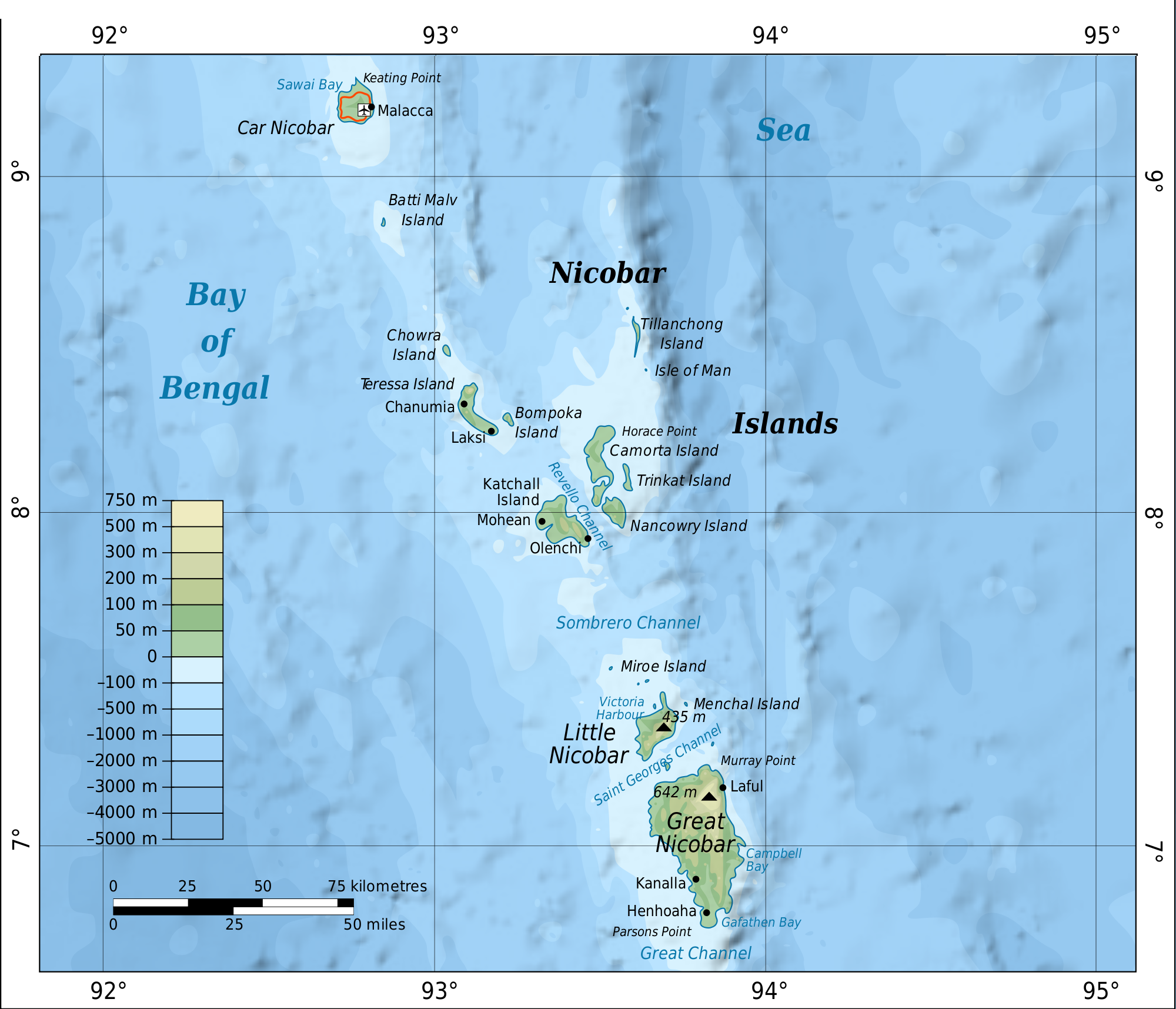 Map
Map -
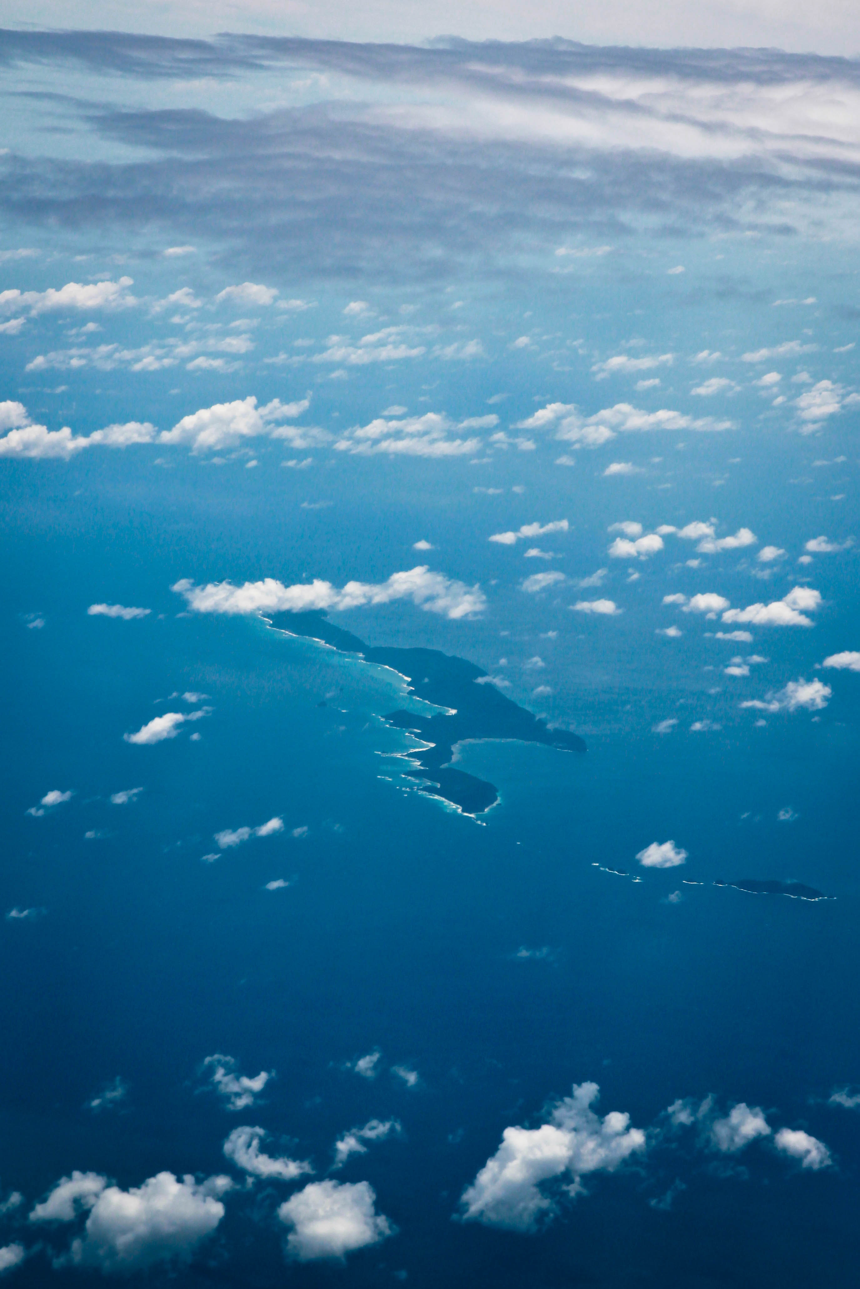 Photo Aerial. The large one in the centre is Tillangchong; Man is the small one below on the right.


References[edit | edit source]
- ↑ "Islandwise Area and Population - 2011 Census" (PDF). Government of Andaman.
- ↑ Info
- ↑ Registration Plate Numbers added to ISO Code
- ↑ Tehsils
- ↑ "Andaman and Nicobar Islands villages" (PDF). Land Records Information Systems Division, NIC. Archived from the original (PDF) on 4 March 2016. Retrieved 25 July 2015.
 | This Andaman and Nicobar Islands location article is a stub. You can help Bharatpedia by expanding it. |