Cleugh Passage: Difference between revisions
>MPGuy2824 (→top: added pushpin_map_alt) |
m (Removed empty portal template using script) |
||
| Line 26: | Line 26: | ||
== References == | == References == | ||
{{reflist}} | {{reflist}} | ||
* [https://web.archive.org/web/20050728121303/http://www.gsi.gov.in/mudvol.htm Geological Survey of India] | * [https://web.archive.org/web/20050728121303/http://www.gsi.gov.in/mudvol.htm Geological Survey of India] | ||
*{{wikivoyage-inline|Andaman and Nicobar Islands}} | *{{wikivoyage-inline|Andaman and Nicobar Islands}} | ||
Latest revision as of 02:23, 14 August 2023
| Cleugh Passage | |
|---|---|
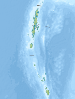
Location in the Andaman and Nicobar Islands and in the Bay of Bengal | |
| Coordinates | 13°37′N 93°00′E / 13.61°N 93.00°ECoordinates: 13°37′N 93°00′E / 13.61°N 93.00°E |
| Ocean/sea sources | Bay of Bengal |
| Basin countries | India |
| Max. width | 5 km (3.1 mi) |
| Islands | Landfall Island, East Island |
Cleugh Passage is a strait of the Bay of Bengal in the Andaman Islands, part of the Indian union territory of Andaman and Nicobar Islands. It lies at the north tip of North Andaman Island (Cape Price), and separates it from the smaller islands Landfall Island and East Island.[1] It is about 5 km wide. West Island lies in the western approach to the passage.[1]
References[edit]
Template:North and Middle Andaman district

