






CleanupBot (talk | contribs) m →References: clean up |
m cleaned up details per sources as per guidelines |
||
| Line 1: | Line 1: | ||
[[ | {{Short description|Major river in Bangladesh}} | ||
''' | {{About|the river|other uses|Padma (disambiguation)}} | ||
{{Use dmy dates|date=October 2024}} | |||
{{Infobox river | |||
| name = Padma | |||
| native_name = {{Native name|bn|পদ্মা}} | |||
| image = Rajshahi T Bandh 10.jpg | |||
| image_alt = Padma River in Bangladesh | |||
| image_caption = Padma River in Bangladesh | |||
| source1_location = Bifurcation of the [[Ganges]] at [[Giria, India]], and The Gangotri Glacier in the middle of Himalayans | |||
| map = Padma River map.jpg | |||
| map_size = | |||
| map_caption = Location in Bangladesh | |||
| map_alt = | |||
| pushpin_map = | |||
| pushpin_map_size = | |||
| pushpin_map_caption = | |||
| mouth_location = [[Meghna River|Lower Meghna]] | |||
| subdivision_type1 = Countries | |||
| subdivision_name1 = [[Bangladesh]], [[India]] | |||
| subdivision_type2 = Districts | |||
| subdivision_name2 = '''India:''' [[Murshidabad District|Murshidabad]] | |||
'''Bangladesh:'''{{hlist|[[Munshiganj District|Munshiganj]] | [[Pabna District|Pabna]] | [[Manikganj District|Manikganj]] | [[Rajshahi District|Rajshahi]] | [[Kushtia District|Kushtia]] | [[Nawabganj District|Nawabganj]] | [[Faridpur District|Faridpur]] | [[Madaripur District|Madaripur]] | [[Rajbari District|Rajbari]] | [[Shariatpur District|Shariatpur]] | [[Chandpur District|Chandpur]]}} | |||
| length = {{convert|356|km|mi|abbr=on}}<ref name="Geologic Framework">{{cite journal |last=Allison |first=Mead A. |date=Summer 1998 |title=Geologic Framework and Environmental Status of the Ganges-Brahmaputra Delta |journal=Journal of Coastal Research |publisher=Coastal Education & Research Foundation, Inc. |volume=13 |number=3 |pages=826–836 |jstor=4298836}}</ref> | |||
| discharge1_avg = (Period: 1971–2000){{convert|34,938.1|m3/s|abbr=on}}<ref name="Ganga (Ganges)-Brahmaputra">{{cite web|url=https://www.riversnetwork.org/V1/index.php/component/content/?view=article&id=57&catid=219&Itemid=179|title=Ganga (Ganges)-Brahmaputra|last=Eric|first=Tilman}}</ref> | |||
| discharge1_max = During [[monsoon]] season {{convert|750,000|m3/s|abbr=on}} | |||
| discharge1_min = During dry season {{convert|15,000|m3/s|abbr=on}} | |||
| basin_size = {{convert|1,487,657.3|km2|mi2|abbr=on}}<ref name="Ganga (Ganges)-Brahmaputra"/> | |||
| river_system = '''[[Ganges River]]''' | |||
| bridges = [[Padma Bridge]]<br />[[Lalon Shah Bridge]]<br />[[Hardinge Bridge]] | |||
}} | |||
[[File:Ganges-Brahmaputra-Meghna basins.jpg|right|thumb|275px|A map showing the major rivers that flow into the Bay of Bengal, including Padma.]] | |||
== | The '''Padma''' ({{langx|bn|পদ্মা|Pôdmā}}) is a major river in [[Bangladesh]]. It is the eastern and main [[distributary]] of the [[Ganges]], flowing generally southeast for {{convert|356|km|mi}} to its confluence with the [[Meghna River]], near the [[Bay of Bengal]].<ref name="Geologic Framework" /> The city of [[Rajshahi]] is located on the banks of the river.<ref name="হোসেইন">Hossain ML, Mahmud J, Islam J, Khokon ZH and Islam S (eds.) (2005) Padma, Tatthyakosh Vol. 1 and 2, Dhaka, Bangladesh, p. 182 {{in lang|bn}}.</ref> Since 1966, over 66,000 hectares of land have been lost to erosion of the Padma.<ref>{{cite news |title=Over 66,000 hectares lost to Padma since 1967: NASA report |url=https://www.thedailystar.net/country/news/over-66000-hectares-lost-padma-1967-nasa-report-1633810 |access-date=14 September 2018 |newspaper=[[The Daily Star (Bangladesh)|The Daily Star]]}}</ref> The Padma River is also an important source of fisheries and supports livelihoods for communities living along its banks.<ref>https://www.britannica.com/place/Padma-River</ref> | ||
== History == | |||
=== Etymology === | |||
The Padma, [[Sanskrit]] for [[lotus flower]], is mentioned in ancient Hindu scripts as a byname for the Goddess [[Lakshmi]].<ref>{{cite book |last1=Williams |first1=George M. |date=2008 |title=Handbook of Hindu Mythology |url=https://books.google.com/books?id=N7LOZfwCDpEC&pg=PA198 |publisher=Oxford University Press |isbn=978-0-19-533261-2 |page=198}}</ref> There is also a narration of Lakshmi’s connection to this river told in the [[Tripura Rahasya]]. <!--including the [[Veda]]s, the [[Purana]]s,<ref>[[Padma Purana]]</ref> the [[Ramayana]] and the [[Mahabharata]].{{Citation needed|date=December 2009}} In all the epic stories, the river is--> | |||
[[File:Boat at padma Bridge.jpg|thumb|Engine Boat at Padma river]] | |||
=== Geographic effects === | |||
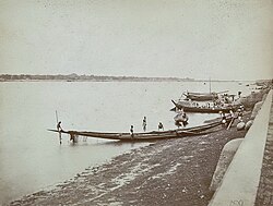
[[File:Padma River 1860.jpg|thumb|Padma River and boats (1860)]] | |||
Eighteenth-century geographer [[James Rennell]] referred to a former course of the Ganges north of its present channel, as follows: | |||
{{Blockquote|text=Appearances favour very strongly the opinion, that the Ganges had its former bed in the tract now occupied by the lakes and morasses between Nattore and Jaffiergunge, striking out of the present course at Bauleah ... to a junction with the Burrampooter or Megna near Fringybazar; where the accumulation of two such mighty streams probably scooped out the present amazing bed of the Megna.<ref>{{cite magazine |last=Rennell |first=James |date=January 1783 |title=Account of the Ganges and Burrampooter Rivers |url=https://books.google.com/books?id=n_I7AQAAMAAJ |magazine=The Scots Magazine |volume=45 |page=62 |access-date=16 October 2014}}</ref> | |||
}} | |||
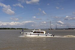
[[File:Speedboat Padma River.jpg|thumb|Speedboat at Padma River]] | |||
[[File:Hardinge Bridge Bangladesh (6).JPG|thumb|Hardinge Bridge in Bangladesh]] | |||
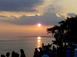
[[File:Sunset in Padma river.jpg|thumb|Sunset from Padma River]] | |||
[[File:Padma river in summer.jpg|thumb|A view of Padma river in summer near [[Rajshahi]]]] | |||
=== Murshidabad District === | |||
{{Main|Jalangi River}} | |||
Murshidabad District is situated on the western bank of the Padma. It flows dividing the Rajshahi and [[Murshidabad District]] of [[West Bengal]] and created a natural river border between India and Bangladesh.<ref>{{Cite web |url=http://en.bdfish.org/2011/11/the-padma-river/ |title=The Padma River |date=22 November 2011 |access-date=11 February 2018}}</ref><ref>{{Cite web |url=https://www.indiatoday.in/featured/story/ganga-padma-erosion-poses-security-concerns-in-bengal-mamata-to-demand-additional-funds-210045-2013-08-19 |title=Ganga-Padma erosion poses security concerns in Bengal |date=19 August 2013 |access-date=11 February 2018}}</ref> The [[Jalangi]] area of the district was seriously affected by [[River bank erosion along the Ganges in Malda and Murshidabad districts|river bank erosion]] of the Padma.<ref name="erosion3">{{cite web |url=http://lrlr.landscapeonline.de/Articles/lrlr-2014-3/articlese6.html |title=River Bank Erosion Induced Human Displacement and Its Consequences – Impact of Ganges River Bank Erosion |work=Tuhin K. Das, Sushil K. Haldar, Ivy Das Gupta and Sayanti Sen |publisher=Living Reviews in Landscape Research |access-date=5 September 2017}}</ref> | |||
[[File:PADRAJ.jpg|thumb|Sunset from the river Padma during monsoon, Rajpara, Rajshahi]] | |||
== Infrastructure == | |||
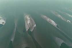
[[File:Sky over river padma.jpg|thumb|Sky over river padma]] | |||
=== Damming === | |||
After the construction of the [[Farakka Barrage]] on the Ganges River in [[West Bengal]], the maximum flows in the Padma River were reduced significantly. The flow reduction caused many problems in Bangladesh, including the loss of fish species, the drying of the Padma's distributaries, increased saltwater intrusion from the Bay of Bengal, and damage to the mangrove forests of the [[Sundarbans]].<ref>{{cite journal |last=Islam |first=Nazrul |date=29 April – 5 May 2006 |title=IRLP or the Ecological Approach to Rivers? |journal=Economic and Political Weekly |volume=41 |number=17 |pages=1693–1702 |jstor=4418148}}</ref> | |||
=== Padma Bridge === | |||
[[file: The padma bridge 02.jpg|thumb|]] | |||
The [[Padma Bridge]] is Bangladesh's largest bridge and cost an estimated US$3 billion to complete. It was inaugurated on 25 June 2022.<ref name="likely">{{cite news |date=24 June 2022 |title=Grand preparations made for Padma Bridge inauguration |work=The Daily Star |url=https://www.thedailystar.net/news/bangladesh/development/news/grand-preparations-made-padma-bridge-inauguration-3055601 |access-date=24 June 2022}}</ref> It was supposed to be open to the public in 2013, but the project's future became uncertain when, in June 2012, the [[World Bank]] cancelled its $1.2 billion loan over allegations of corruption.<ref>{{cite press release |title=World Bank Statement on Padma Bridge |publisher=World Bank Group |url=http://www.worldbank.org/en/news/press-release/2012/06/29/world-bank-statement-padma-bridge |date=29 June 2012 |access-date=16 October 2014}}</ref> In June 2014, the government of Bangladesh, proceeded without the loan and hired a Chinese firm to construct the {{convert|6.15|km|mi|adj=on}} main part of the bridge. In October 2014, it hired a South Korean firm to supervise construction, with the aim of finishing the project by 2018.<ref name ="Korean Firm">{{cite news |last=Kallol |first=Assif Showkat |date=14 October 2014 |title=Korean Firm Gets Padma Bridge Construction Supervision Job |url=http://www.dhakatribune.com/bangladesh/2014/oct/14/korean-firm-gets-padma-bridge-construction-supervision-job |newspaper=Dhaka Tribune |access-date=16 October 2014}}</ref> The final (41st) span of the bridge was installed on 10 December 2020.<ref name="Last span of Padma Multipurpose Bridge installed">{{Cite news |date=10 December 2020 |title=Last span of Padma Multipurpose Bridge installed |url=https://www.thedailystar.net/country/news/last-span-padma-bridge-being-installed-2009001 |access-date=10 December 2020 |work=The Daily Star |language=en}}</ref><ref>{{Cite news |title=Last span of Padma Multipurpose Bridge installed |url=https://www.daily-sun.com/post/522887/Last-span-of-Padma-Bridge-installed |access-date=10 December 2020 |work=Daily Sun |language=en}}</ref> The last road slab was installed on the span that linked pillars 12 and 13 of the Padma bridge on 24 August 2021.<ref>{{cite news |title=It's possible to walk across the Padma now |url=https://www.thedailystar.net/news/bangladesh/transport/news/its-possible-walk-across-the-padma-now-2159256 |work=The Daily Star |date=24 August 2021 |language=en}}</ref><ref name=Open202206>{{cite news |title=Padma Bridge likely to open to traffic by June 2022 |url=https://www.dhakatribune.com/bangladesh/2020/12/10/padma-bridge-likely-to-open-for-traffic-by-june-2022 |work=Dhaka Tribune |access-date=22 December 2020}}</ref> | |||
[[File:A dying river.jpg|thumb|Effect of climate change of Padma river in 2024 ]] | |||
In 2009, government plans also included rail lines on both sides of the Padma with a connection via the new bridge.<ref>{{cite news |title=Plan to Lay 80 km Rail Line on Both Sides of Padma Bridge |url=http://archive.thedailystar.net/newDesign/news-details.php?nid=101453 |newspaper=The Daily Star |agency=BSS |date=15 August 2009 |archive-date=18 October 2014 |access-date=25 June 2014 |archive-url=https://web.archive.org/web/20141018040126/http://archive.thedailystar.net/newDesign/news-details.php?nid=101453 |url-status=dead }}</ref>{{update inline|reason=old plan dead or alive?|date=January 2022}} | |||
The [[Lalon Shah Bridge]] and [[Hardinge Bridge]] also crosses the Padma further upstream. | |||
== See also == | |||
* [[Ganges Barrage Project]] | |||
* [[Railway stations in Bangladesh]] | |||
== References == | |||
{{Reflist}} | |||
== External links == | |||
{{Commons category}} | |||
* {{cite book |last=Chowdhury |first=Masud Hasan |year=2012 |chapter=Padma River |chapter-url=http://en.banglapedia.org/index.php?title=Padma_River |editor1-last=Islam |editor1-first=Sirajul |editor1-link=Sirajul Islam |editor2-last=Jamal |editor2-first=Ahmed A. |title=Banglapedia: National Encyclopedia of Bangladesh |edition=Second |publisher=[[Asiatic Society of Bangladesh]]}} | |||
{{Rivers in and around Bengal}} | |||
{{Authority control}} | |||
{{Coord|23|16|N|90|36|E|type:waterbody_region:BD_dim:75000|display=title}} | |||
[[Category:Bay of Bengal]] | |||
[[Category:Border rivers]] | |||
[[Category:Distributaries of the Ganges]] | |||
[[Category:International rivers of Asia]] | |||
[[Category:Rajshahi District]] | |||
[[Category:Rivers of Bangladesh]] | [[Category:Rivers of Bangladesh]] | ||
[[Category: | [[Category:Rivers of Chittagong Division]] | ||
[[Category:Rivers of Dhaka Division]] | |||
[[Category:Rivers of Rajshahi Division]] | |||
[[Category:Rivers of West Bengal]] | |||
Latest revision as of 02:42, 2 May 2026
| Padma | |
|---|---|
 Padma River in Bangladesh | |
 Location in Bangladesh | |
| Native name | [পদ্মা (Bengali)] Error: {{Native name}}: missing language tag (help) (language?) |
| Location | |
| Countries | Bangladesh, India |
| Districts | India: Murshidabad Bangladesh: |
| Physical characteristics | |
| Source | |
| • location | Bifurcation of the Ganges at Giria, India, and The Gangotri Glacier in the middle of Himalayans |
| Mouth | |
• location | Lower Meghna |
| Length | 356 km (221 mi)[1] |
| Basin size | 1,487,657.3 km2 (574,387.7 sq mi)[2] |
| Discharge | |
| • average | (Period: 1971–2000)34,938.1 m3/s (1,233,830 cu ft/s)[2] |
| • minimum | During dry season 15,000 m3/s (530,000 cu ft/s) |
| • maximum | During monsoon season 750,000 m3/s (26,000,000 cu ft/s) |
| Basin features | |
| River system | Ganges River |
| Bridges | Padma Bridge Lalon Shah Bridge Hardinge Bridge |

The Padma (Bengali: পদ্মা, romanized: Pôdmā) is a major river in Bangladesh. It is the eastern and main distributary of the Ganges, flowing generally southeast for 356 kilometres (221 mi) to its confluence with the Meghna River, near the Bay of Bengal.[1] The city of Rajshahi is located on the banks of the river.[3] Since 1966, over 66,000 hectares of land have been lost to erosion of the Padma.[4] The Padma River is also an important source of fisheries and supports livelihoods for communities living along its banks.[5]
History[edit | edit source]
Etymology[edit | edit source]
The Padma, Sanskrit for lotus flower, is mentioned in ancient Hindu scripts as a byname for the Goddess Lakshmi.[6] There is also a narration of Lakshmi’s connection to this river told in the Tripura Rahasya.

Geographic effects[edit | edit source]

Eighteenth-century geographer James Rennell referred to a former course of the Ganges north of its present channel, as follows:
Appearances favour very strongly the opinion, that the Ganges had its former bed in the tract now occupied by the lakes and morasses between Nattore and Jaffiergunge, striking out of the present course at Bauleah ... to a junction with the Burrampooter or Megna near Fringybazar; where the accumulation of two such mighty streams probably scooped out the present amazing bed of the Megna.[7]

.JPG)


Murshidabad District[edit | edit source]
Murshidabad District is situated on the western bank of the Padma. It flows dividing the Rajshahi and Murshidabad District of West Bengal and created a natural river border between India and Bangladesh.[8][9] The Jalangi area of the district was seriously affected by river bank erosion of the Padma.[10]

Infrastructure[edit | edit source]

Damming[edit | edit source]
After the construction of the Farakka Barrage on the Ganges River in West Bengal, the maximum flows in the Padma River were reduced significantly. The flow reduction caused many problems in Bangladesh, including the loss of fish species, the drying of the Padma's distributaries, increased saltwater intrusion from the Bay of Bengal, and damage to the mangrove forests of the Sundarbans.[11]
Padma Bridge[edit | edit source]

The Padma Bridge is Bangladesh's largest bridge and cost an estimated US$3 billion to complete. It was inaugurated on 25 June 2022.[12] It was supposed to be open to the public in 2013, but the project's future became uncertain when, in June 2012, the World Bank cancelled its $1.2 billion loan over allegations of corruption.[13] In June 2014, the government of Bangladesh, proceeded without the loan and hired a Chinese firm to construct the 6.15-kilometre (3.82 mi) main part of the bridge. In October 2014, it hired a South Korean firm to supervise construction, with the aim of finishing the project by 2018.[14] The final (41st) span of the bridge was installed on 10 December 2020.[15][16] The last road slab was installed on the span that linked pillars 12 and 13 of the Padma bridge on 24 August 2021.[17][18]

In 2009, government plans also included rail lines on both sides of the Padma with a connection via the new bridge.[19][needs update]
The Lalon Shah Bridge and Hardinge Bridge also crosses the Padma further upstream.
See also[edit | edit source]
References[edit | edit source]
- ↑ 1.0 1.1 Allison, Mead A. (Summer 1998). "Geologic Framework and Environmental Status of the Ganges-Brahmaputra Delta". Journal of Coastal Research. 13 (3). Coastal Education & Research Foundation, Inc.: 826–836. JSTOR 4298836.
- ↑ 2.0 2.1 Eric, Tilman. "Ganga (Ganges)-Brahmaputra".
- ↑ Hossain ML, Mahmud J, Islam J, Khokon ZH and Islam S (eds.) (2005) Padma, Tatthyakosh Vol. 1 and 2, Dhaka, Bangladesh, p. 182 (in Bengali).
- ↑ "Over 66,000 hectares lost to Padma since 1967: NASA report". The Daily Star. Retrieved 14 September 2018.
- ↑ https://www.britannica.com/place/Padma-River
- ↑ Williams, George M. (2008). Handbook of Hindu Mythology. Oxford University Press. p. 198. ISBN 978-0-19-533261-2.
- ↑ Rennell, James (January 1783). "Account of the Ganges and Burrampooter Rivers". The Scots Magazine. Vol. 45. p. 62. Retrieved 16 October 2014.
- ↑ "The Padma River". 22 November 2011. Retrieved 11 February 2018.
- ↑ "Ganga-Padma erosion poses security concerns in Bengal". 19 August 2013. Retrieved 11 February 2018.
- ↑ "River Bank Erosion Induced Human Displacement and Its Consequences – Impact of Ganges River Bank Erosion". Tuhin K. Das, Sushil K. Haldar, Ivy Das Gupta and Sayanti Sen. Living Reviews in Landscape Research. Retrieved 5 September 2017.
- ↑ Islam, Nazrul (29 April – 5 May 2006). "IRLP or the Ecological Approach to Rivers?". Economic and Political Weekly. 41 (17): 1693–1702. JSTOR 4418148.
- ↑ "Grand preparations made for Padma Bridge inauguration". The Daily Star. 24 June 2022. Retrieved 24 June 2022.
- ↑ "World Bank Statement on Padma Bridge" (Press release). World Bank Group. 29 June 2012. Retrieved 16 October 2014.
- ↑ Kallol, Assif Showkat (14 October 2014). "Korean Firm Gets Padma Bridge Construction Supervision Job". Dhaka Tribune. Retrieved 16 October 2014.
- ↑ "Last span of Padma Multipurpose Bridge installed". The Daily Star. 10 December 2020. Retrieved 10 December 2020.
- ↑ "Last span of Padma Multipurpose Bridge installed". Daily Sun. Retrieved 10 December 2020.
- ↑ "It's possible to walk across the Padma now". The Daily Star. 24 August 2021.
- ↑ "Padma Bridge likely to open to traffic by June 2022". Dhaka Tribune. Retrieved 22 December 2020.
- ↑ "Plan to Lay 80 km Rail Line on Both Sides of Padma Bridge". The Daily Star. BSS. 15 August 2009. Archived from the original on 18 October 2014. Retrieved 25 June 2014.
External links[edit | edit source]
- Chowdhury, Masud Hasan (2012). "Padma River". In Islam, Sirajul; Jamal, Ahmed A. (eds.). Banglapedia: National Encyclopedia of Bangladesh (Second ed.). Asiatic Society of Bangladesh.