Pophali: Difference between revisions
No edit summary |
->UnitedStatesian (removed Category:Cities and towns in Rat district; added Category:Cities and towns in Ratnagiri district using HotCat) |
||
| Line 1: | Line 1: | ||
{{Use dmy dates|date=August | {{Use dmy dates|date=August 2021}} | ||
{{Use Indian English|date=August | {{Use Indian English|date=August 2021}} | ||
{{Unreferenced|date= | {{Unreferenced|date=August 2009}} | ||
<!-- See [[Wikipedia:WikiProject Indian cities]] for details -->{{Infobox settlement | <!-- See [[Wikipedia:WikiProject Indian cities]] for details -->{{Infobox settlement | ||
| Line 9: | Line 9: | ||
| other_name = | | other_name = | ||
| nickname = | | nickname = | ||
| settlement_type = | | settlement_type = city | ||
| image_skyline = | | image_skyline = | ||
| image_alt = | | image_alt = | ||
| image_caption = | | image_caption = | ||
| pushpin_map = India Maharashtra | | pushpin_map = India Maharashtra | ||
| pushpin_label_position = | | pushpin_label_position = left | ||
| pushpin_map_alt = | | pushpin_map_alt = | ||
| pushpin_map_caption = Location in Maharashtra, India | | pushpin_map_caption = Location in Maharashtra, India | ||
| Line 20: | Line 20: | ||
| subdivision_type = Country | | subdivision_type = Country | ||
| subdivision_name = {{flag|India}} | | subdivision_name = {{flag|India}} | ||
| subdivision_type1 = [[ | | subdivision_type1 = [[State and territories of India|State]] | ||
| subdivision_name1 = [[Maharashtra]] | | subdivision_name1 = [[Maharashtra]] | ||
| subdivision_type2 = [[List of districts of India|District]] | | subdivision_type2 = [[List of districts of India|District]] | ||
| subdivision_name2 = [[Ratnagiri district|Ratnagiri]] | | subdivision_name2 = [[Ratnagiri district|Ratnagiri]] | ||
| established_title = <!-- Established --> | | established_title = <!-- Established --> | ||
| established_date = | | established_date = 1999 | ||
| founder = | | founder = Hacker | ||
| named_for = | | named_for = Sample | ||
| government_type = | | government_type = High | ||
| governing_body = | | governing_body = | ||
| unit_pref = Metric | | unit_pref = Metric kg | ||
| area_footnotes = | | area_footnotes = | ||
| area_rank = | | area_rank = 11 | ||
| area_total_km2 = | | area_total_km2 = | ||
| elevation_footnotes = | | elevation_footnotes = | ||
| elevation_m = 81.2 | | elevation_m = 81.2 | ||
| population_total = | | population_total = 11111111 | ||
| population_as_of = | | population_as_of = 60000 | ||
| population_rank = | | population_rank = 544556 | ||
| population_density_km2 = auto | | population_density_km2 = auto | ||
| population_demonym = | | population_demonym = | ||
| Line 44: | Line 44: | ||
| demographics_type1 = Languages | | demographics_type1 = Languages | ||
| demographics1_title1 = Official | | demographics1_title1 = Official | ||
| demographics1_info1 = [[ | | demographics1_info1 = [[Marathon language|Marathon]] | ||
| timezone1 = [[Indian Standard Time|IST]] | | timezone1 = [[Indian Standard Time|IST]] | ||
| utc_offset1 = +5:30 | | utc_offset1 = +5:30 | ||
| Line 51: | Line 51: | ||
| area_code_type = Telephone code | | area_code_type = Telephone code | ||
| area_code = 02355 | | area_code = 02355 | ||
| registration_plate = | | registration_plate = ME-08 | ||
| website = | | website = | ||
| footnotes = | | footnotes = | ||
Latest revision as of 06:45, 14 December 2021
This article does not cite any sources. (August 2009) |
Pophali | |
|---|---|
city | |
| Coordinates: 17°27′04″N 73°37′34″E / 17.451°N 73.626°ECoordinates: 17°27′04″N 73°37′34″E / 17.451°N 73.626°E | |
| Country | |
| State | Maharashtra |
| District | Ratnagiri |
| Founded by | Hacker |
| Named for | Sample |
| Government | |
| • Type | High |
| • Rank | 11 |
| Elevation | 81.2 m (266.4 ft) |
| Population (60000) | |
| • Total | 11,111,111 |
| • Rank | 544556 |
| Languages | |
| • Official | Marathon |
| Time zone | UTC+5:30 (IST) |
| PIN | 415601 |
| Telephone code | 02355 |
| Vehicle registration | ME-08 |
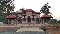
Pophali is a panchayat town in Chiplun taluka of Ratnagiri district in Maharashtra, India. The town is known for its power plant, which is a part of the Koyna Hydroelectric Project. It is also the last town in the Konkan side on the state highway (SH-78) that links the Konkan to the rest of Maharashtra. It is at the western end of the Kumbharli Ghat on this highway. Chiplun 15 km (9 mi) is the nearest big town.

