Labhuani, Bhojpur: Difference between revisions
->3 kids in a trenchcoat (←Created page with '{{Infobox settlement | name = Labhuani | other_name = Labhuāni | nickname = | settlement_type = Village |...') |
No edit summary |
||
| Line 51: | Line 51: | ||
| footnotes = | | footnotes = | ||
}} | }} | ||
'''Labhuani''' is a village in [[Garhani]] block of [[Bhojpur district, India|Bhojpur district]], [[Bihar]], [[India]]. | '''Labhuani''' is a village in [[Garhani]] block of [[Bhojpur district, India|Bhojpur district]], [[Bihar]], [[India]]. In 2011, its population was 1,246, in 258 households.<ref name="Census 2011">{{cite web |title=Census of India 2011: Bihar District Census Handbook - Bhojpur, Part A (Village and Town Directory) |pages=604-627 |url=https://censusindia.gov.in/2011census/dchb/BiharA.html |website=Census 2011 India|accessdate=22 August 2020}}</ref> | ||
== References == | == References == | ||
Latest revision as of 14:17, 16 March 2022
Labhuani
Labhuāni | |
|---|---|
Village | |
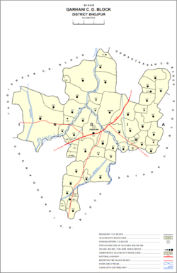
 Map of Labhuani (#516) in Garhani block | |
| Coordinates: 25°26′10″N 84°36′03″E / 25.43602°N 84.60095°ECoordinates: 25°26′10″N 84°36′03″E / 25.43602°N 84.60095°E[1] | |
| Country | India |
| State | Bihar |
| District | Bhojpur |
| Area | |
| • Total | 0.158 km2 (0.061 sq mi) |
| Elevation | 70 m (230 ft) |
| Population (2011) | |
| • Total | 1,246[2] |
| Languages | |
| • Official | Bhojpuri, Hindi |
| Time zone | UTC+5:30 (IST) |
Labhuani is a village in Garhani block of Bhojpur district, Bihar, India. In 2011, its population was 1,246, in 258 households.[2]
References[edit]
- ↑ 1.0 1.1 "Geonames.org. Labhuāni". Retrieved 22 August 2020.
- ↑ 2.0 2.1 2.2 "Census of India 2011: Bihar District Census Handbook - Bhojpur, Part A (Village and Town Directory)". Census 2011 India. pp. 604–627. Retrieved 22 August 2020.
