Garchuk Lachit Garh
 Thank you for being part of the Bharatpedia family! 0% transparency: ₹0 raised out of ₹100,000 (0 supporter) |
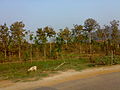
Garchuk Lachit Garh (meaning 'fort' in Assamese) or Fort, now popularly known as Lachit Garh, is located in northeastern India in the southwestern part of Guwahati city to the west of Ahomgaon. The fort was constructed under the Ahom kingdom during the times of Lachit Borphukan around the year 1670 CE, and stretches from the northern Fatasil hills at Garchuk locality cutting across the National Highway (N.H.)-37 at Garchuk Charali to the southern hills via Pamahi and Moinakhurung. The length of the fortification is about 3 km.
| Garchuk Lachit Garh | |
|---|---|
| Part of Assam | |
| Guwahati, Assam, India | |
 Garchuk fort, Guwahati | |
| Type | Fort |
| Site information | |
| Controlled by | Government of Assam |
| Condition | Ruins |
| Site history | |
| Built | 17th century |
| Built by | Ahom kingdom |
| Materials | Granite Stones and lime mortar |
| Battles/wars | Ahom–Mughal conflicts |
The fortification was built centuries ago to deter the Mughal cavalry with two earthen ramparts and two water filled lakes in between and ditches dug in front, which can be seen by visitors. But illegal encroachment has taken its toll on this heritage site.

Garchuk fort, Guwahati

Garchuk fort, Guwahati

Garchuk fort, Guwahati
Garchuk fort, Guwahati


ReferencesEdit
External linksEdit
Coordinates: 26°06′20″N 91°42′34″E / 26.10560°N 91.70951°E